The Landsat satellite record stretches from 1972 to the present. This gallery includes all Landsat images published on the Earth Observatory, Visible Earth, and Landsat Science web sites from all seven Landsat satellites (Landsats 1-8, Landsat 6 failed to achieve orbit). All of the images are in the public domain and may be used with attribution. The correct attribution for imagery obtained from this site is:
“Landsat imagery courtesy of NASA Goddard Space Flight Center and U.S. Geological Survey” or “USGS/NASA Landsat”
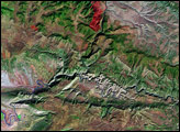
Tonto National Monument Read more
Hurricane Katrina Floods the Southeastern United States Read more
Saguaro National Park Read more
The Tour de France Visits Courchevel Read more
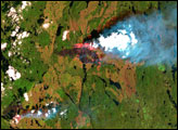
Fires in Northern Quebec Read more
Arches National Park Read more
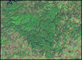
Mammoth Cave National Park Read more
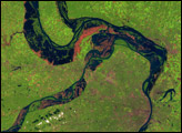
Great Flood of the Mississippi River, 1993 Read more
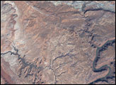
Dinosaur National Monument Read more