The Landsat satellite record stretches from 1972 to the present. This gallery includes all Landsat images published on the Earth Observatory, Visible Earth, and Landsat Science web sites from all seven Landsat satellites (Landsats 1-8, Landsat 6 failed to achieve orbit). All of the images are in the public domain and may be used with attribution. The correct attribution for imagery obtained from this site is:
“Landsat imagery courtesy of NASA Goddard Space Flight Center and U.S. Geological Survey” or “USGS/NASA Landsat”
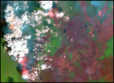
Fires In Alaska and Northern Canada Read more
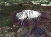
Mt. Ruapehu, New Zealand Read more
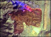
Picnic Rock Fire, CO Read more

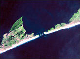
Earthquake near San Simeon, California Read more
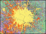
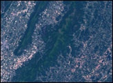
Urban Growth in Sichuan, China Read more
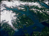
Glacier Bay National Park and Preserve Read more
Hurricane Isabel Read more
Shenandoah National Park Read more

Changes in the Mamore River, Bolivia Read more