The Landsat satellite record stretches from 1972 to the present. This gallery includes all Landsat images published on the Earth Observatory, Visible Earth, and Landsat Science web sites from all seven Landsat satellites (Landsats 1-8, Landsat 6 failed to achieve orbit). All of the images are in the public domain and may be used with attribution. The correct attribution for imagery obtained from this site is:
“Landsat imagery courtesy of NASA Goddard Space Flight Center and U.S. Geological Survey” or “USGS/NASA Landsat”
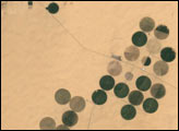
Irrigation in the Heart of the Sahara Read more
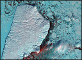
Akpatok Island Read more
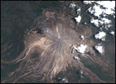
Colima Volcano Erupts in Mexico Read more
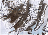
McMurdo Dry Valleys Read more
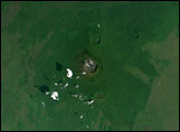
Nyiragongo Volcano before the Eruption Read more
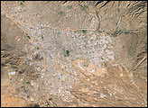
Tucson, Arizona, and its Surroundings Read more
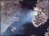
Aftermath of World Trade Center Attack Read more

Drought in the Klamath River Basin Read more
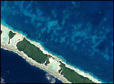
Coral Bleaching in French Polynesia Read more