The Landsat satellite record stretches from 1972 to the present. This gallery includes all Landsat images published on the Earth Observatory, Visible Earth, and Landsat Science web sites from all seven Landsat satellites (Landsats 1-8, Landsat 6 failed to achieve orbit). All of the images are in the public domain and may be used with attribution. The correct attribution for imagery obtained from this site is:
“Landsat imagery courtesy of NASA Goddard Space Flight Center and U.S. Geological Survey” or “USGS/NASA Landsat”
![](https://eoimages.gsfc.nasa.gov/images/imagerecords/152000/152350/japan_dpm_20240102_th.jpg)
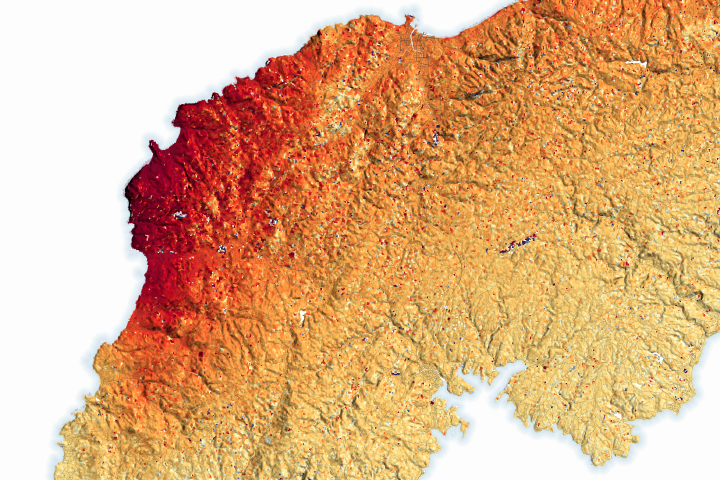
Earthquake Lifts the Noto Peninsula Read more
![](https://eoimages.gsfc.nasa.gov/images/imagerecords/152000/152364/jakobshavn_oli_20220904_th.jpg)
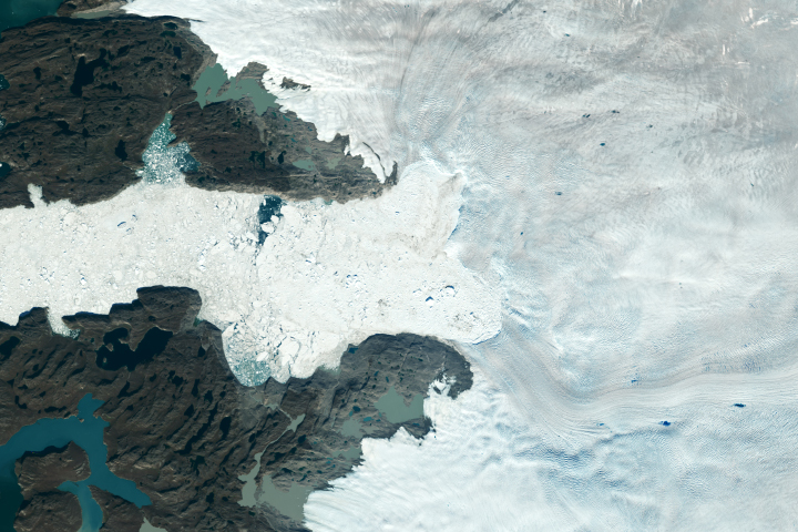
Greenland’s Biggest Losers Read more
![](https://eoimages.gsfc.nasa.gov/images/imagerecords/152000/152368/chuquicamata_mine_oli2_20240104_th.jpg)
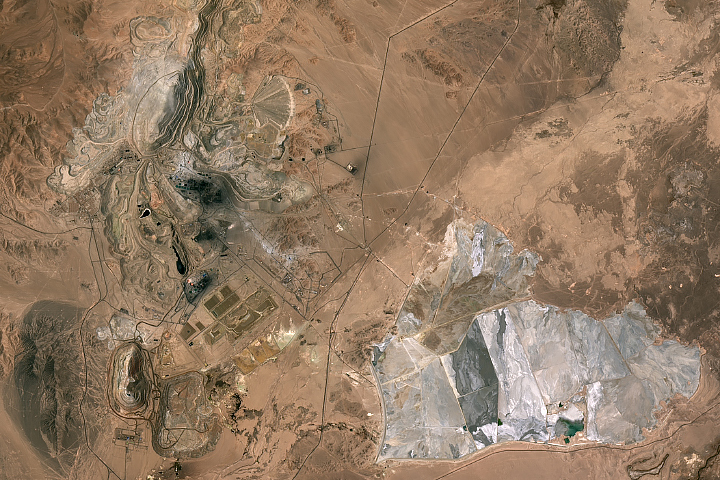
Copper Mining at Chuquicamata Read more
![](https://eoimages.gsfc.nasa.gov/images/imagerecords/152000/152378/klinakliniglacier_oli_20230922_th.jpg)
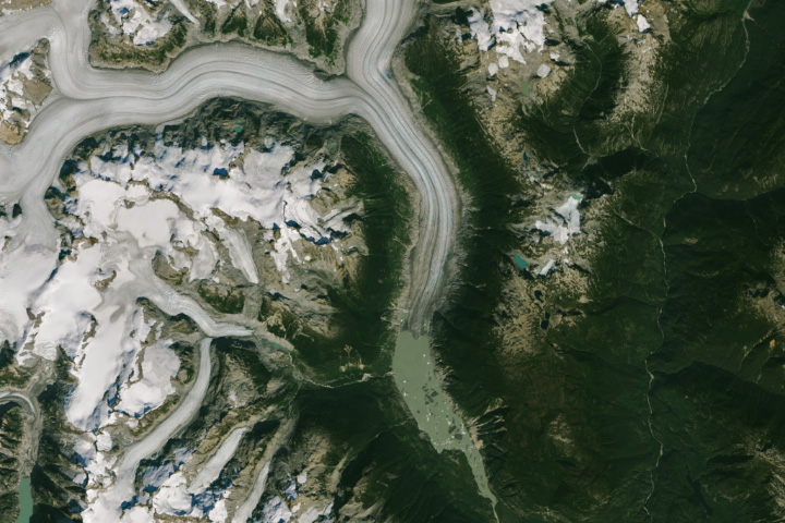
Retreat at Klinaklini Read more
![](https://eoimages.gsfc.nasa.gov/images/imagerecords/152000/152388/popocatepetll_oli_20240127_th.jpg)
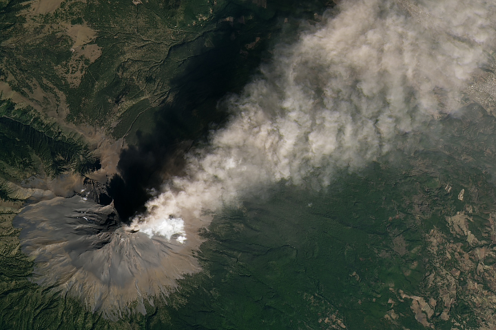
Another Puff of Ash from Popocatépetl Read more
![](https://eoimages.gsfc.nasa.gov/images/imagerecords/152000/152391/mahakamdelta_oli2_20220426_th.jpg)
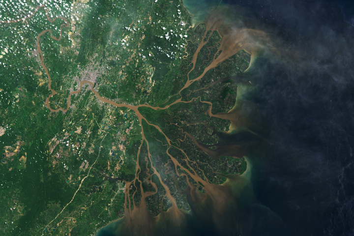
Indonesia’s Mahakam Delta Read more
![](https://eoimages.gsfc.nasa.gov/images/imagerecords/152000/152395/openetwideca_model_2023_th.jpg)
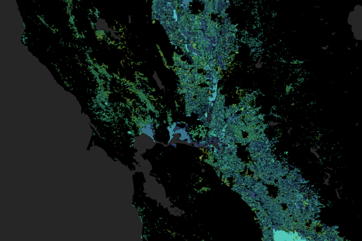
Tracking the Invisible Movement of Water Read more
![](https://eoimages.gsfc.nasa.gov/images/imagerecords/152000/152400/safricafire_oli_20240131_th.jpg)
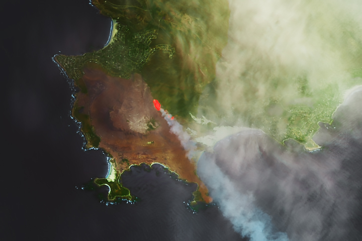
Fire Chars Pringle Bay Read more
![](https://eoimages.gsfc.nasa.gov/images/imagerecords/152000/152404/solarstorage_oli2_20240112_th.jpg)
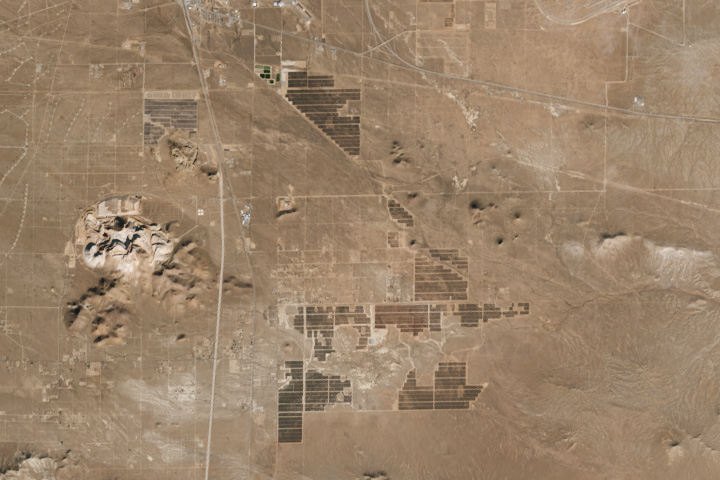
Solar and Batteries Go Big in the Desert Read more