The Landsat satellite record stretches from 1972 to the present. This gallery includes all Landsat images published on the Earth Observatory, Visible Earth, and Landsat Science web sites from all seven Landsat satellites (Landsats 1-8, Landsat 6 failed to achieve orbit). All of the images are in the public domain and may be used with attribution. The correct attribution for imagery obtained from this site is:
“Landsat imagery courtesy of NASA Goddard Space Flight Center and U.S. Geological Survey” or “USGS/NASA Landsat”
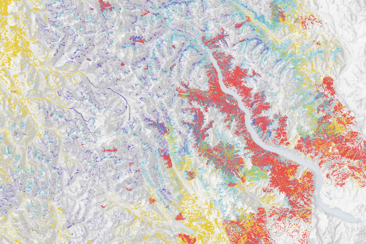
Spotting the Spotted Owl: 30 Years of Forest Disturbance Read more
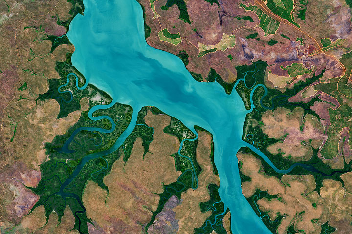
Folklore and Science Meet at Tiwi Read more
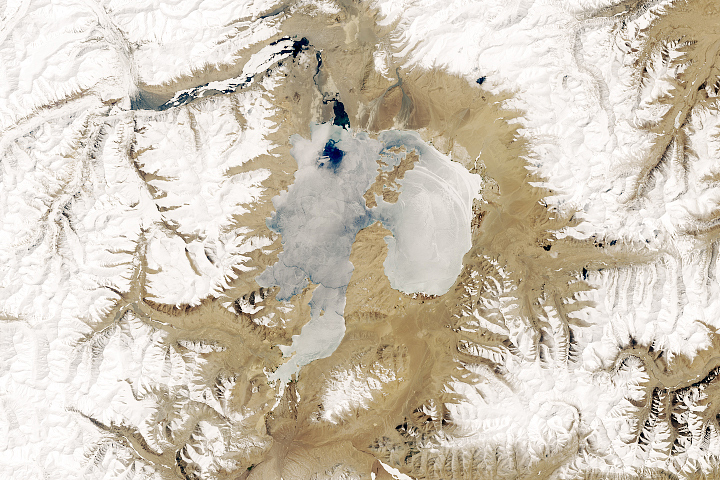
Frozen Karakul Lake Read more
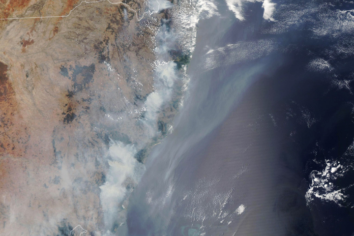
Fires Take a Toll on Australian Forests Read more
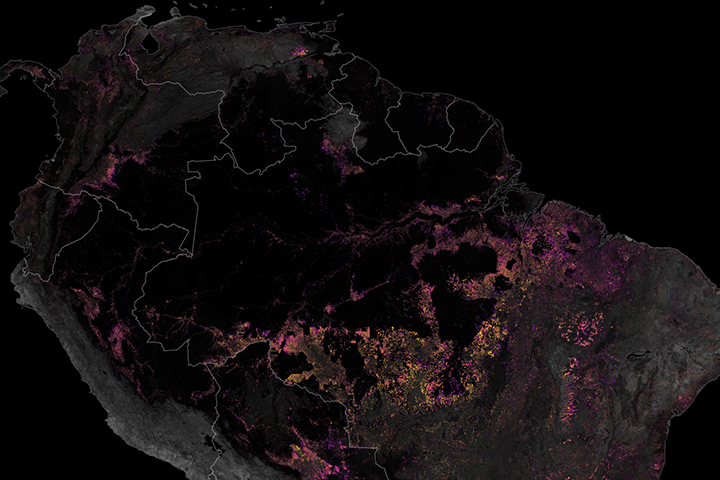
Tracking Amazon Deforestation from Above Read more
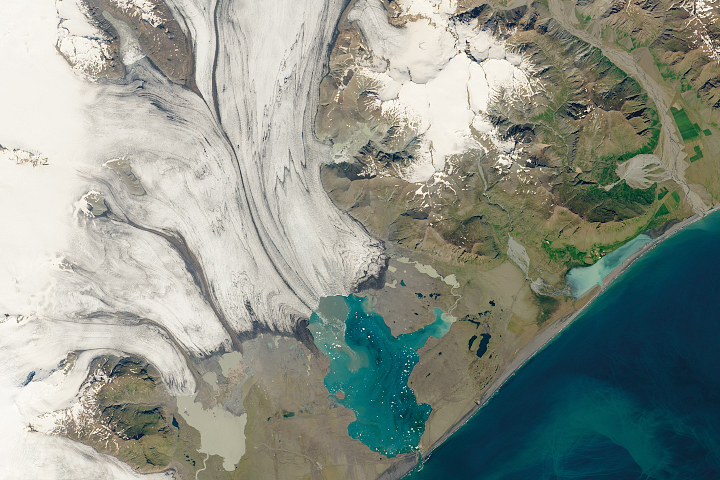
Iceland’s Glacial Lagoon Read more
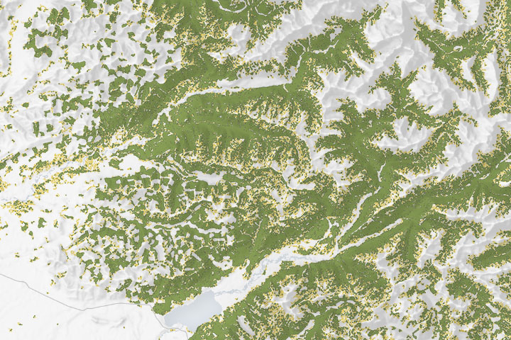
Spotting the Spotted Owl: 30 Years of Habitat Change Read more
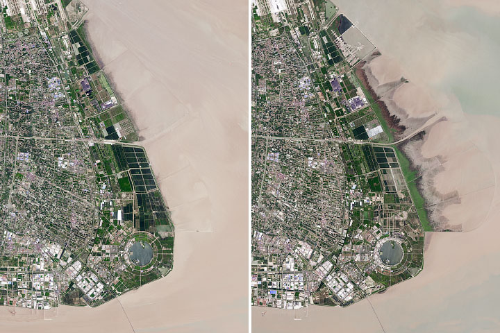
The Expansion of Shanghai Read more
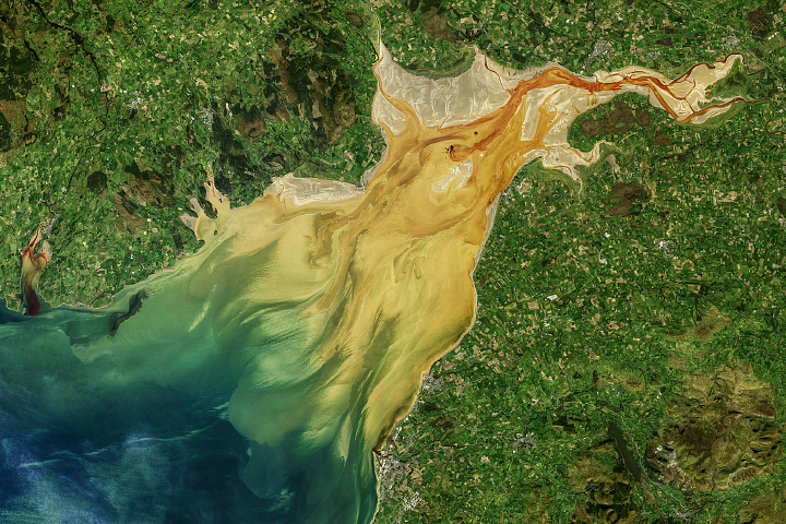
Sediment Sloshes in Solway Firth Read more