The Landsat satellite record stretches from 1972 to the present. This gallery includes all Landsat images published on the Earth Observatory, Visible Earth, and Landsat Science web sites from all seven Landsat satellites (Landsats 1-8, Landsat 6 failed to achieve orbit). All of the images are in the public domain and may be used with attribution. The correct attribution for imagery obtained from this site is:
“Landsat imagery courtesy of NASA Goddard Space Flight Center and U.S. Geological Survey” or “USGS/NASA Landsat”
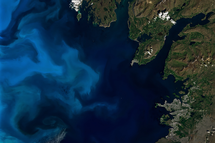
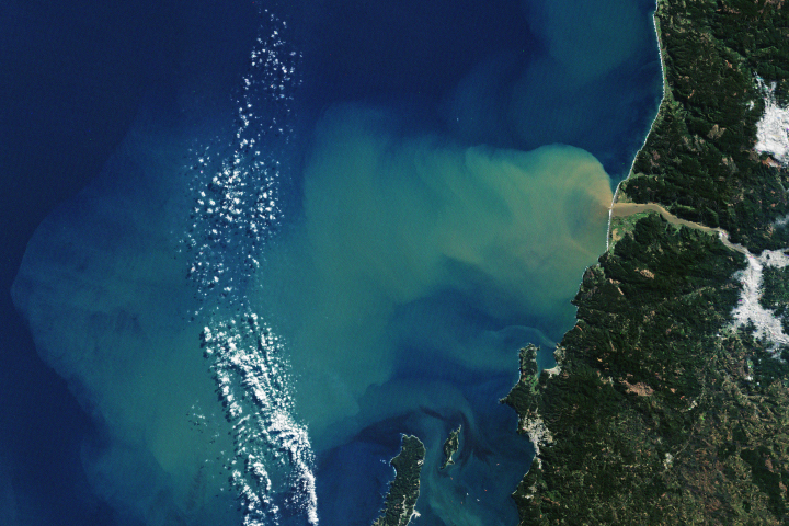
Iceland’s Waters Abloom Read more

Green Space is Good for Mental Health Read more
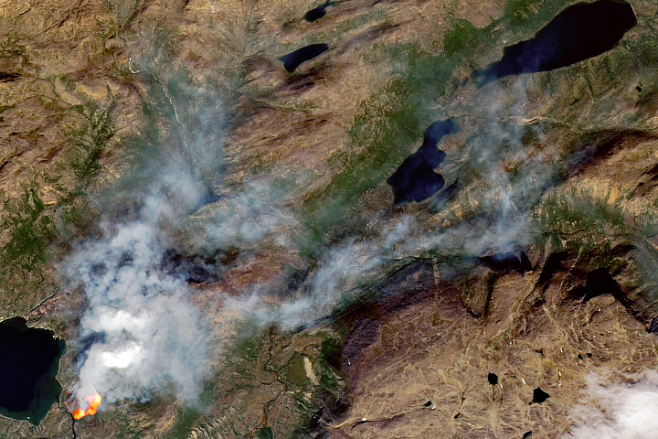
Another Fire in Greenland Read more
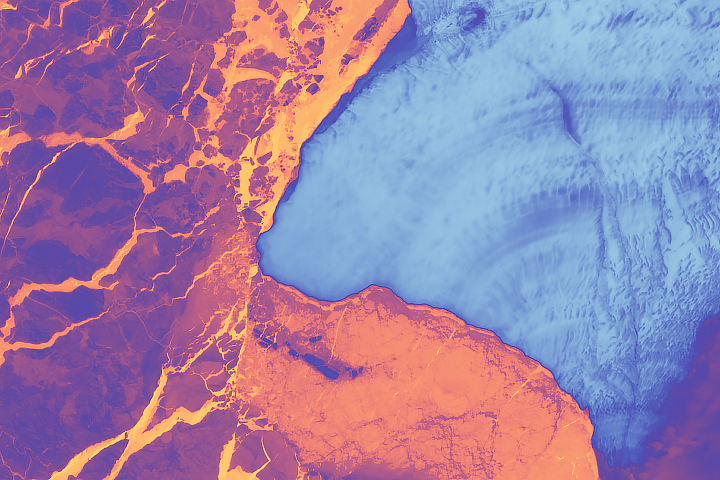
Brunt Ice Shelf Survives the Solstice Read more
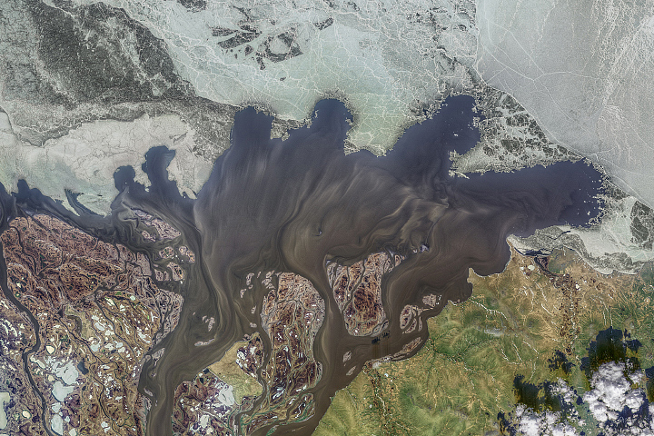
Kolyma’s Annual Purge Read more
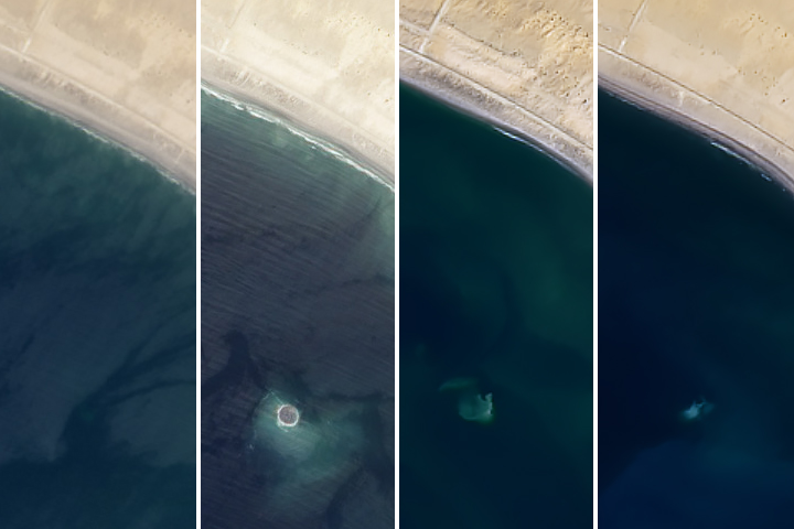
The Sea Takes Back a Baby Island Read more
Atmospheric River Swells Terrestrial Rivers Read more
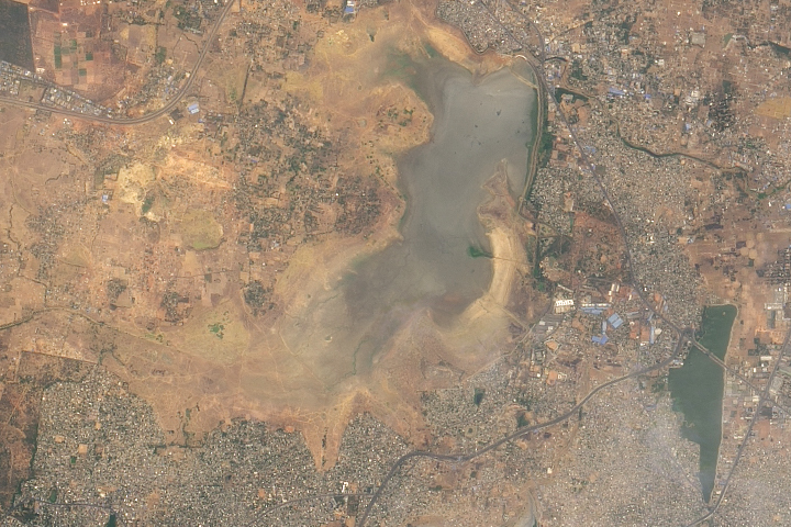
Water Shortages in India Read more
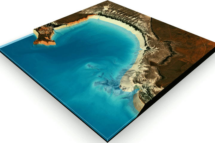
Mapping the Land Between the Tides Read more