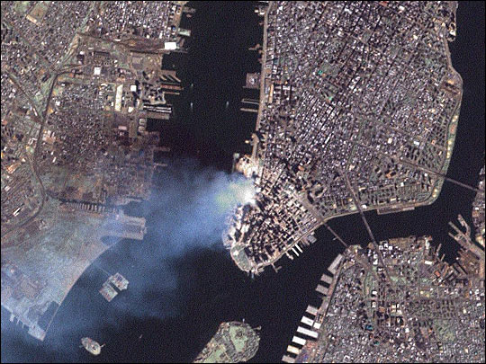
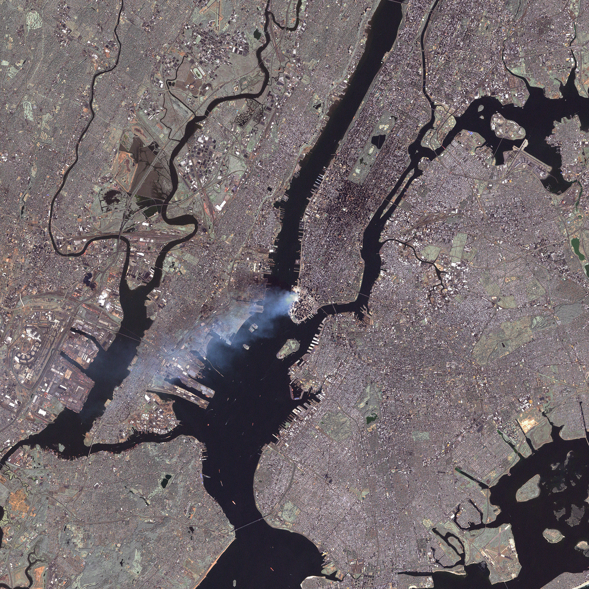
Aftermath of World Trade Center Attack
Downloads
- wtc-merge-321pan.jpg (540x405, JPEG)
- wtc-merge-321pan_lrg.jpg (2048x2048, JPEG)
Metadata
- Sensor(s):
- Landsat 7 - ETM+
- Data Date: September 12, 2001
- Visualization Date: September 13, 2001
This true-color image was taken by the Enhanced Thematic Mapper Plus (ETM+) aboard the Landsat 7 satellite on September 12, 2001, at roughly 11:30 a.m. Eastern Daylight Savings Time.
Visit the USGS Landsat 7 site for additional Landsat imagery, the NASA home page for photos from the space station and MODIS, and GlobalSecurity.org for images from other satellites.
Image courtesy USGS Landsat 7 team, at the EROS Data Center.