The Landsat satellite record stretches from 1972 to the present. This gallery includes all Landsat images published on the Earth Observatory, Visible Earth, and Landsat Science web sites from all seven Landsat satellites (Landsats 1-8, Landsat 6 failed to achieve orbit). All of the images are in the public domain and may be used with attribution. The correct attribution for imagery obtained from this site is:
“Landsat imagery courtesy of NASA Goddard Space Flight Center and U.S. Geological Survey” or “USGS/NASA Landsat”
![](https://eoimages.gsfc.nasa.gov/images/imagerecords/151000/151492/donanagw_oli_2018_th.jpg)
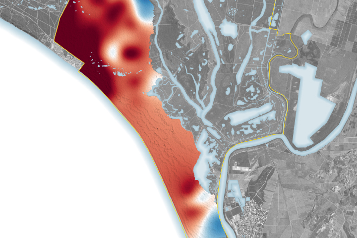
Water Woes in Doñana National Park Read more
![](https://eoimages.gsfc.nasa.gov/images/imagerecords/151000/151522/jasmundnationalpark_oli2_2023162_th.jpg)
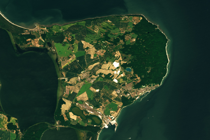
The Ancient Forests and White Cliffs of Jasmund Read more
![](https://eoimages.gsfc.nasa.gov/images/imagerecords/151000/151549/elephantbutte_oli_2013189_tn_new.jpg)
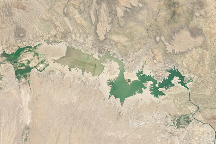
On This Day in 2013: Elephant Butte Reservoir Read more
![](https://eoimages.gsfc.nasa.gov/images/imagerecords/151000/151560/nishinoshima_oli_2020186_tn.jpg)
On This Day in 2020: Nishinoshima Belches Read more
![](https://eoimages.gsfc.nasa.gov/images/imagerecords/151000/151568/macquarieisland_oli2_2022039_th.jpg)
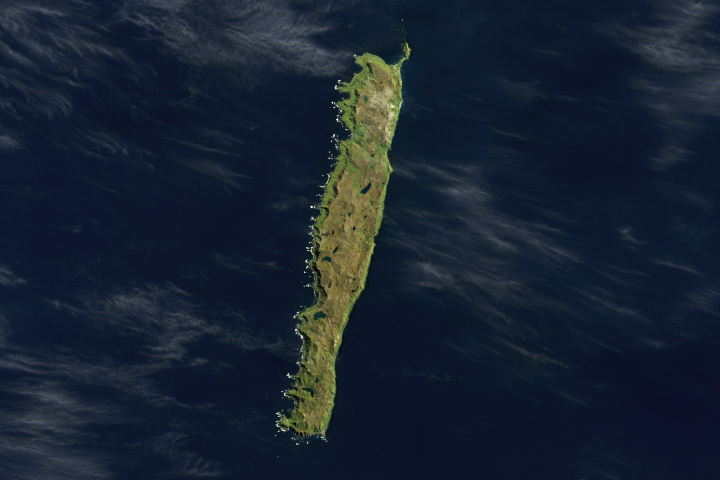
A Waypoint in the Southern Ocean Read more
![](https://eoimages.gsfc.nasa.gov/images/imagerecords/151000/151574/pasoseverino reservoir_oli2_2023164_th.png)
Reservoirs Run Dry in Montevideo Read more
![](https://eoimages.gsfc.nasa.gov/images/imagerecords/151000/151581/okeechobeealgae_oli2_2023163_th.jpg)
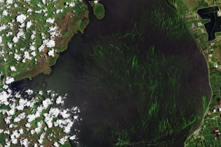
Algae Bloom in Lake Okeechobee Read more
![](https://eoimages.gsfc.nasa.gov/images/imagerecords/151000/151591/apbeaversnatclr_oli2_2022175_th.jpg)
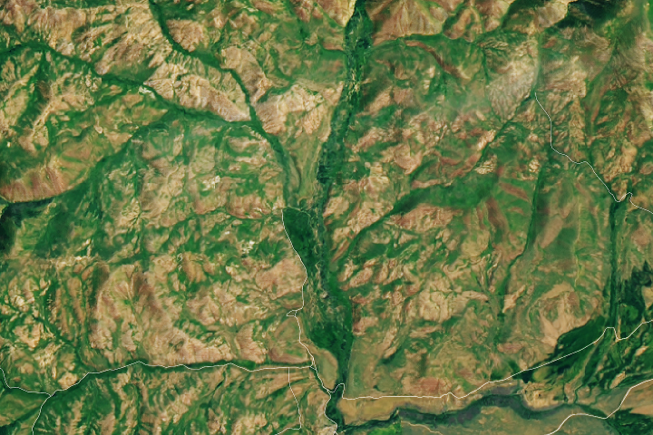
Idaho’s Emerald Refuge Read more
![](https://eoimages.gsfc.nasa.gov/images/imagerecords/151000/151619/shishaldinvolcano_oli_2023198_th.jpg)
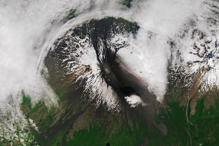
Shishaldin Erupts Read more