The Landsat satellite record stretches from 1972 to the present. This gallery includes all Landsat images published on the Earth Observatory, Visible Earth, and Landsat Science web sites from all seven Landsat satellites (Landsats 1-8, Landsat 6 failed to achieve orbit). All of the images are in the public domain and may be used with attribution. The correct attribution for imagery obtained from this site is:
“Landsat imagery courtesy of NASA Goddard Space Flight Center and U.S. Geological Survey” or “USGS/NASA Landsat”
![](https://eoimages.gsfc.nasa.gov/images/imagerecords/151000/151029/antakyacomp_bmhd_2023040_th.jpg)
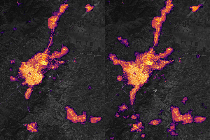
Dark Nights in Antakya Read more
![](https://eoimages.gsfc.nasa.gov/images/imagerecords/151000/151034/socalsnow_oli2_2023057_th.jpg)
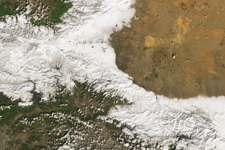
Snow in Southern California Read more
![](https://eoimages.gsfc.nasa.gov/images/imagerecords/151000/151046/mayottezm_oli_2015196_th.jpg)
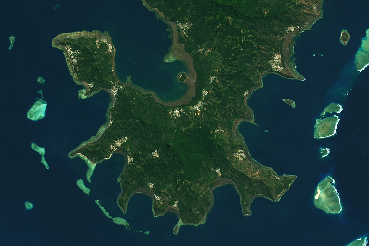
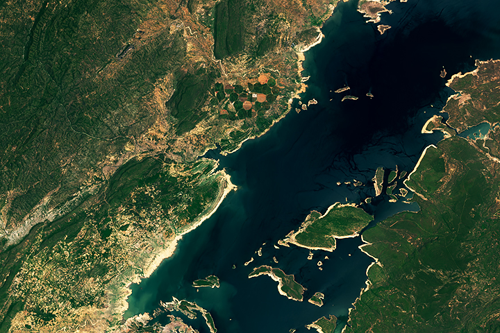
Mayotte’s Lagoon Read more
![](https://eoimages.gsfc.nasa.gov/images/imagerecords/151000/151051/brazillandslides_oli_2023057_th.jpg)
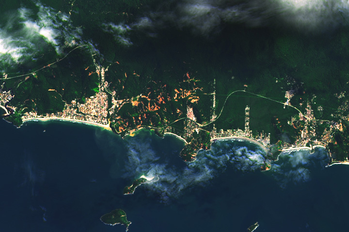
Landslides in São Paulo, Brazil Read more
![](https://eoimages.gsfc.nasa.gov/images/imagerecords/151000/151059/potosi_oli_2022328_th.jpg)
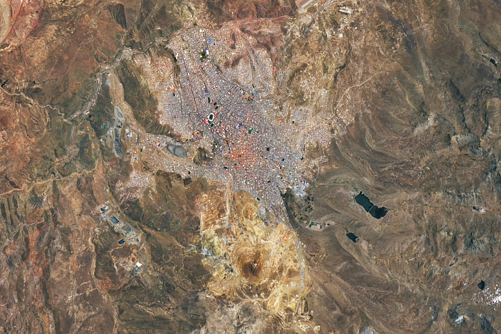
Potosí and Cerro Rico Read more
![](https://eoimages.gsfc.nasa.gov/images/imagerecords/151000/151068/kariba_oli_2022324_th.jpg)
Low Water Level on Lake Kariba Read more
![](https://eoimages.gsfc.nasa.gov/images/imagerecords/151000/151073/louisianarice_oli2_2023034_th.jpg)
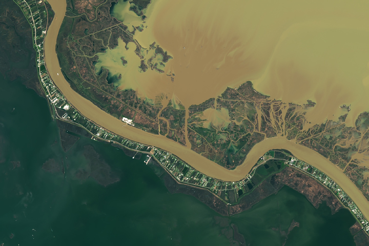
Flooded Rice Fields in Louisiana Read more
![](https://eoimages.gsfc.nasa.gov/images/imagerecords/151000/151085/mountainpassmine_oli_2022359_th.jpg)
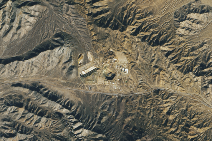
Mountain Pass Rare Earth Mine Read more
![](https://eoimages.gsfc.nasa.gov/images/imagerecords/151000/151089/neptunepass_oli_2023037_th.jpg)
The Widening of Neptune Pass Read more