The Landsat satellite record stretches from 1972 to the present. This gallery includes all Landsat images published on the Earth Observatory, Visible Earth, and Landsat Science web sites from all seven Landsat satellites (Landsats 1-8, Landsat 6 failed to achieve orbit). All of the images are in the public domain and may be used with attribution. The correct attribution for imagery obtained from this site is:
“Landsat imagery courtesy of NASA Goddard Space Flight Center and U.S. Geological Survey” or “USGS/NASA Landsat”
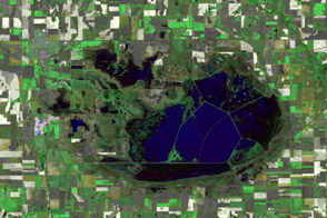
Cheyenne Bottoms in Drought Read more
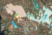
Sivash, Ukraine Read more
Deepwater Horizon Oil Spill Read more
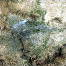
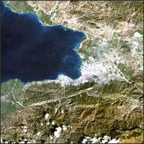
Kabul, Afghanistan Read more
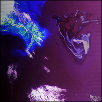
Gulf of Mexico Oil Spill 2010 Read more
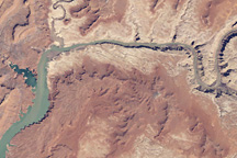
April 2010 Water Level in Lake Powell Read more
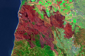
Mapping the Severity of Springs Fire from Space Read more
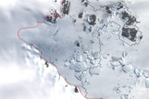
New Map of Antarctica’s Icy Edge Read more
Haiti Earthquake 2010 Read more