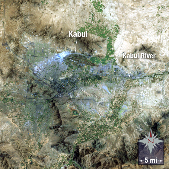
acquired May 14, 2010
Kabul, Afghanistan
Downloads
- Kabul_Afghanistan.tif (3981x3981, TIFF)
Metadata
- Sensor(s):
- Landsat 7 - ETM+
- Data Date: May 14, 2010
- Visualization Date: May 26, 2010
Kabul, Afghanistan is thought to have been founded between 2000 BC and 1500 BC. It is the capital and largest city of Afghanistan with a population numbering between 2 to 3 million. The city is located between South and Central Asia along the Kabul River in a valley between the Hindu Kush Mountains.
In this image Kabul is a silvery-grey and dark blue. Hills, mountains, and bare ground that surround the city appear various shades of brown and tan. Vegetation appears green.
This Landsat 7 panchromatic image was acquired on July 27, 2002. It is a true color image using bands 3,2,1 and the panchromatic band. Kabul falls on Landsat WRS-2 Path 153 Row 36.
NASA GSFC Landsat/LDCM EPO Team