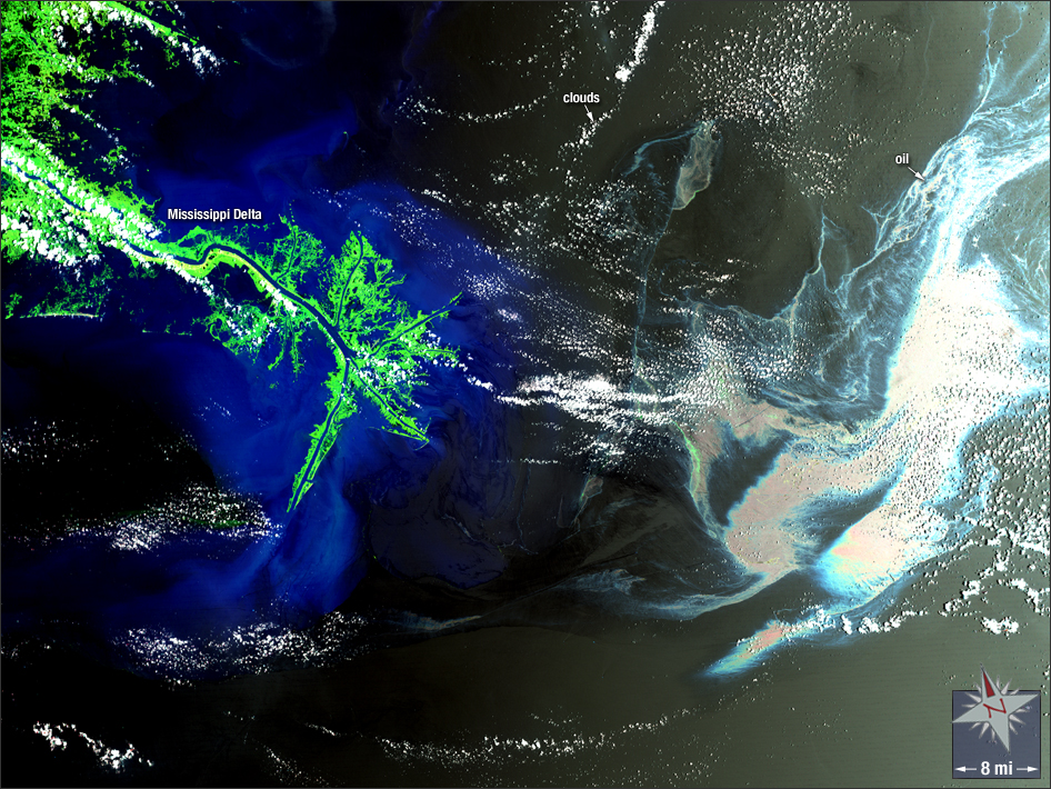
acquired May 17, 2010
Deepwater Horizon Oil Spill
Downloads
- 2010_Oil_Spill.tif (TIFF)
Metadata
- Sensor(s):
- Landsat 7 - ETM+
- Data Date: May 17, 2010
- Visualization Date: May 22, 2012
On April 20, 2010, an explosion on the Deepwater Horizon oil platform in the Gulf of Mexico killed eleven workers, sunk the platform, and left its seafloor well gushing. This initiated a massive offshore oil spill—the largest in U.S. history. The spill continued until July 15, 2010, causing immense surface oil slicks and ecological damage to the U.S. coastline. In this false-color Landsat 7 image, a colossal oil slick can be seen floating southeast of the Mississippi Delta.
NASA GSFC Landsat/LDCM EPO Team