The Landsat satellite record stretches from 1972 to the present. This gallery includes all Landsat images published on the Earth Observatory, Visible Earth, and Landsat Science web sites from all seven Landsat satellites (Landsats 1-8, Landsat 6 failed to achieve orbit). All of the images are in the public domain and may be used with attribution. The correct attribution for imagery obtained from this site is:
“Landsat imagery courtesy of NASA Goddard Space Flight Center and U.S. Geological Survey” or “USGS/NASA Landsat”

Getting Saltier Read more
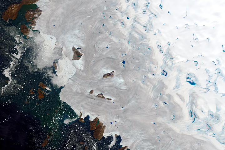
Warm Weather Brings Major Melting to Greenland Read more
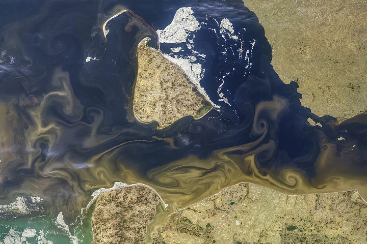
Tawny Swirls in the Kara Sea Read more
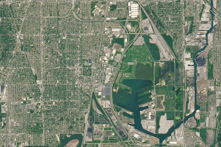
Laboring in Pullman Read more
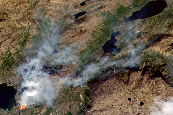
Another Fire in Greenland Read more
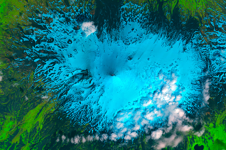
Heightened Activity at Shishaldin Volcano Read more
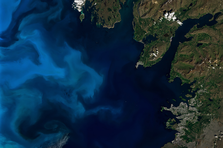
Iceland’s Waters Abloom Read more
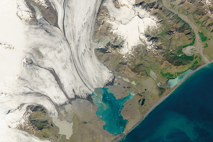
Iceland’s Glacial Lagoon Read more
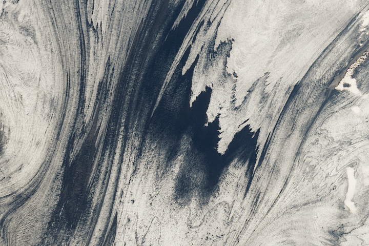
Iceland’s Volcanic Glacier Read more