The Landsat satellite record stretches from 1972 to the present. This gallery includes all Landsat images published on the Earth Observatory, Visible Earth, and Landsat Science web sites from all seven Landsat satellites (Landsats 1-8, Landsat 6 failed to achieve orbit). All of the images are in the public domain and may be used with attribution. The correct attribution for imagery obtained from this site is:
“Landsat imagery courtesy of NASA Goddard Space Flight Center and U.S. Geological Survey” or “USGS/NASA Landsat”

Freshwater Stores Shrank in Tigris-Euphrates Basin Read more
First Images from the Landsat Data Continuity Mission Read more
First View from the New Landsat Satellite Read more
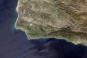
Earth Science Lifts off from the California Coast Read more
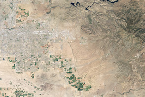
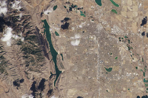
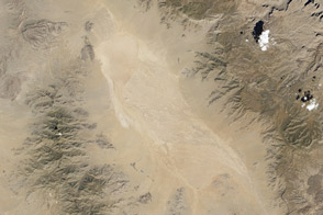
Hot and Cold in the Arizona Desert Read more
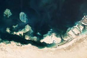
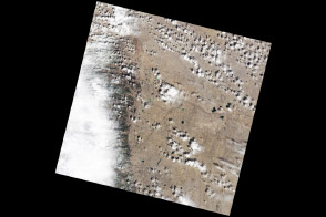
Mangroves, Domes, and Flats on the UAE Coast Read more
Eye Exam for a Satellite Read more
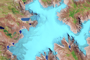
Tropical Climate History...Shrinking Read more

Exploring the Grand Canyon Read more