The Landsat satellite record stretches from 1972 to the present. This gallery includes all Landsat images published on the Earth Observatory, Visible Earth, and Landsat Science web sites from all seven Landsat satellites (Landsats 1-8, Landsat 6 failed to achieve orbit). All of the images are in the public domain and may be used with attribution. The correct attribution for imagery obtained from this site is:
“Landsat imagery courtesy of NASA Goddard Space Flight Center and U.S. Geological Survey” or “USGS/NASA Landsat”

Mudtrails from Fishing Trawlers in Gulf of Mexico Read more
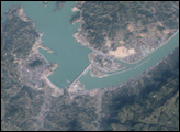
Three Gorges Dam, China Read more
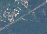
Tornadoes Strike Northern Wisconsin Read more
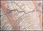
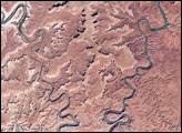
Capitol Reef National Park, Utah Read more
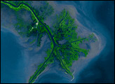
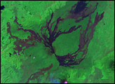
Mississippi River Delta Read more
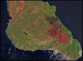
Burn Scar on Santa Catalina Island Read more
Nyamuragira and Nyiragongo Read more
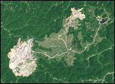
Hobet-21 Mine, West Virginia Read more
Island in the Sky, Canyonlands National Park Read more