The Landsat satellite record stretches from 1972 to the present. This gallery includes all Landsat images published on the Earth Observatory, Visible Earth, and Landsat Science web sites from all seven Landsat satellites (Landsats 1-8, Landsat 6 failed to achieve orbit). All of the images are in the public domain and may be used with attribution. The correct attribution for imagery obtained from this site is:
“Landsat imagery courtesy of NASA Goddard Space Flight Center and U.S. Geological Survey” or “USGS/NASA Landsat”
Denver Skyline Read more
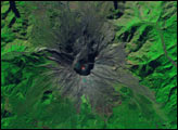
Mount St. Helens Read more
Oil Spill off Unalaska Island Read more
Delaware Water Gap Read more
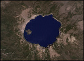
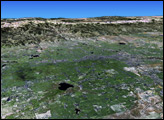
Crater Lake National Park Read more
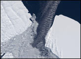
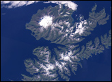
Antarctic Iceberg Gets Stuck Read more
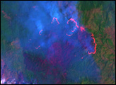
Fires in Hispaniola Read more
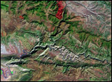
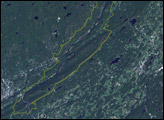
Dinosaur National Monument Read more
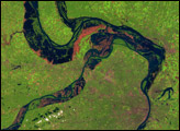
Great Flood of the Mississippi River, 1993 Read more