The Landsat satellite record stretches from 1972 to the present. This gallery includes all Landsat images published on the Earth Observatory, Visible Earth, and Landsat Science web sites from all seven Landsat satellites (Landsats 1-8, Landsat 6 failed to achieve orbit). All of the images are in the public domain and may be used with attribution. The correct attribution for imagery obtained from this site is:
“Landsat imagery courtesy of NASA Goddard Space Flight Center and U.S. Geological Survey” or “USGS/NASA Landsat”
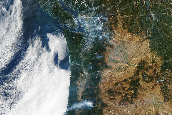
Late-Season Fires in the Pacific Northwest Read more
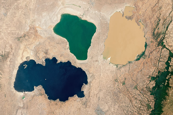
A Trio of Ethiopian Lakes Read more
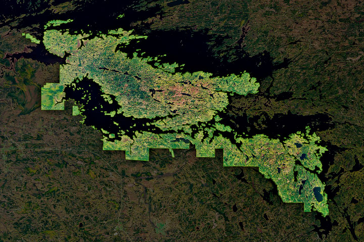
Voyageurs National Park Read more
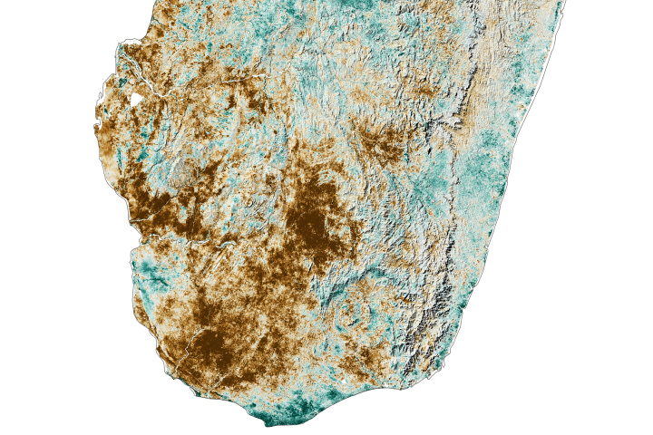
Another Lean Season in the Grand Sud Read more
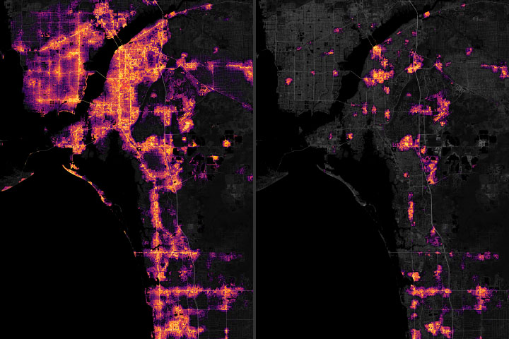
Power Outages after Hurricane Ian Read more
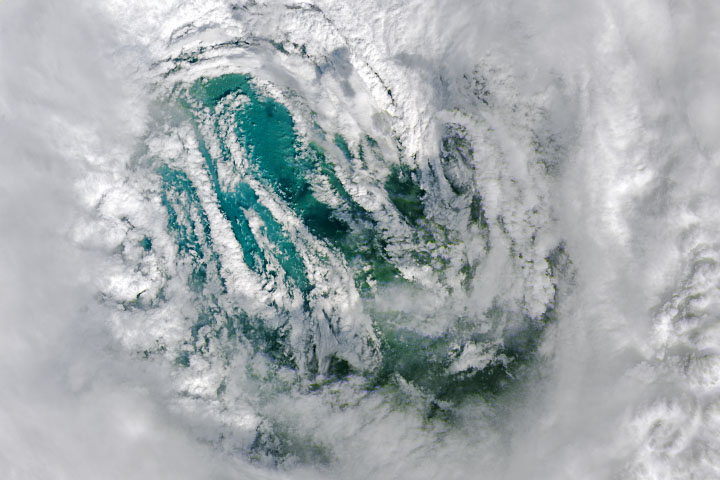
Staring Into Ian’s Eye Read more
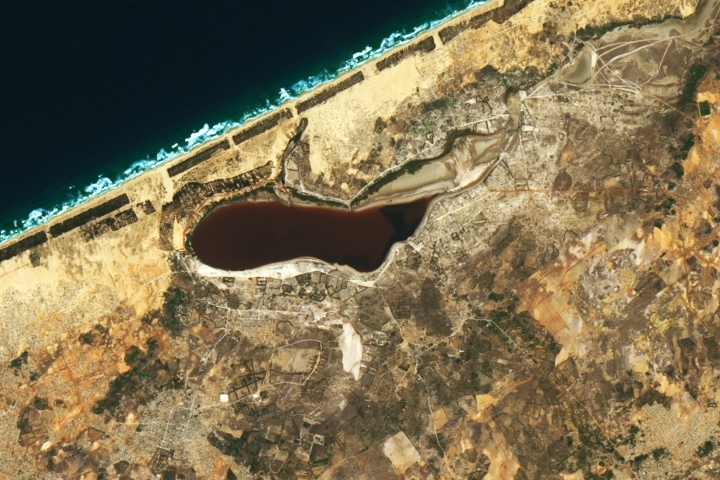
Pink Lake Loses its Rosy Hue Read more
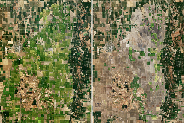
A Rough Year for Rice in California Read more
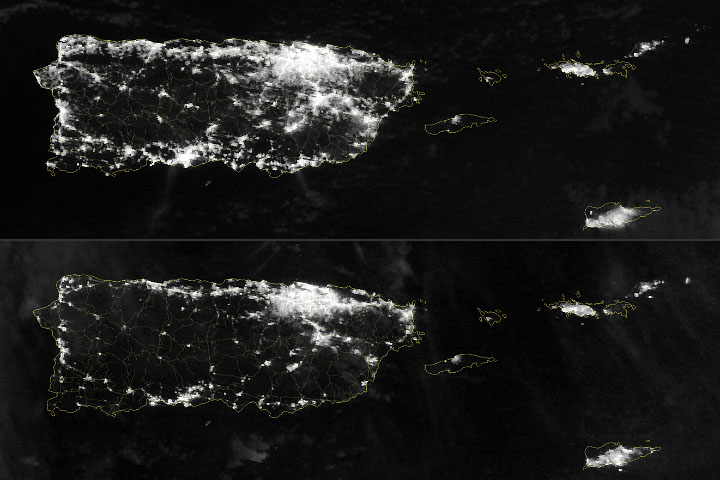
Power Outages in Puerto Rico Read more