The Landsat satellite record stretches from 1972 to the present. This gallery includes all Landsat images published on the Earth Observatory, Visible Earth, and Landsat Science web sites from all seven Landsat satellites (Landsats 1-8, Landsat 6 failed to achieve orbit). All of the images are in the public domain and may be used with attribution. The correct attribution for imagery obtained from this site is:
“Landsat imagery courtesy of NASA Goddard Space Flight Center and U.S. Geological Survey” or “USGS/NASA Landsat”
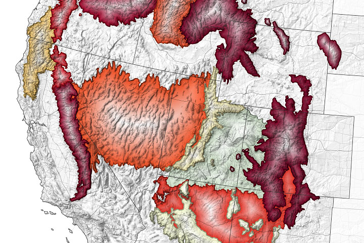
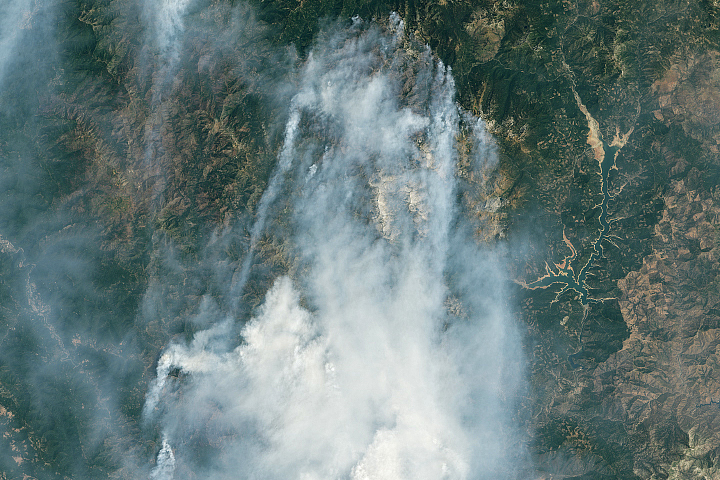
Climate Change Pushes Fires to Higher Ground Read more
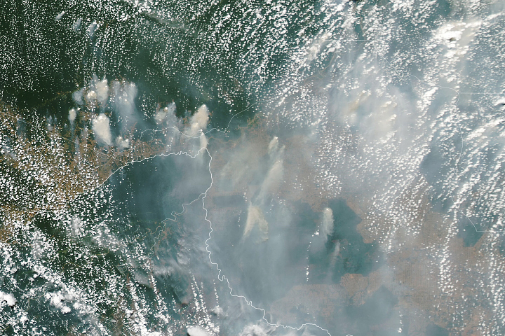
Smoky Skies in the Western Amazon Read more
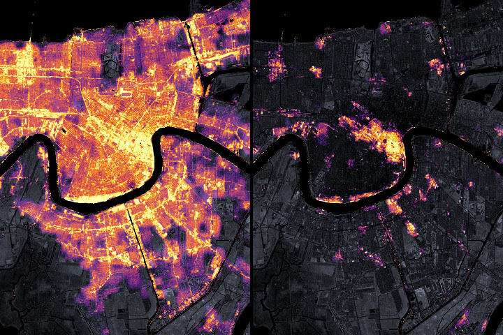
Satellite Observes Power Outages in New Orleans Read more
Arc of Fires in the U.S. West Read more
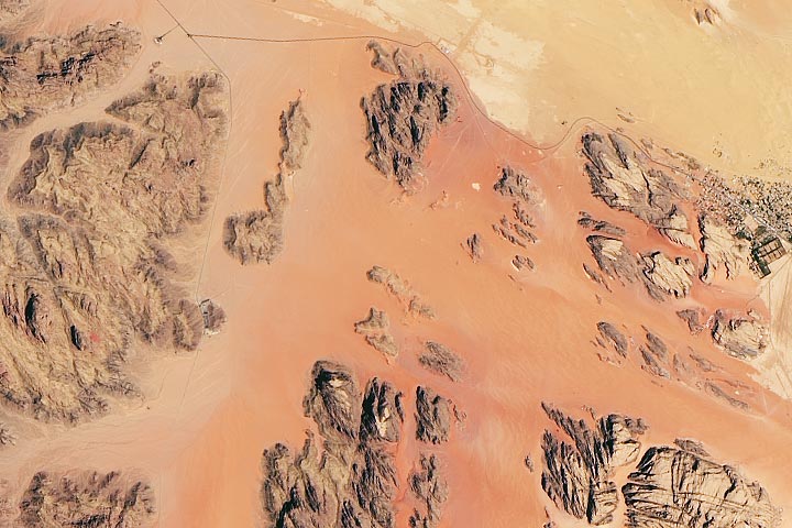
Movie Mars on Earth Read more
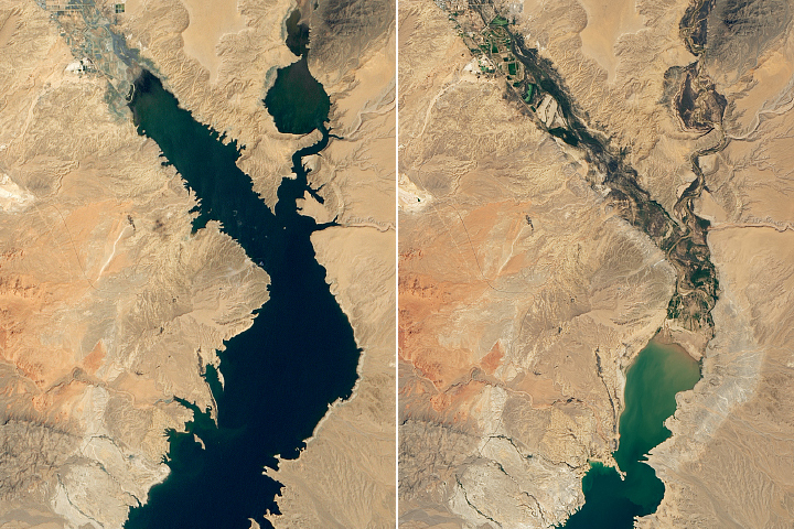
Lake Mead Drops to a Record Low Read more
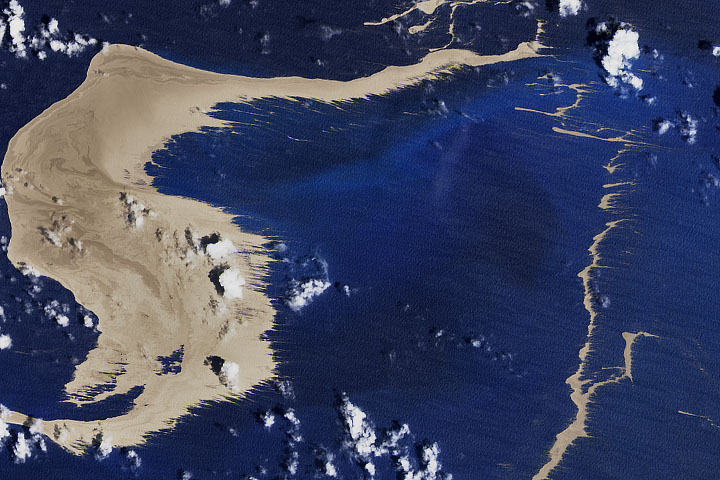
Fukutoku-Okanoba Explodes Read more
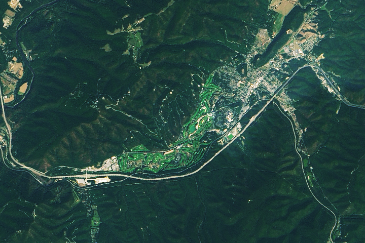
Birthplace of a Hidden Figure Read more
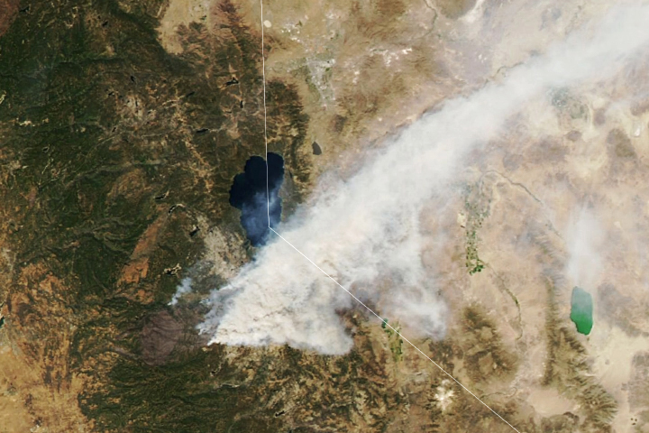
California Burning Read more