The Landsat satellite record stretches from 1972 to the present. This gallery includes all Landsat images published on the Earth Observatory, Visible Earth, and Landsat Science web sites from all seven Landsat satellites (Landsats 1-8, Landsat 6 failed to achieve orbit). All of the images are in the public domain and may be used with attribution. The correct attribution for imagery obtained from this site is:
“Landsat imagery courtesy of NASA Goddard Space Flight Center and U.S. Geological Survey” or “USGS/NASA Landsat”
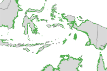
Mapping Mangroves by Satellite Read more
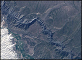
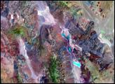
Black Canyon Read more
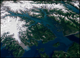
Glacier Bay National Park and Preserve Read more

New York City Temperature and Vegetation Read more

Reflecting on a Tumultuous Amazon Fire Season Read more
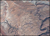
Arches National Park Read more
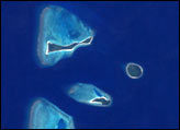
Coral Atolls Read more
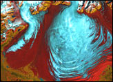
Malaspina Glacier, Alaska Read more
Death Valley National Park Read more