The Landsat satellite record stretches from 1972 to the present. This gallery includes all Landsat images published on the Earth Observatory, Visible Earth, and Landsat Science web sites from all seven Landsat satellites (Landsats 1-8, Landsat 6 failed to achieve orbit). All of the images are in the public domain and may be used with attribution. The correct attribution for imagery obtained from this site is:
“Landsat imagery courtesy of NASA Goddard Space Flight Center and U.S. Geological Survey” or “USGS/NASA Landsat”
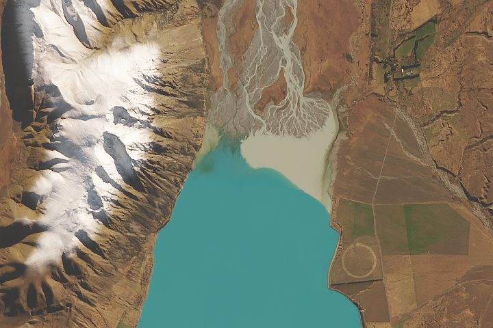
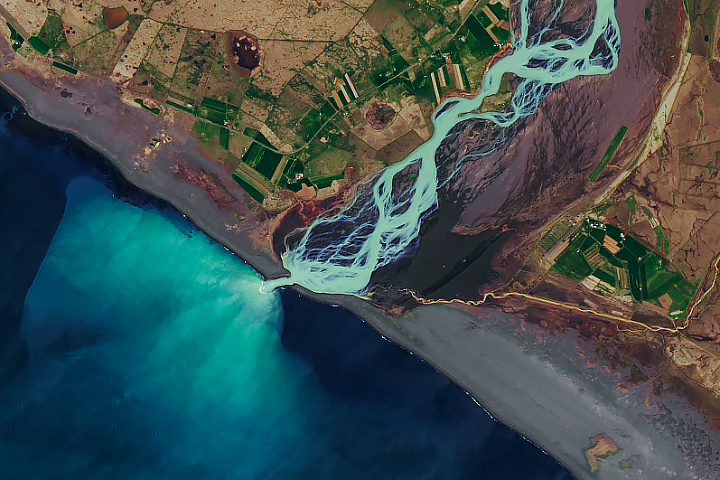
How Glaciers Turn Lakes Turquoise Read more
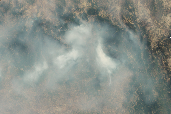
Wildfire Smoke Shrouds Mexico City Read more
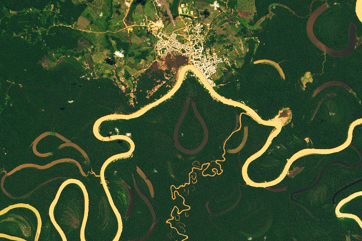
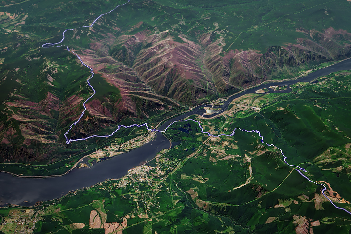
The Many Meanders of the Juruá Read more
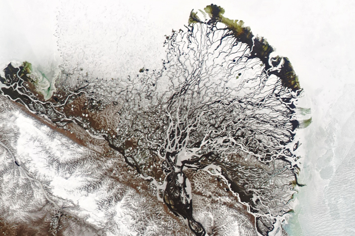
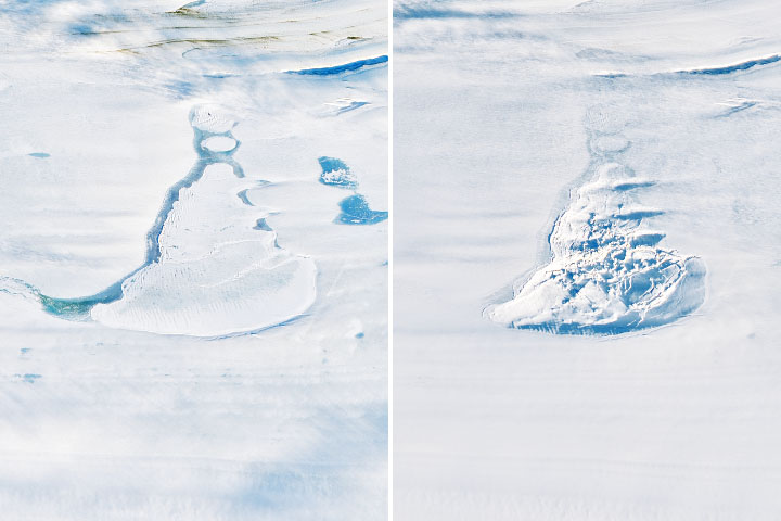
Lena Delta Shakes Off Winter Read more
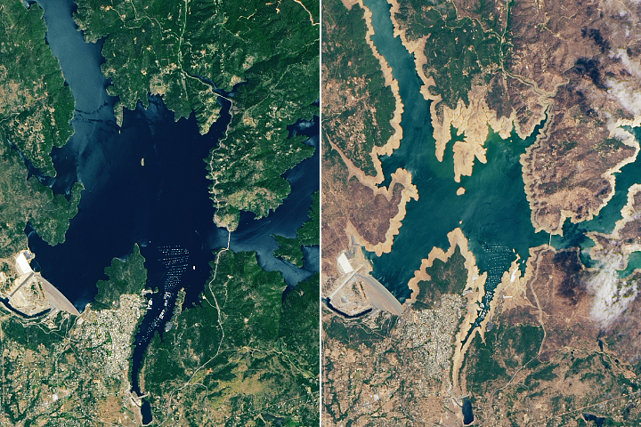
California Reservoirs Reflect Deepening Drought Read more
Iceland’s Raging Rivers Read more
Space Lasers Map Meltwater Lakes Read more
Landmarks of the Pacific Crest Trail Read more
A Muddy Mess in Indonesia Read more