The Landsat satellite record stretches from 1972 to the present. This gallery includes all Landsat images published on the Earth Observatory, Visible Earth, and Landsat Science web sites from all seven Landsat satellites (Landsats 1-8, Landsat 6 failed to achieve orbit). All of the images are in the public domain and may be used with attribution. The correct attribution for imagery obtained from this site is:
“Landsat imagery courtesy of NASA Goddard Space Flight Center and U.S. Geological Survey” or “USGS/NASA Landsat”
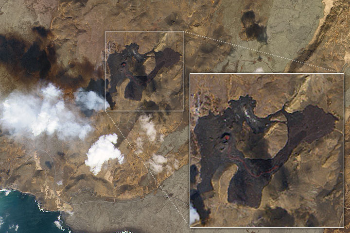
Lava Flows From Fagradalsfjall Read more
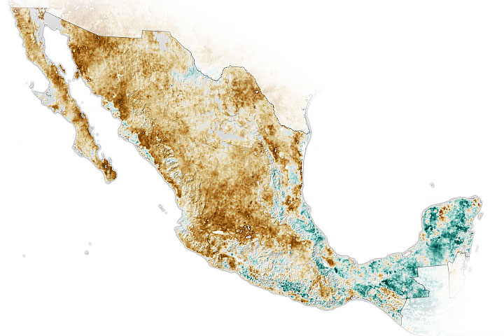
Widespread Drought in Mexico Read more
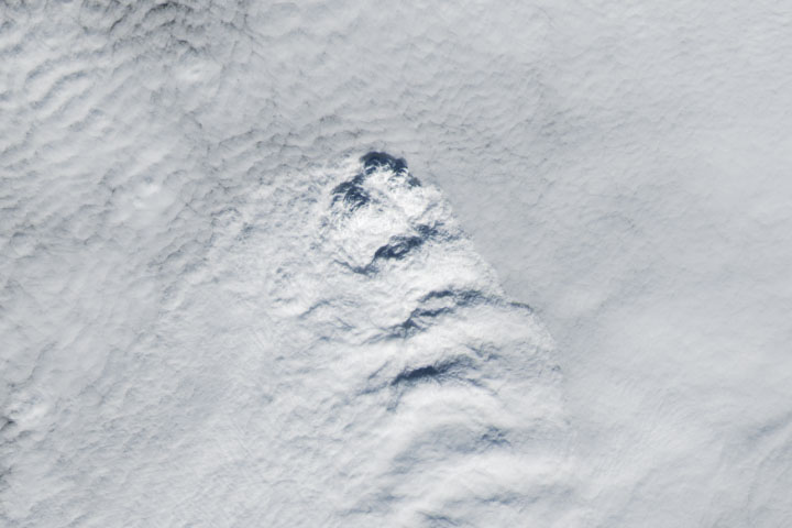
A Curious Case of Clouds in Iceland Read more

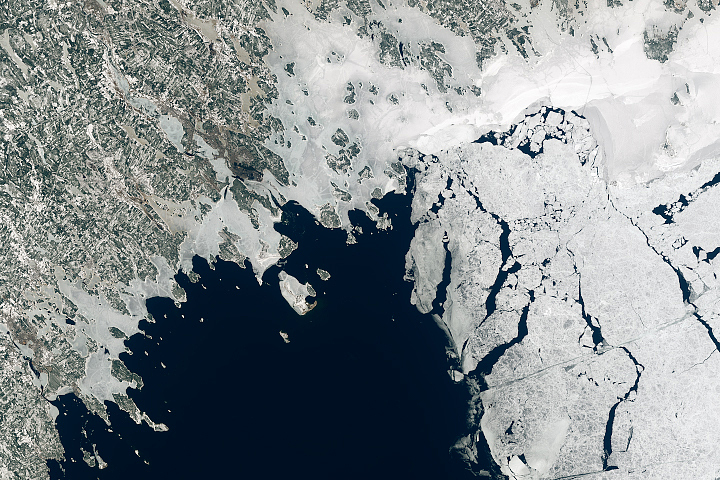
Ice Jam in Buckland Read more
Bothnian Bay Before the Breakup Read more
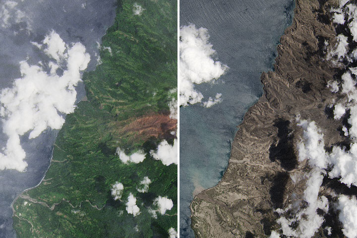
Rock and Glass Shards Blanket La Soufriére Read more
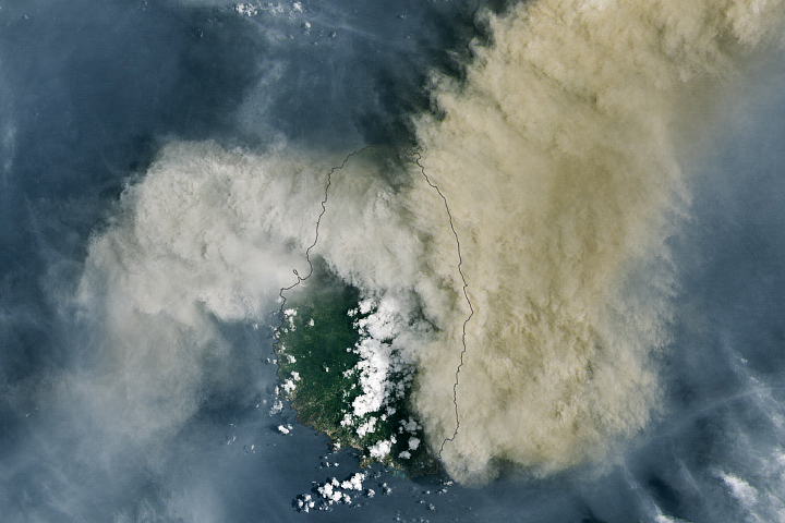
Tracking La Soufrière’s Plume Read more
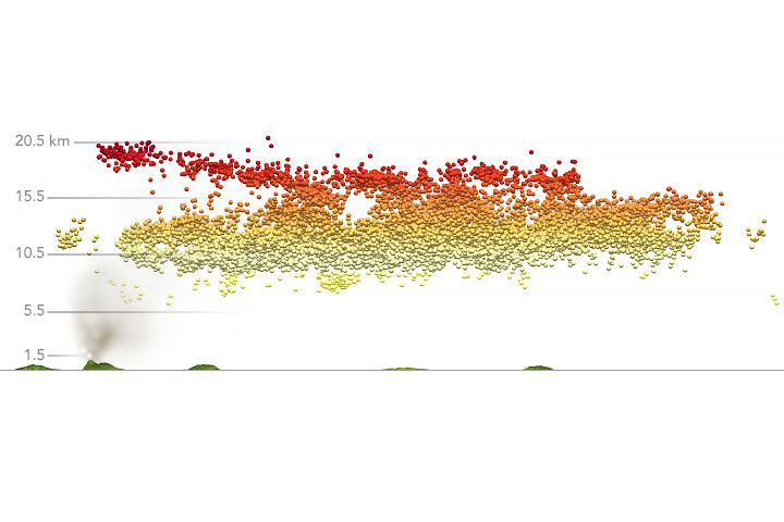
Eruption at La Soufrière Read more
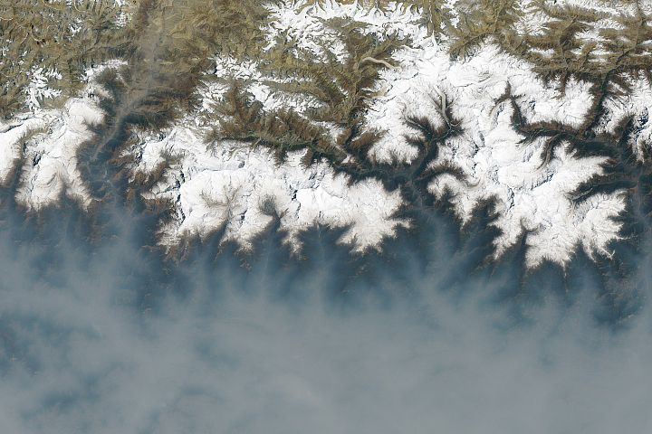
A Fierce Fire Season in Nepal Read more