The Landsat satellite record stretches from 1972 to the present. This gallery includes all Landsat images published on the Earth Observatory, Visible Earth, and Landsat Science web sites from all seven Landsat satellites (Landsats 1-8, Landsat 6 failed to achieve orbit). All of the images are in the public domain and may be used with attribution. The correct attribution for imagery obtained from this site is:
“Landsat imagery courtesy of NASA Goddard Space Flight Center and U.S. Geological Survey” or “USGS/NASA Landsat”
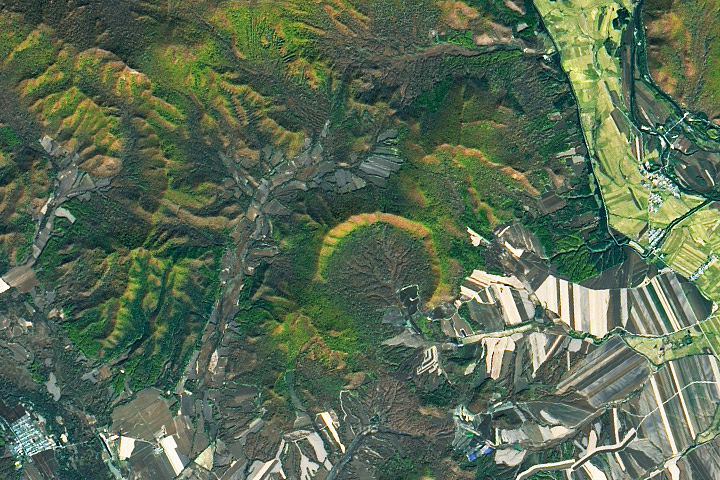
Young Impact Crater Uncovered in Yilan Read more
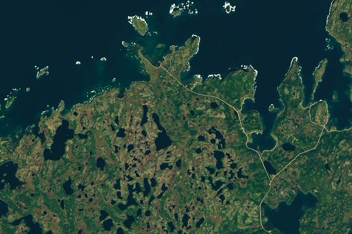
Burst of New Evidence for Viking Travels Read more
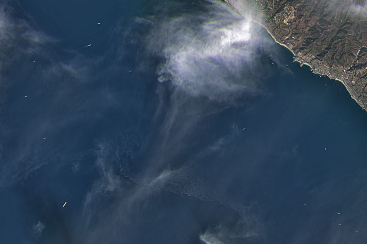
Satellites View California Oil Spill Read more
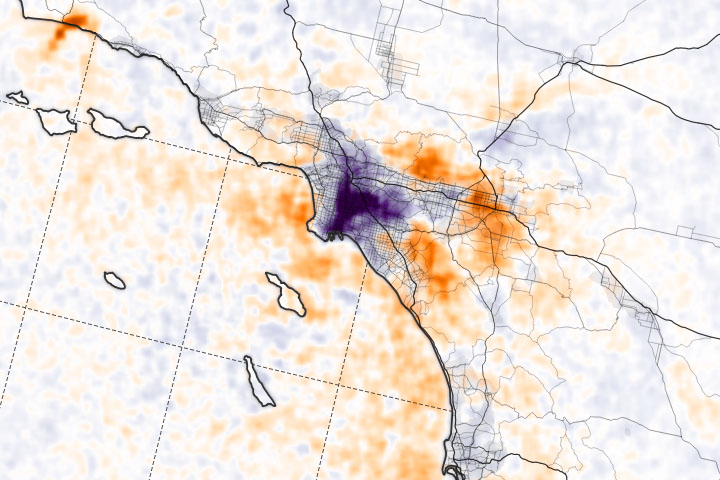
Scientific Questions Arrive in Ports Read more
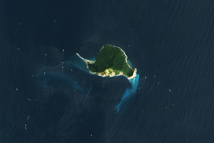
Guishan Island Read more
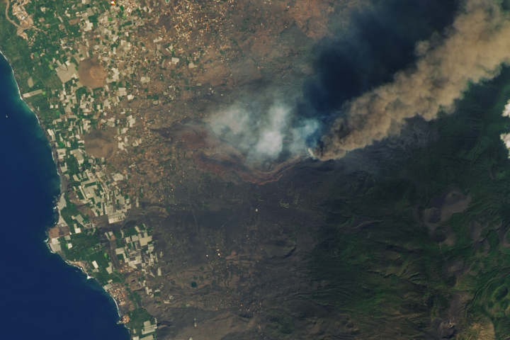
Lava Burns a Path Through La Palma Read more
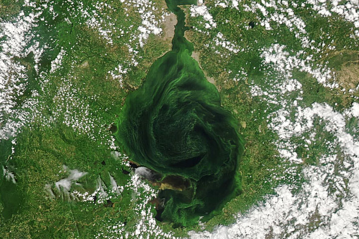
Troubled Waters Read more
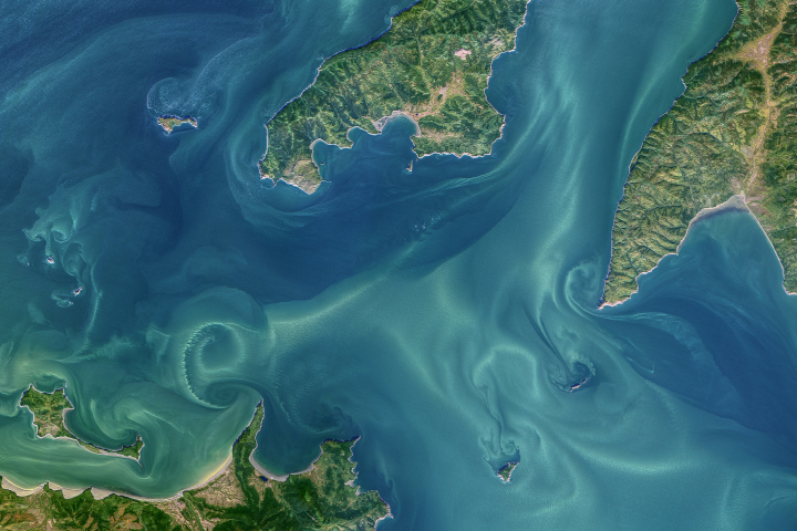
Tidal Vortices in the Sea of Okhotsk Read more

Intense, Widespread Drought Grips South America Read more