The Landsat satellite record stretches from 1972 to the present. This gallery includes all Landsat images published on the Earth Observatory, Visible Earth, and Landsat Science web sites from all seven Landsat satellites (Landsats 1-8, Landsat 6 failed to achieve orbit). All of the images are in the public domain and may be used with attribution. The correct attribution for imagery obtained from this site is:
“Landsat imagery courtesy of NASA Goddard Space Flight Center and U.S. Geological Survey” or “USGS/NASA Landsat”

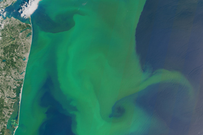
Algae Boom in Lake Erie Read more
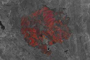
Rocky Fire, California Read more
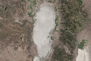
Goose Lake Dries Up Read more
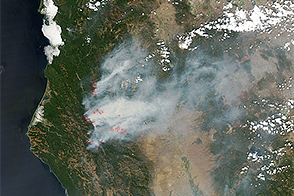
Wildfires in the West Read more
Blooms off Both North American Coasts Read more
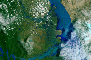
Flood Waters on the Irrawaddy Read more
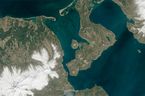
Keeping False Pass True Read more
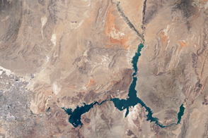
Losses in Lake Mead Read more
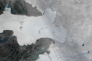
Ice Loss From Jakobshavn Glacier Read more