The Landsat satellite record stretches from 1972 to the present. This gallery includes all Landsat images published on the Earth Observatory, Visible Earth, and Landsat Science web sites from all seven Landsat satellites (Landsats 1-8, Landsat 6 failed to achieve orbit). All of the images are in the public domain and may be used with attribution. The correct attribution for imagery obtained from this site is:
“Landsat imagery courtesy of NASA Goddard Space Flight Center and U.S. Geological Survey” or “USGS/NASA Landsat”
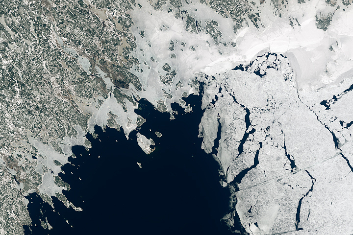
Bothnian Bay Before the Breakup Read more
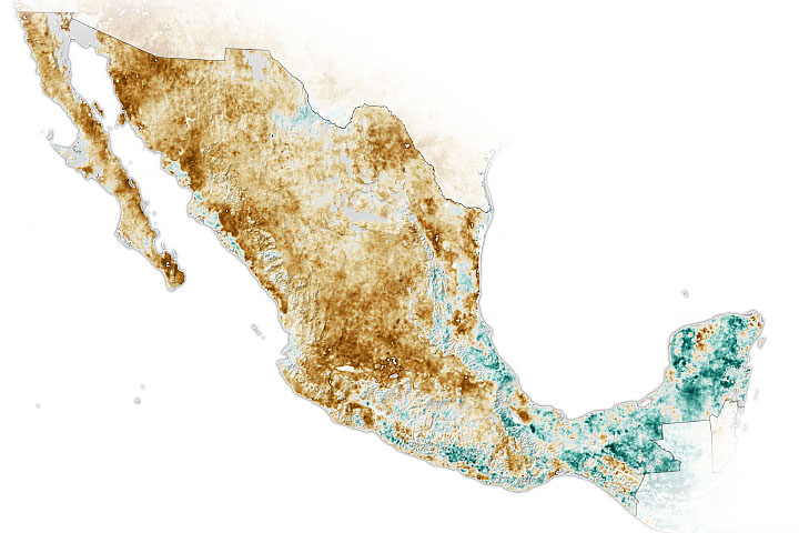
Widespread Drought in Mexico Read more
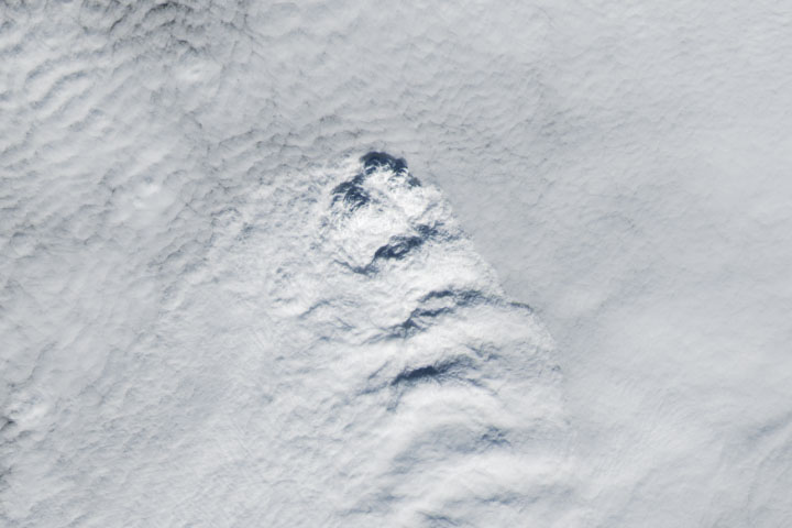
A Curious Case of Clouds in Iceland Read more
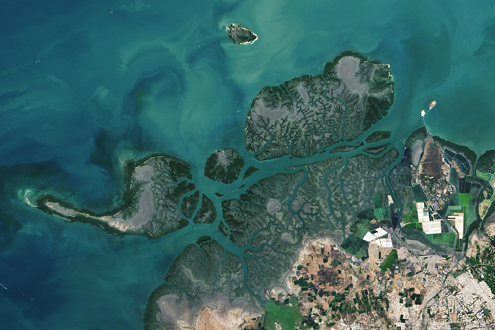
Kutch’s Coral Reefs Read more
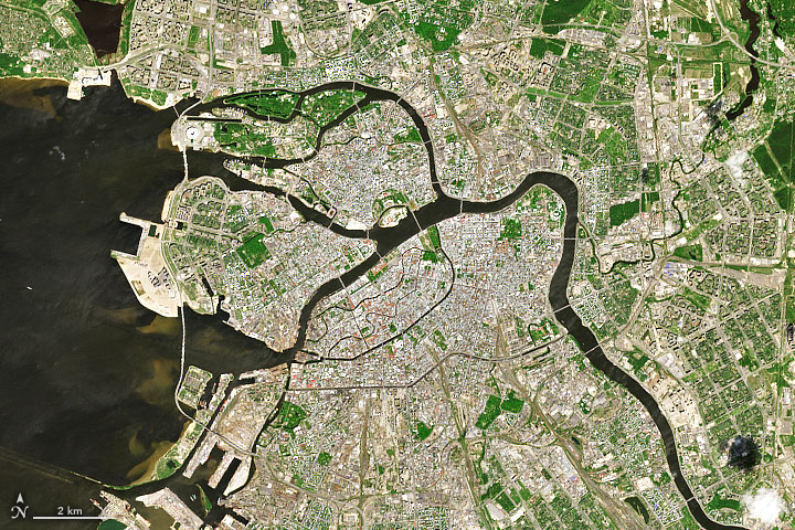
Saint Petersburg Keeps the Sea at Bay Read more
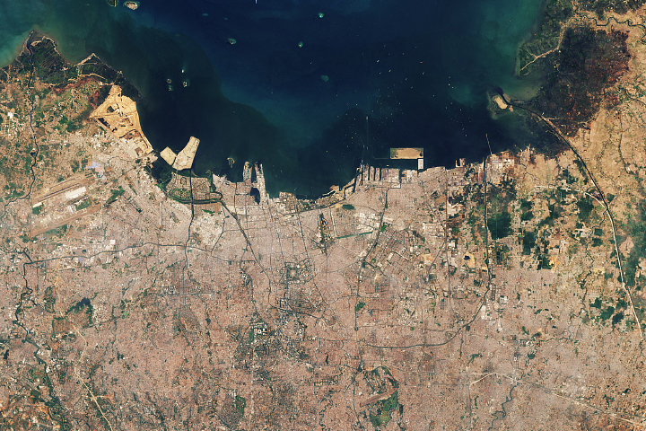
As Jakarta Grows, So Do the Water Issues Read more
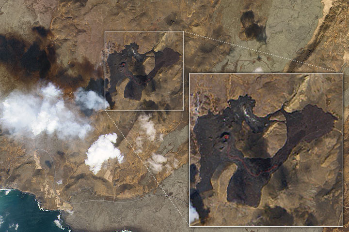
Lava Flows From Fagradalsfjall Read more
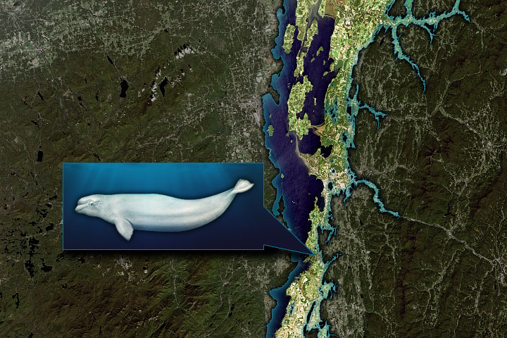
Discovering the Charlotte Whale Read more
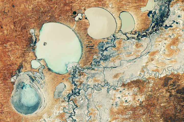
Menindee Lakes Finally Refilling Read more