The Landsat satellite record stretches from 1972 to the present. This gallery includes all Landsat images published on the Earth Observatory, Visible Earth, and Landsat Science web sites from all seven Landsat satellites (Landsats 1-8, Landsat 6 failed to achieve orbit). All of the images are in the public domain and may be used with attribution. The correct attribution for imagery obtained from this site is:
“Landsat imagery courtesy of NASA Goddard Space Flight Center and U.S. Geological Survey” or “USGS/NASA Landsat”
![](https://eoimages.gsfc.nasa.gov/images/imagerecords/147000/147600/kobukdunes_oli_2020229_th.jpg)
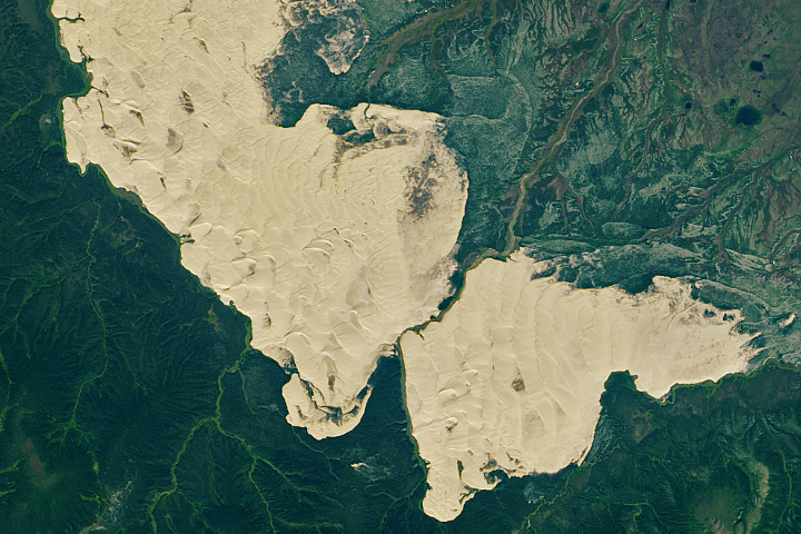
An Unexpected Expanse of Sand in Alaska Read more
![](https://eoimages.gsfc.nasa.gov/images/imagerecords/147000/147629/svalbard_oli_2020236_th.jpg)
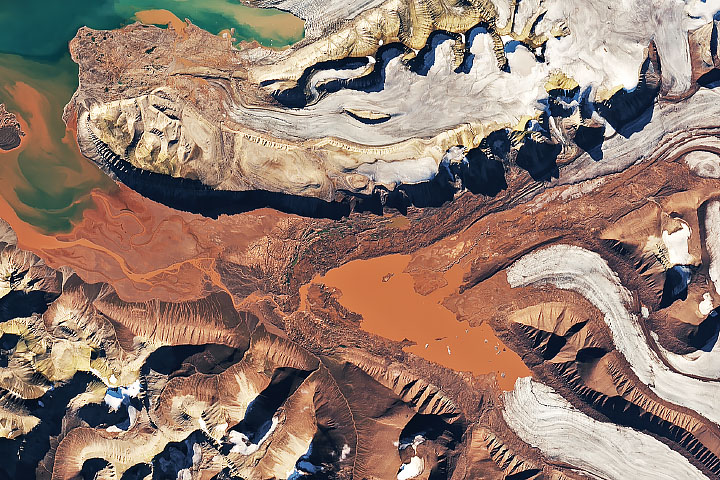
A Swirl of Old Supercontinent Silt Read more
![](https://eoimages.gsfc.nasa.gov/images/imagerecords/147000/147215/california_oli_2020245_th.jpg)
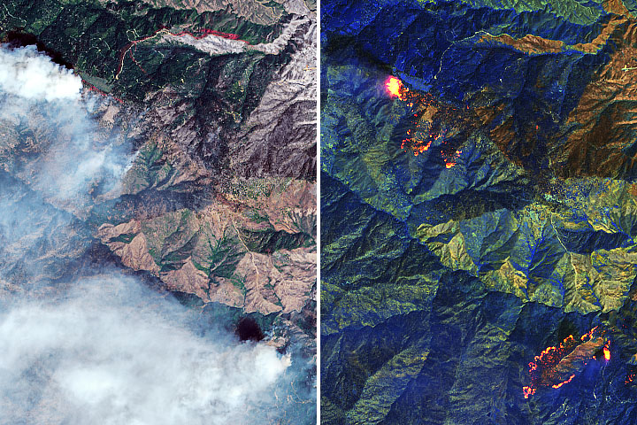
California Continues to Burn Read more
![](https://eoimages.gsfc.nasa.gov/images/imagerecords/151000/151913/lakeurmiazm_oli2_2023250_th.jpg)
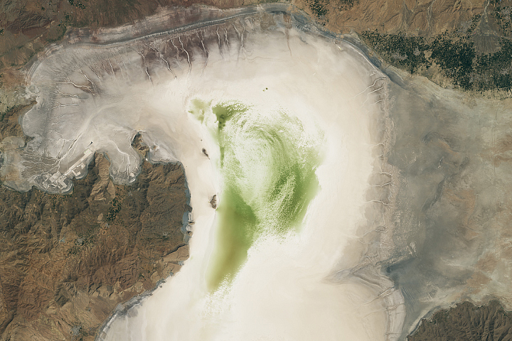
Lake Urmia Shrivels Again Read more
![](https://eoimages.gsfc.nasa.gov/images/imagerecords/147000/147269/pantanalfires_tmo_2020250_th.jpg)
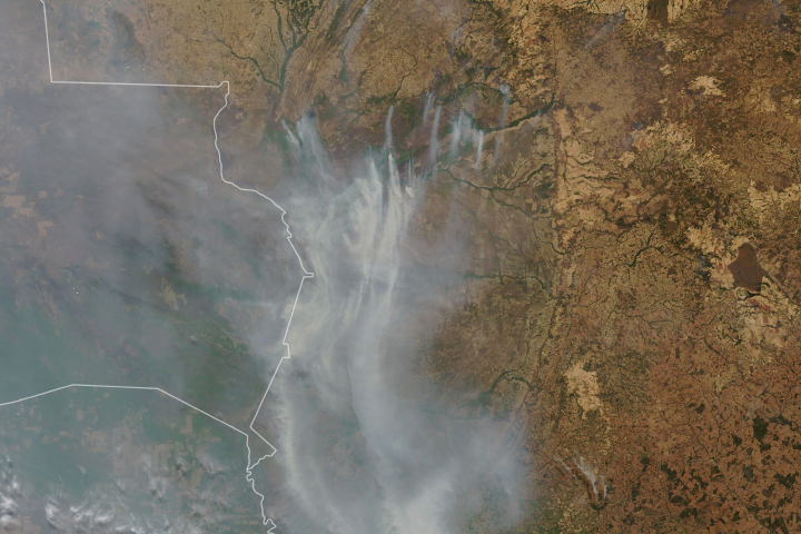
Fires Char the Pantanal Read more
![](https://eoimages.gsfc.nasa.gov/images/imagerecords/149000/149922/paramaribo_oli_2020254_th.jpg)
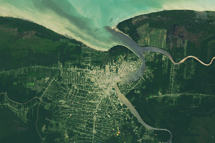
Paramaribo, Suriname Read more
![](https://eoimages.gsfc.nasa.gov/images/imagerecords/147000/147359/kotelny_oli_2020255_th.jpg)
Sandy Plains in the Arctic Read more
![](https://eoimages.gsfc.nasa.gov/images/imagerecords/148000/148844/sudbury_oli_2020255_th.jpg)
Sudbury Impact Structure Read more
![](https://eoimages.gsfc.nasa.gov/images/imagerecords/148000/148234/rainbowmtnspt2_oli_2020261_th.jpg)
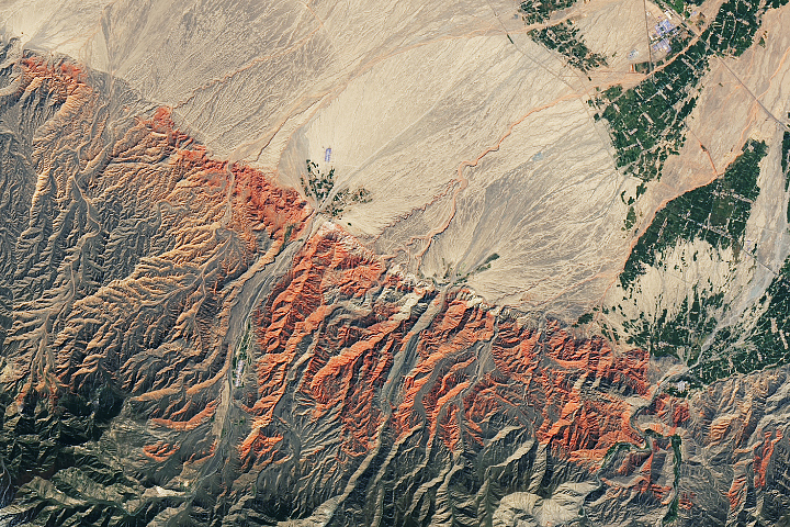
Red Rocks and Rainbow Ridges Read more