The Landsat satellite record stretches from 1972 to the present. This gallery includes all Landsat images published on the Earth Observatory, Visible Earth, and Landsat Science web sites from all seven Landsat satellites (Landsats 1-8, Landsat 6 failed to achieve orbit). All of the images are in the public domain and may be used with attribution. The correct attribution for imagery obtained from this site is:
“Landsat imagery courtesy of NASA Goddard Space Flight Center and U.S. Geological Survey” or “USGS/NASA Landsat”
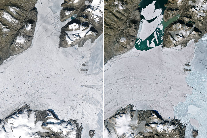
Spalte Splits Read more
The Specter of a Mega-Tsunami in Alaska Read more
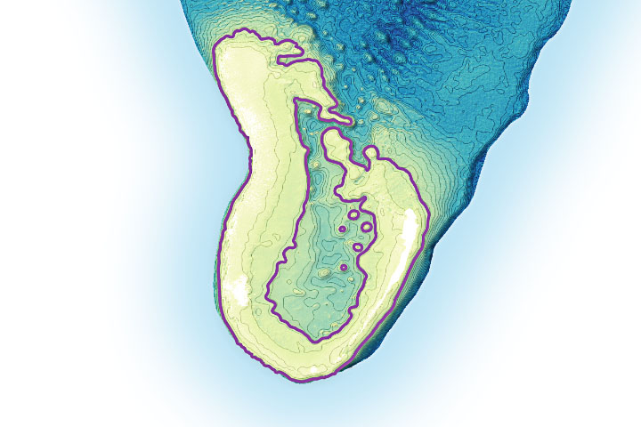
Mapping Shallow Seafloors Read more
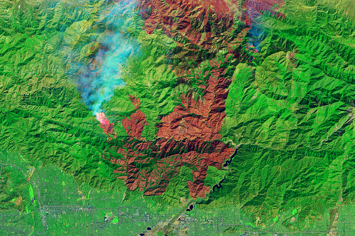
Bobcat Fire Scorches Southern California Read more
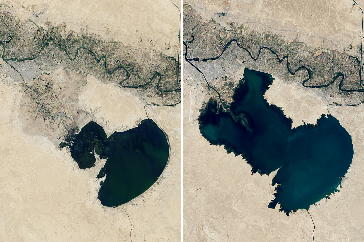
Iraq Lakes Bounce Back Read more
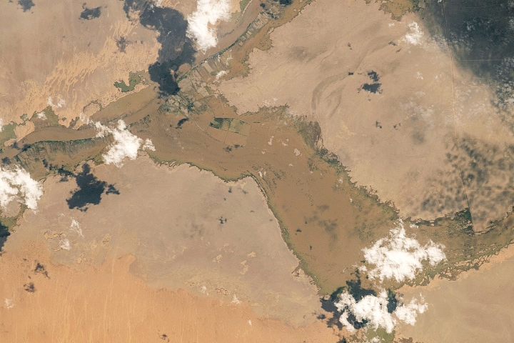
Record Flooding in Sudan Read more
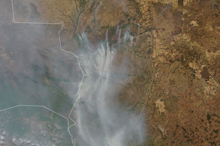
Fires Char the Pantanal Read more

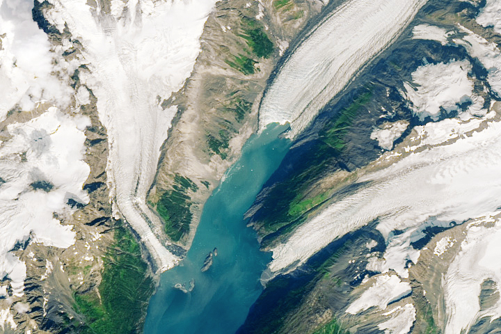
Where Ice Still Flows into Glacier Bay Read more
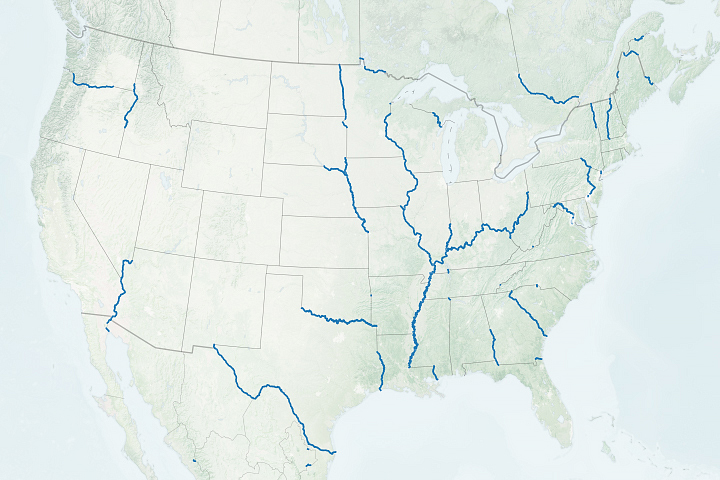
How Rivers Shape States Read more