The Landsat satellite record stretches from 1972 to the present. This gallery includes all Landsat images published on the Earth Observatory, Visible Earth, and Landsat Science web sites from all seven Landsat satellites (Landsats 1-8, Landsat 6 failed to achieve orbit). All of the images are in the public domain and may be used with attribution. The correct attribution for imagery obtained from this site is:
“Landsat imagery courtesy of NASA Goddard Space Flight Center and U.S. Geological Survey” or “USGS/NASA Landsat”
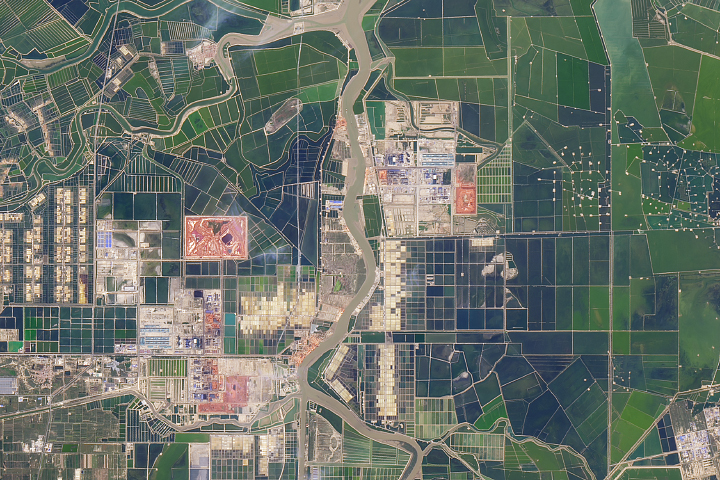
A Very Human Landscape in China Read more

Darkness Blooms Read more
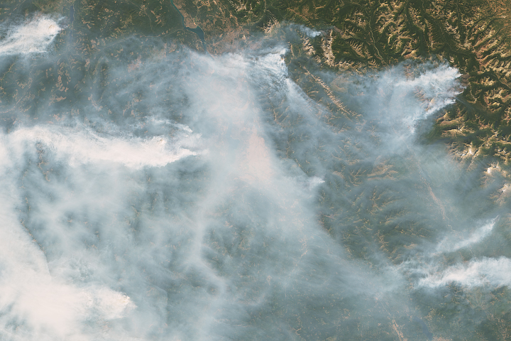
Fires near the Montana-Canada Border Read more
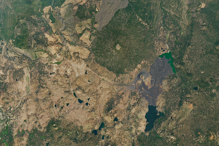
A Fateful Year at Cinder Cone Read more
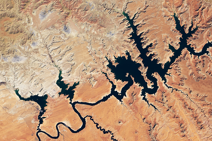
Lake Powell Reaches New Low Read more
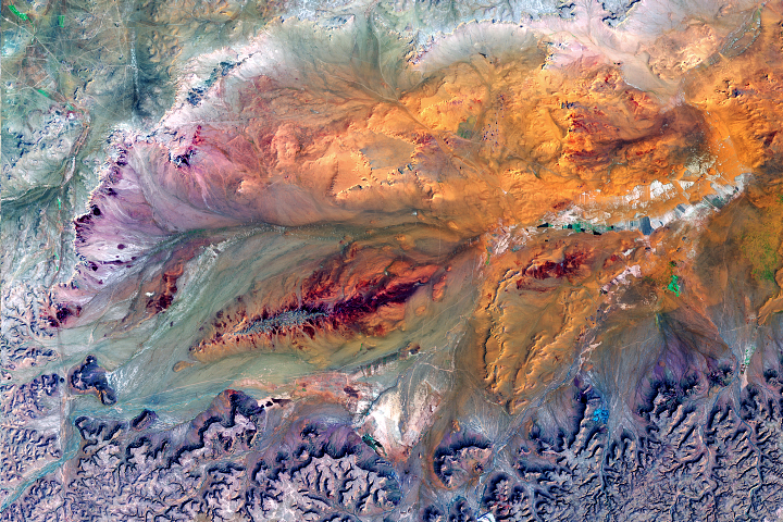
Sculpting a Basin Read more
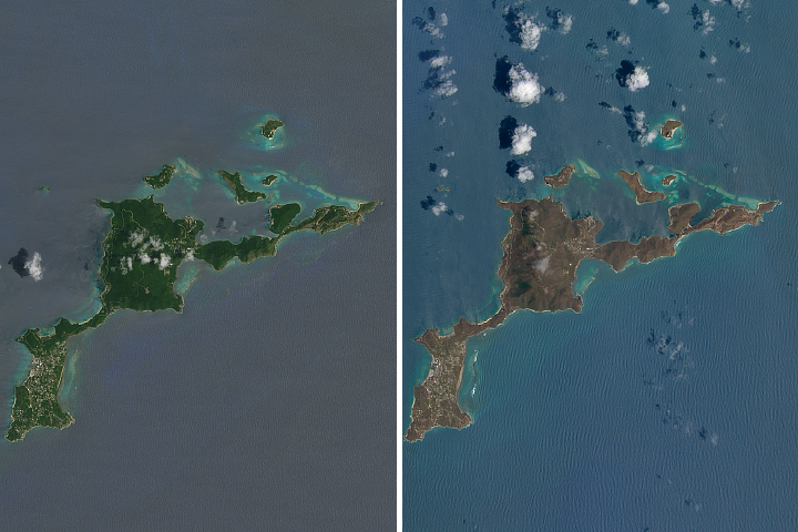
Hurricane Irma Turns Caribbean Islands Brown Read more
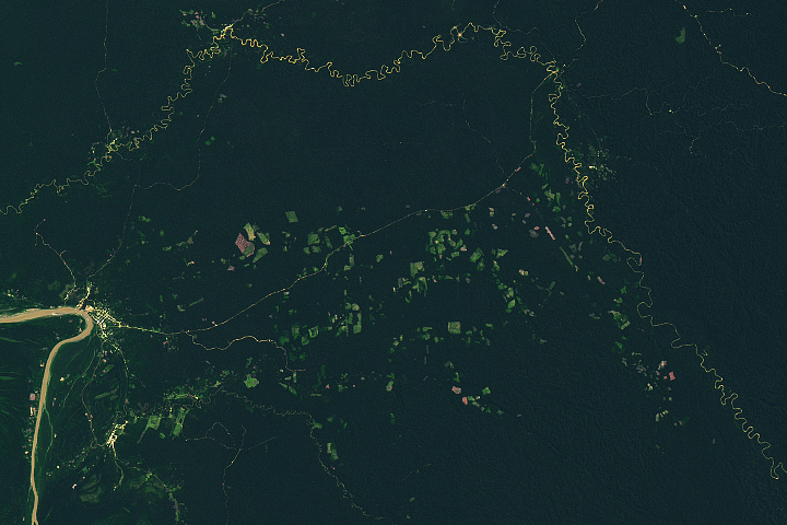
Deforestation Follows a Road Through Ucayali Read more
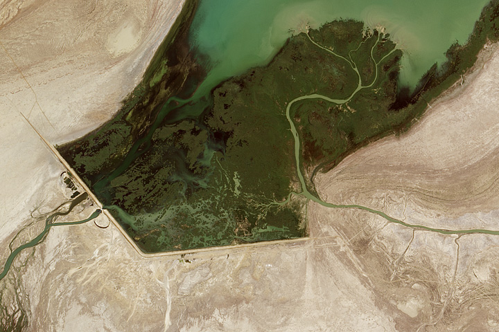
New Water in the Aral Sea Read more