The Landsat satellite record stretches from 1972 to the present. This gallery includes all Landsat images published on the Earth Observatory, Visible Earth, and Landsat Science web sites from all seven Landsat satellites (Landsats 1-8, Landsat 6 failed to achieve orbit). All of the images are in the public domain and may be used with attribution. The correct attribution for imagery obtained from this site is:
“Landsat imagery courtesy of NASA Goddard Space Flight Center and U.S. Geological Survey” or “USGS/NASA Landsat”
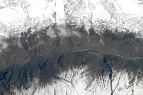
Landslide in Langtang Valley Read more

Sediments Betray Hidden Shipwrecks Read more

Volcanic Mood Rings Read more
“New” Pacific Island Consumes Its Neighbor Read more
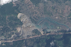
Landslide and Barrier Lake near Oso, Washington Read more
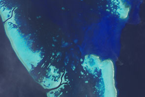
Seeing the Reef for the Corals Read more
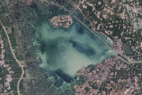
Nansi Lake, China Read more
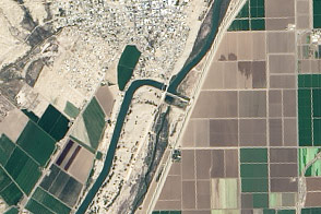
Restoring a Pulse to the Lower Colorado Read more
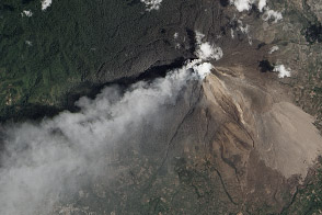
Eruption of Sinabung Volcano, Indonesia Read more