The Landsat satellite record stretches from 1972 to the present. This gallery includes all Landsat images published on the Earth Observatory, Visible Earth, and Landsat Science web sites from all seven Landsat satellites (Landsats 1-8, Landsat 6 failed to achieve orbit). All of the images are in the public domain and may be used with attribution. The correct attribution for imagery obtained from this site is:
“Landsat imagery courtesy of NASA Goddard Space Flight Center and U.S. Geological Survey” or “USGS/NASA Landsat”

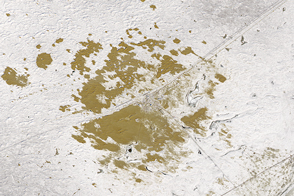
Grounded in the Caspian Sea Read more
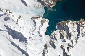
Glaciers Ebb in South Georgia Read more
Beating Back the Sands in Isatay Read more
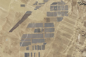
Longyangxia Dam Solar Park Read more
The Alphabet from Orbit: Letter H Read more
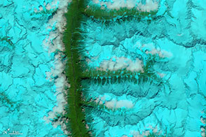
The Alphabet from Orbit: Letter F Read more
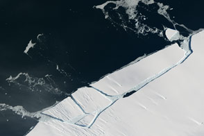
Glacial “Aftershock” Spawns Antarctic Iceberg Read more
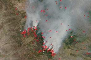
Finding Fires in Peru Read more
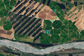
New Zealand: Where River and Winds Weave Read more