The Landsat satellite record stretches from 1972 to the present. This gallery includes all Landsat images published on the Earth Observatory, Visible Earth, and Landsat Science web sites from all seven Landsat satellites (Landsats 1-8, Landsat 6 failed to achieve orbit). All of the images are in the public domain and may be used with attribution. The correct attribution for imagery obtained from this site is:
“Landsat imagery courtesy of NASA Goddard Space Flight Center and U.S. Geological Survey” or “USGS/NASA Landsat”
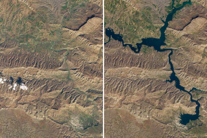
Slowly Flooding History Read more
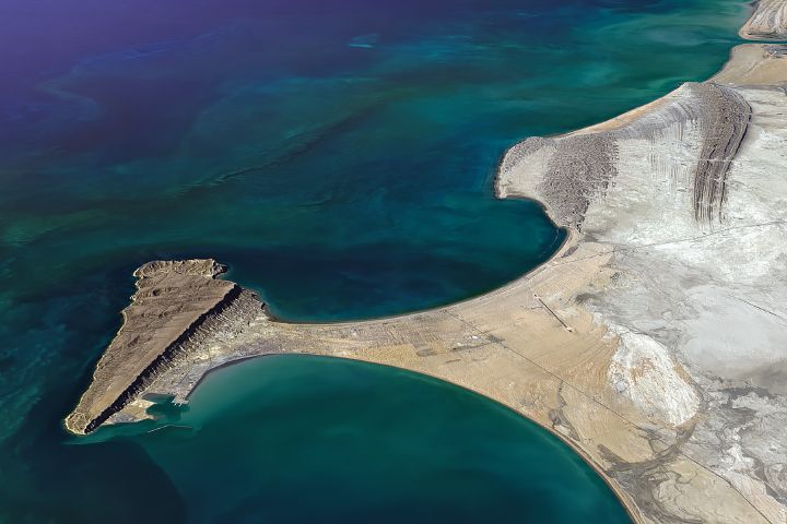
Hammerhead Horsts on the Makran Coast Read more
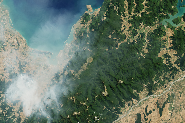
Fires Burn in Parched New Zealand Read more
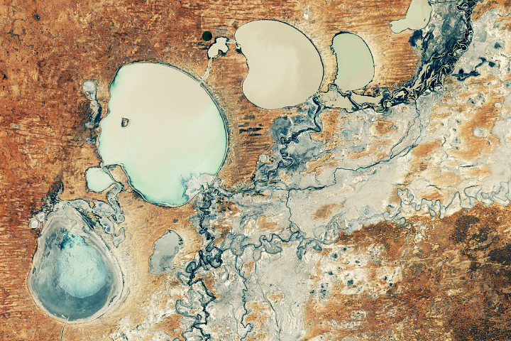
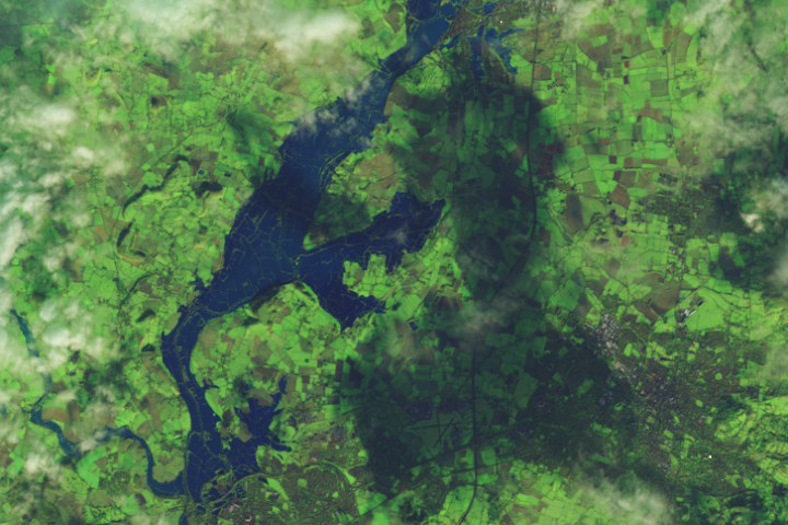
Menindee Lakes Finally Refilling Read more
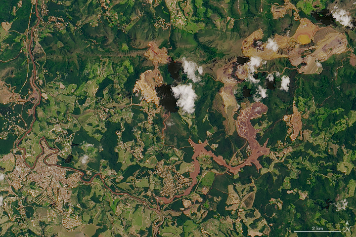
Another Deadly Dam Collapse in Brazil Read more
Storm Batters the United Kingdom Read more
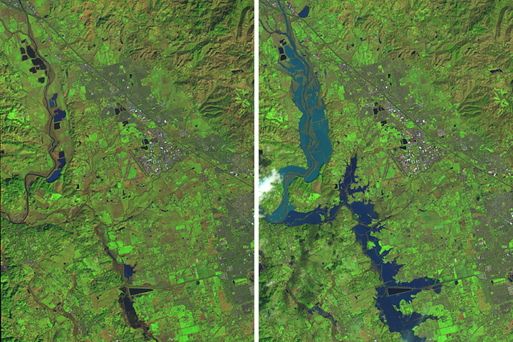
Flooding on the Russian River Read more
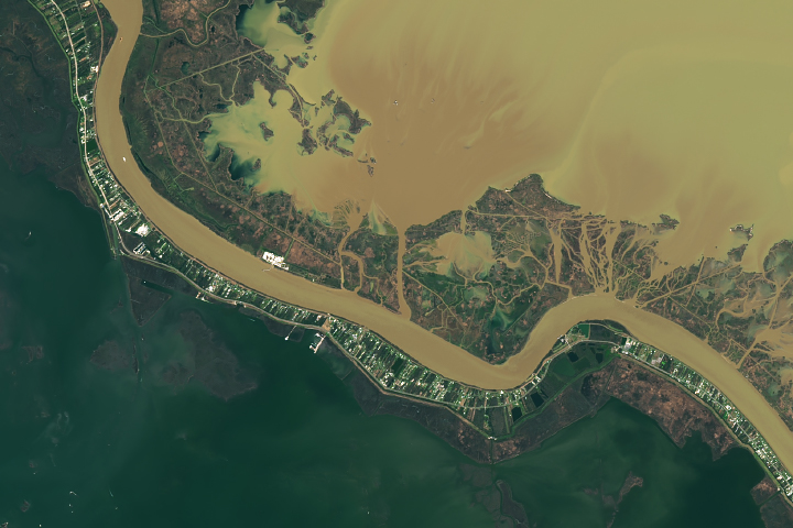
The Widening of Neptune Pass Read more
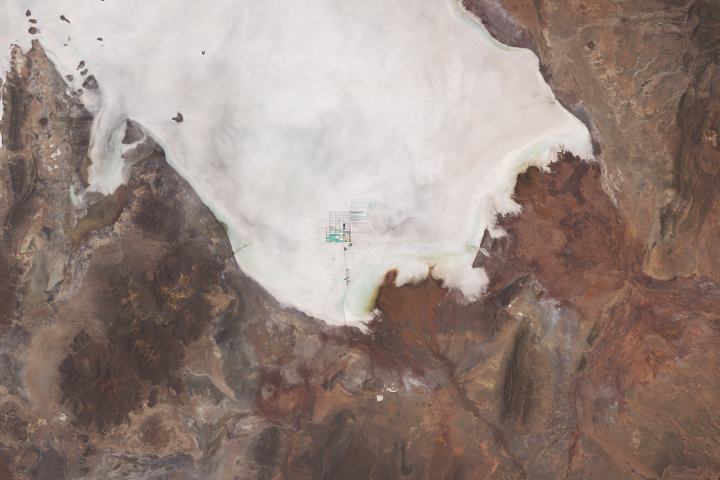
Lithium Harvesting at Salar de Uyuni Read more