The Landsat satellite record stretches from 1972 to the present. This gallery includes all Landsat images published on the Earth Observatory, Visible Earth, and Landsat Science web sites from all seven Landsat satellites (Landsats 1-8, Landsat 6 failed to achieve orbit). All of the images are in the public domain and may be used with attribution. The correct attribution for imagery obtained from this site is:
“Landsat imagery courtesy of NASA Goddard Space Flight Center and U.S. Geological Survey” or “USGS/NASA Landsat”
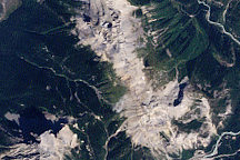
Burgess Shale, Yoho National Park of Canada Read more
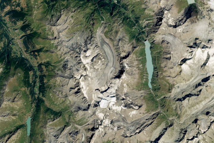
A Climate Archive Melts Read more
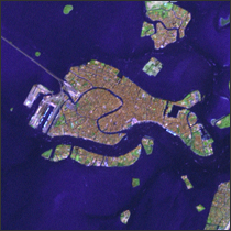
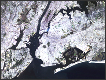
Venice, Italy Read more
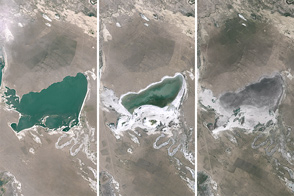
Shrinking Lakes on the Mongolian Plateau Read more
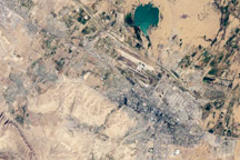
Ashgabat, Turkmenistan Read more
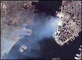
Aftermath of World Trade Center Attack Read more
9/11 Still Smolders Read more
9/11 Read more
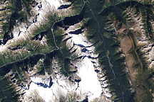
Glacier National Park, Canada Read more