The Landsat satellite record stretches from 1972 to the present. This gallery includes all Landsat images published on the Earth Observatory, Visible Earth, and Landsat Science web sites from all seven Landsat satellites (Landsats 1-8, Landsat 6 failed to achieve orbit). All of the images are in the public domain and may be used with attribution. The correct attribution for imagery obtained from this site is:
“Landsat imagery courtesy of NASA Goddard Space Flight Center and U.S. Geological Survey” or “USGS/NASA Landsat”
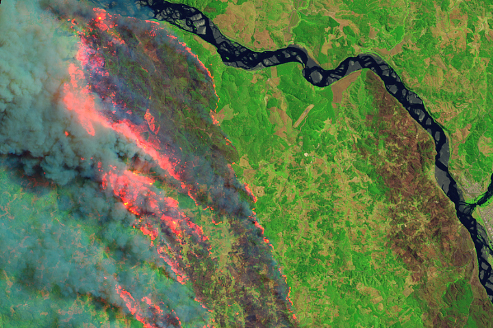
Fires Blaze Through South-Central Chile Read more
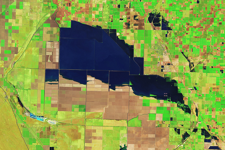
Tulare Lake Grows Read more
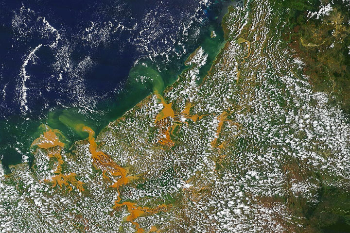
Cheneso Floods Madagascar Read more
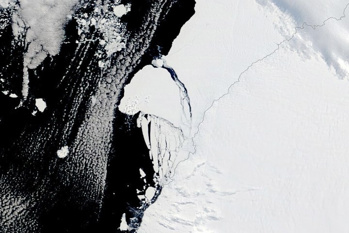
Antarctica’s Brunt Ice Shelf Finally Breaks Read more
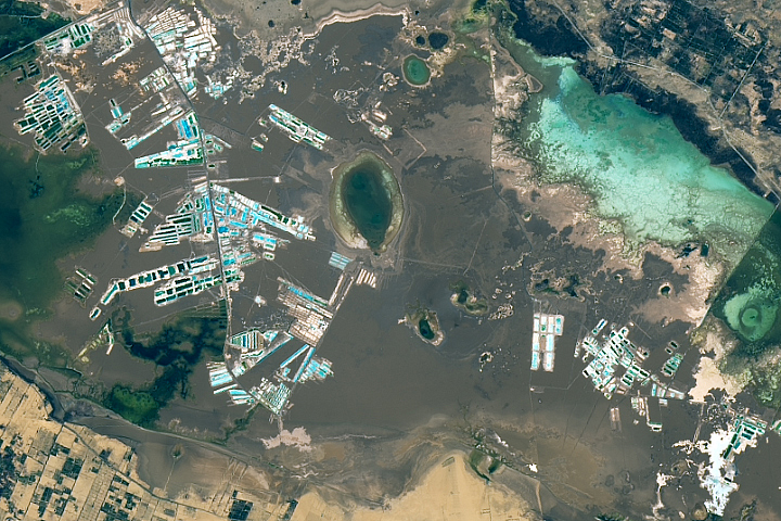
A Salty Desert Retreat Read more

Wintry Dunes on Earth and Mars Read more
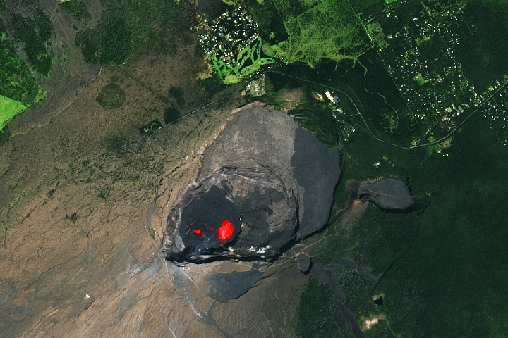
Kilauea Glows Read more
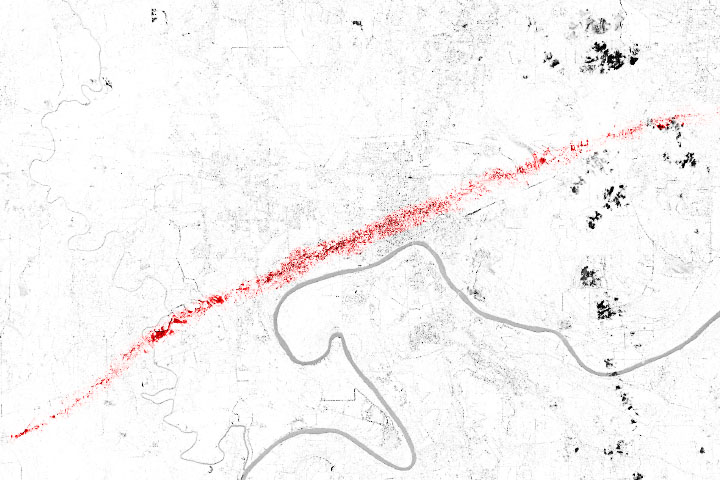
A Tornado Scars Selma Read more
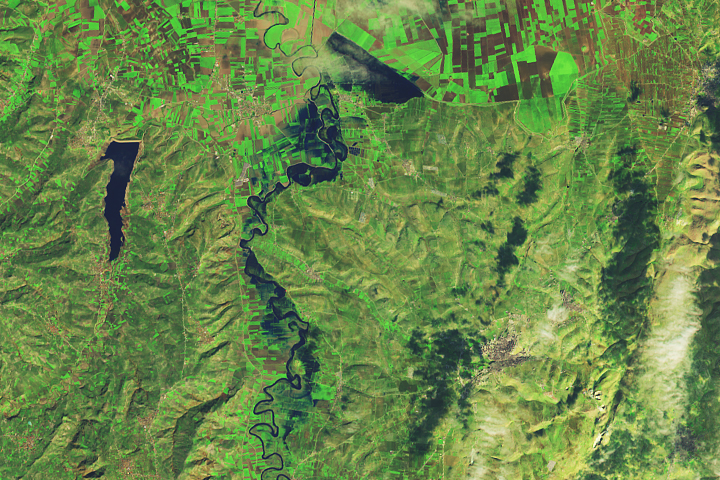
Flooding Along the Orontes River Read more