The Landsat satellite record stretches from 1972 to the present. This gallery includes all Landsat images published on the Earth Observatory, Visible Earth, and Landsat Science web sites from all seven Landsat satellites (Landsats 1-8, Landsat 6 failed to achieve orbit). All of the images are in the public domain and may be used with attribution. The correct attribution for imagery obtained from this site is:
“Landsat imagery courtesy of NASA Goddard Space Flight Center and U.S. Geological Survey” or “USGS/NASA Landsat”
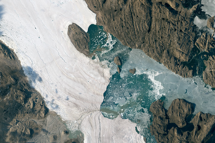
Summer Breakout in Northeast Greenland Read more
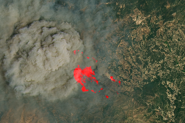
Fires Ignite on Greek Islands Read more
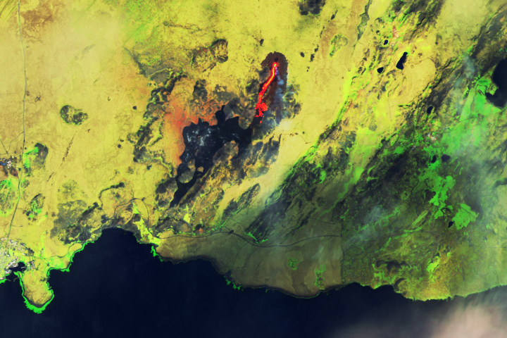
Lava and Smoke Blanket Fagradalsfjall Read more
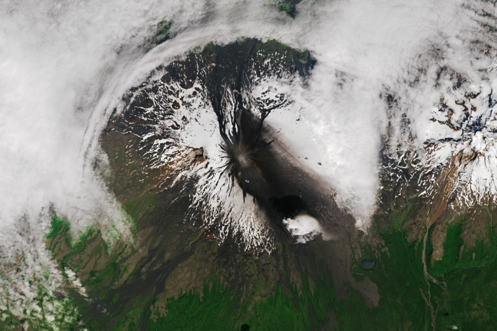
Shishaldin Erupts Read more
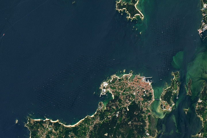
Mussel Rafts of the Rías de Arousa Read more
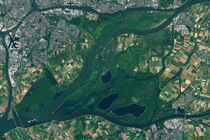
The Biesbosch of the Netherlands Read more
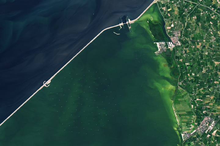
The World’s Largest Freshwater Wind Farm Read more
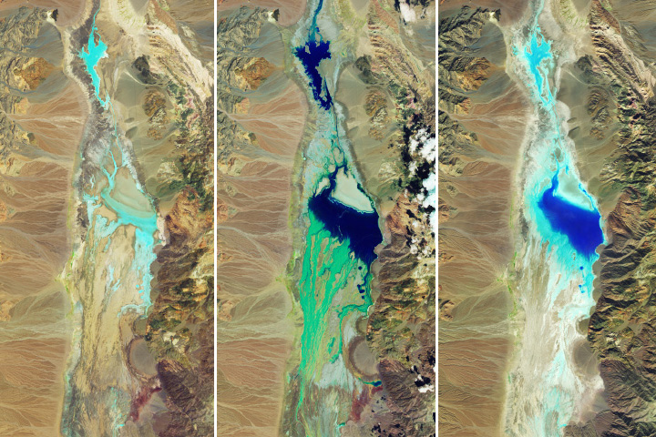
Floodwaters Fill Badwater Basin Read more
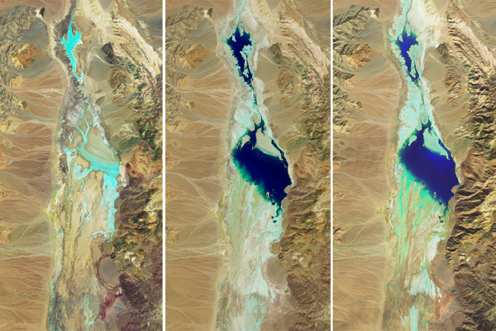
Badwater Basin Refills Read more