The Landsat satellite record stretches from 1972 to the present. This gallery includes all Landsat images published on the Earth Observatory, Visible Earth, and Landsat Science web sites from all seven Landsat satellites (Landsats 1-8, Landsat 6 failed to achieve orbit). All of the images are in the public domain and may be used with attribution. The correct attribution for imagery obtained from this site is:
“Landsat imagery courtesy of NASA Goddard Space Flight Center and U.S. Geological Survey” or “USGS/NASA Landsat”
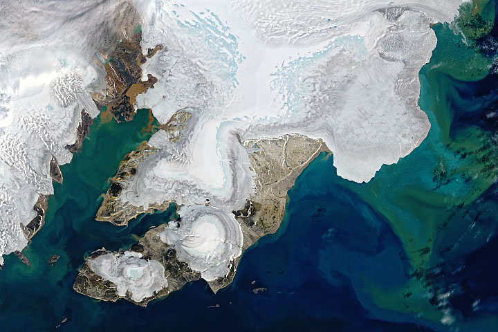
Summer Melting in Svalbard Read more
Tropical Storm Nalgae Batters the Philippines Read more
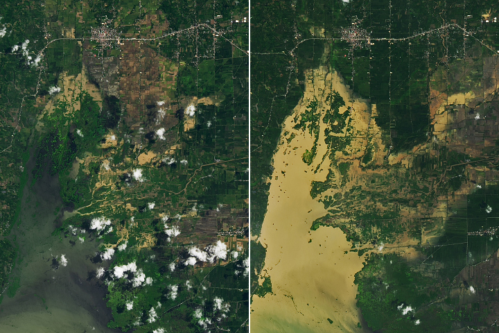
Devastating Floods in Pakistan Read more
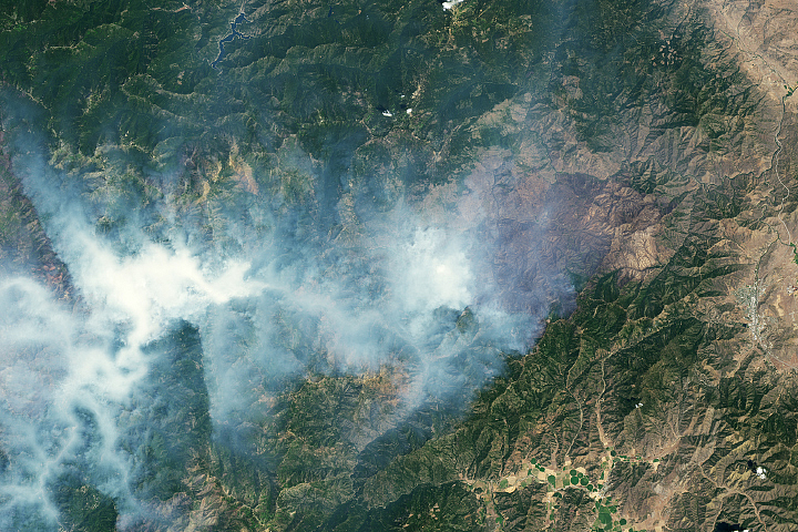
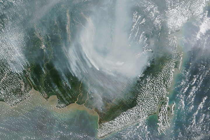
Scarred Land and Smoky Skies Read more
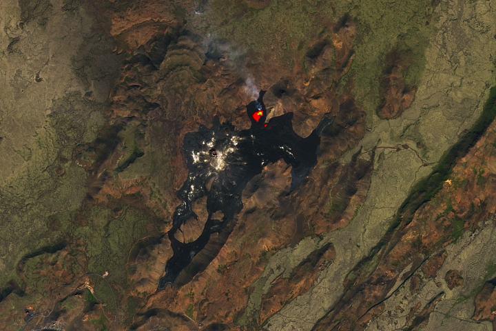
Eruption in Fagradalsfjall, Iceland Read more
Indonesian Fires Return in 2023 Read more
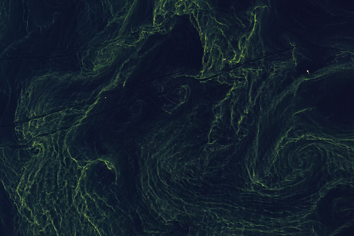
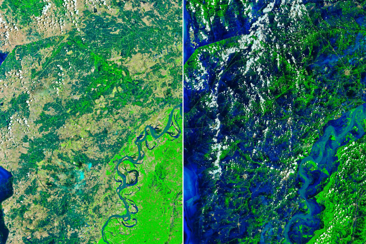
Greening the Gulf of Finland Read more
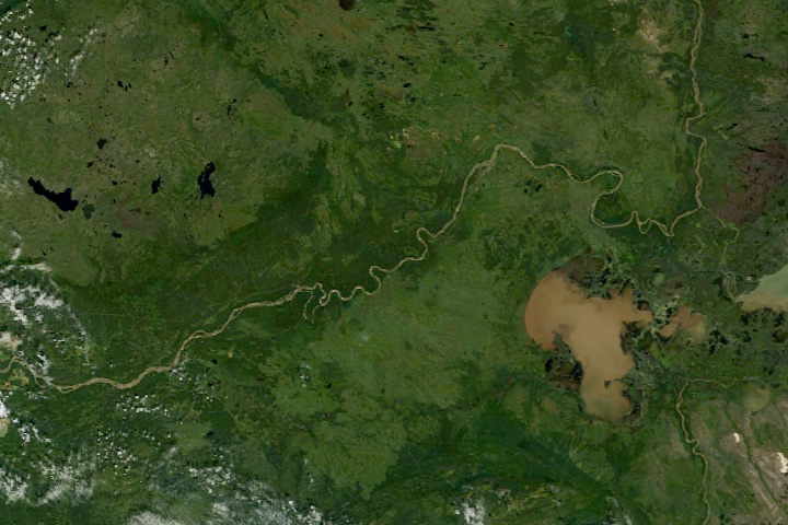
Where the Wood Bison Roam Read more
Ireland’s Cutaway Peatlands Read more