The Landsat satellite record stretches from 1972 to the present. This gallery includes all Landsat images published on the Earth Observatory, Visible Earth, and Landsat Science web sites from all seven Landsat satellites (Landsats 1-8, Landsat 6 failed to achieve orbit). All of the images are in the public domain and may be used with attribution. The correct attribution for imagery obtained from this site is:
“Landsat imagery courtesy of NASA Goddard Space Flight Center and U.S. Geological Survey” or “USGS/NASA Landsat”
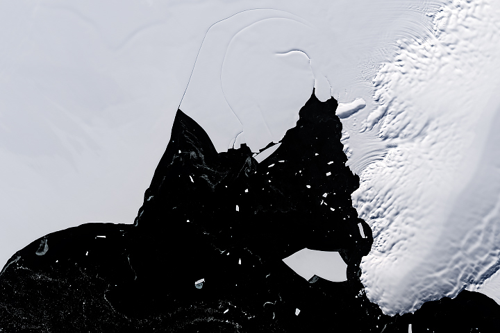
Is the Wilkins Ice Shelf Weakening? Read more
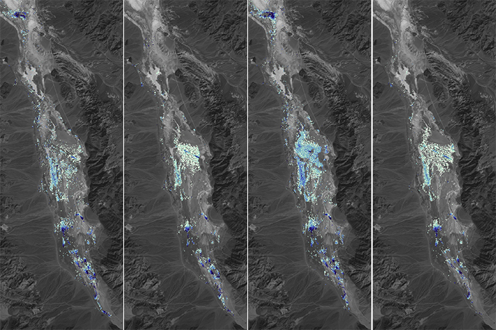
How Deep Was Death Valley’s Temporary Lake? Read more
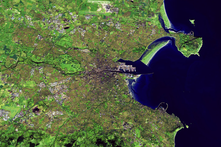
Dublin’s Urban Expansion Read more
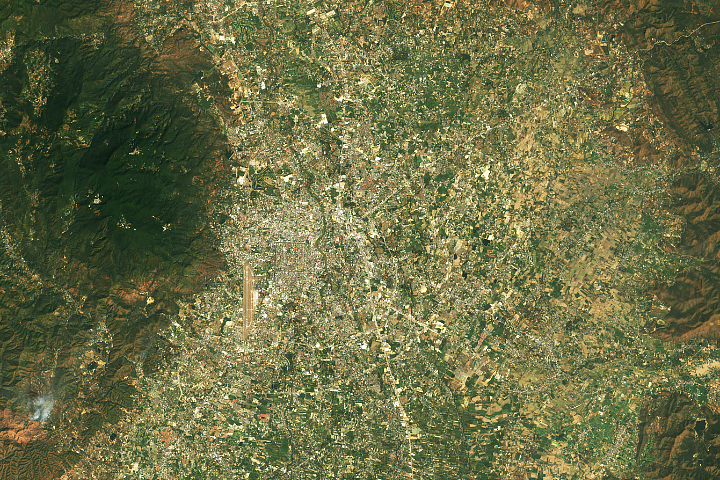
Hazy Skies in a Growing City Read more
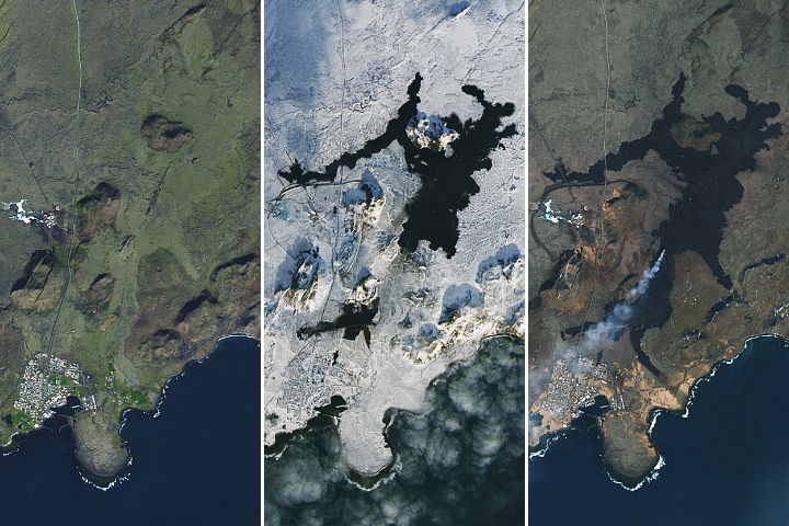
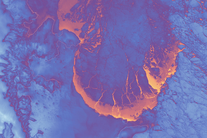
Fresh Flows Spread Across Iceland Read more

Fire in Southern Mexico Read more
Scenes from the Polar Night Read more
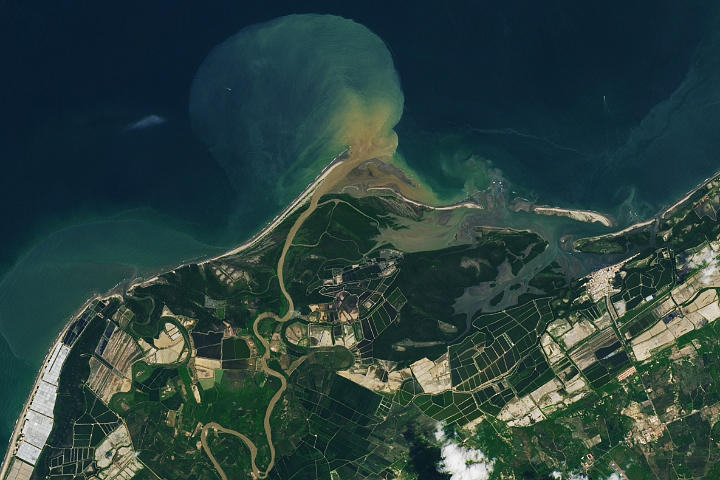
Aquaculture in the Tumbes River Delta Read more
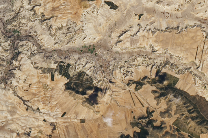
Orce’s Archaeological Wonderland Read more