The Landsat satellite record stretches from 1972 to the present. This gallery includes all Landsat images published on the Earth Observatory, Visible Earth, and Landsat Science web sites from all seven Landsat satellites (Landsats 1-8, Landsat 6 failed to achieve orbit). All of the images are in the public domain and may be used with attribution. The correct attribution for imagery obtained from this site is:
“Landsat imagery courtesy of NASA Goddard Space Flight Center and U.S. Geological Survey” or “USGS/NASA Landsat”
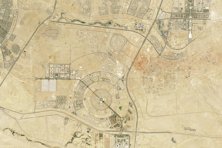
Constructing Egypt’s New Capital Read more

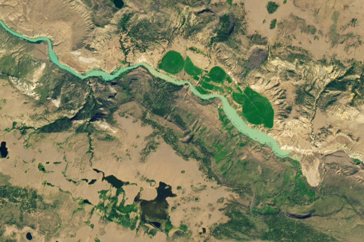
Dry in the Rio Grande Basin Read more

Golfing in Illinois Read more
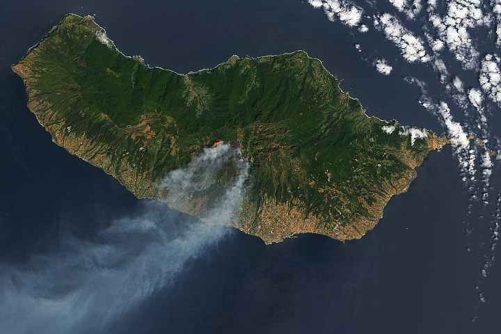
Smoke Streams from Fires in Madeira Read more

Treasured Maps Read more
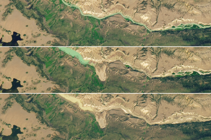
Chilcotin River’s Landslide Lake Begins Draining Read more

Svalbard Melts Read more
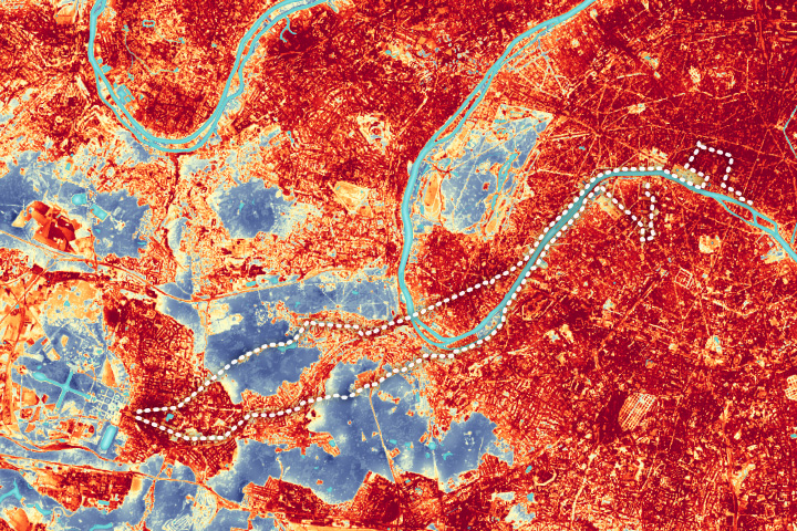
Running Through Paris Heat Read more
Landslide Dams the Chilcotin River Read more