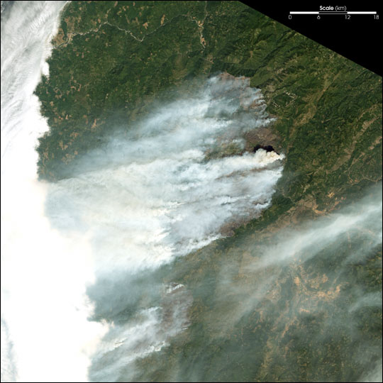
acquired July 29, 2002
Fires Scorch Oregon
Downloads
- biscuit_ls7_2002210_321_lrg.jpg (2701x2701, JPEG)
Metadata
- Sensor(s):
- Landsat 7 - ETM+
- Data Date: July 29, 2002
- Visualization Date: August 23, 2002
In southwestern Oregon, the Florence Fire (north) and the Sour Biscuit Fire (south) continue to grow explosively. This image from the Landsat 7 Enhanced Thematic Mapper Plus was captured on July 29, 2002. The Florence Fire had grown to 50,000 acres and the Sour Biscuit Fire had grown to 16,000 acres. Numerous evacuation notices remain in effect.
Thick smoke from the actively burning eastern perimeter of the Florence Fire is billowing southward and mingling with the Biscuit Fire smoke.
Image provided by the USGS EROS Data Center Satellite Systems Branch.
This image record originally appeared on the Earth Observatory. Click here to view the full, original record.