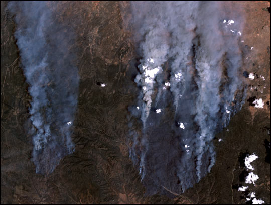
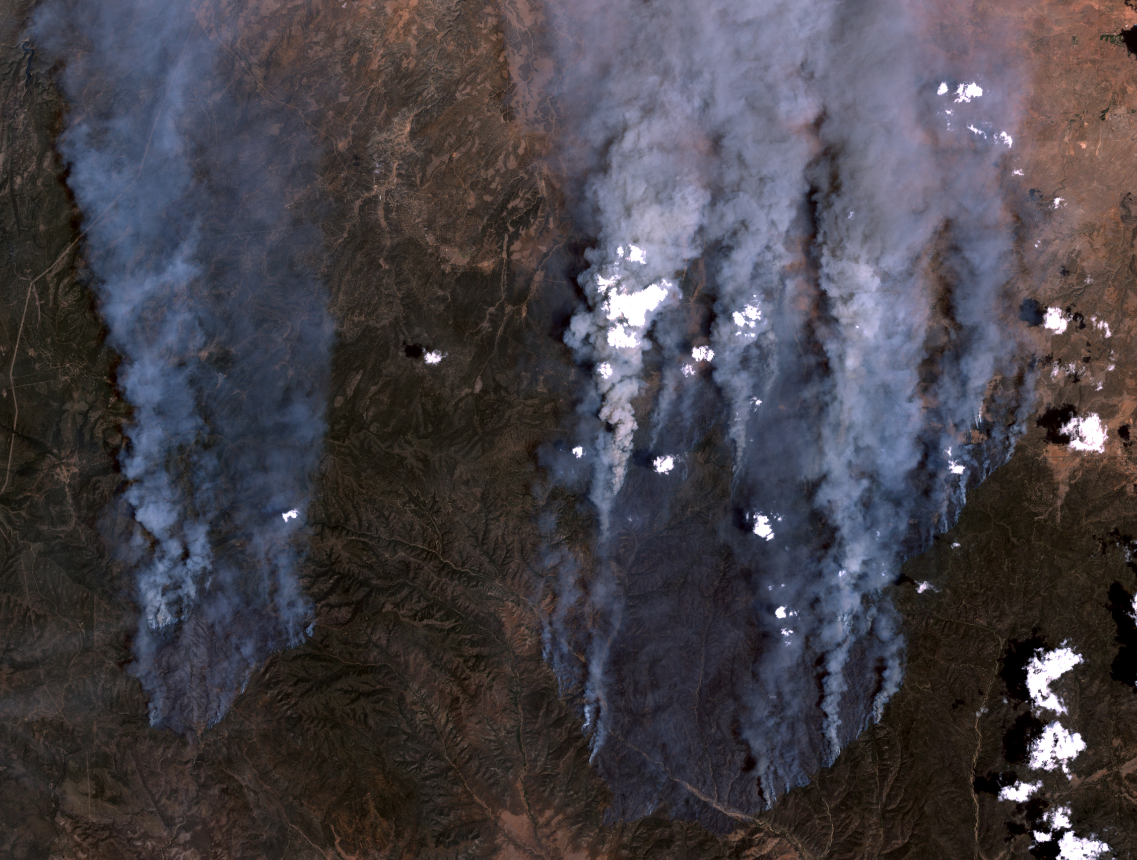
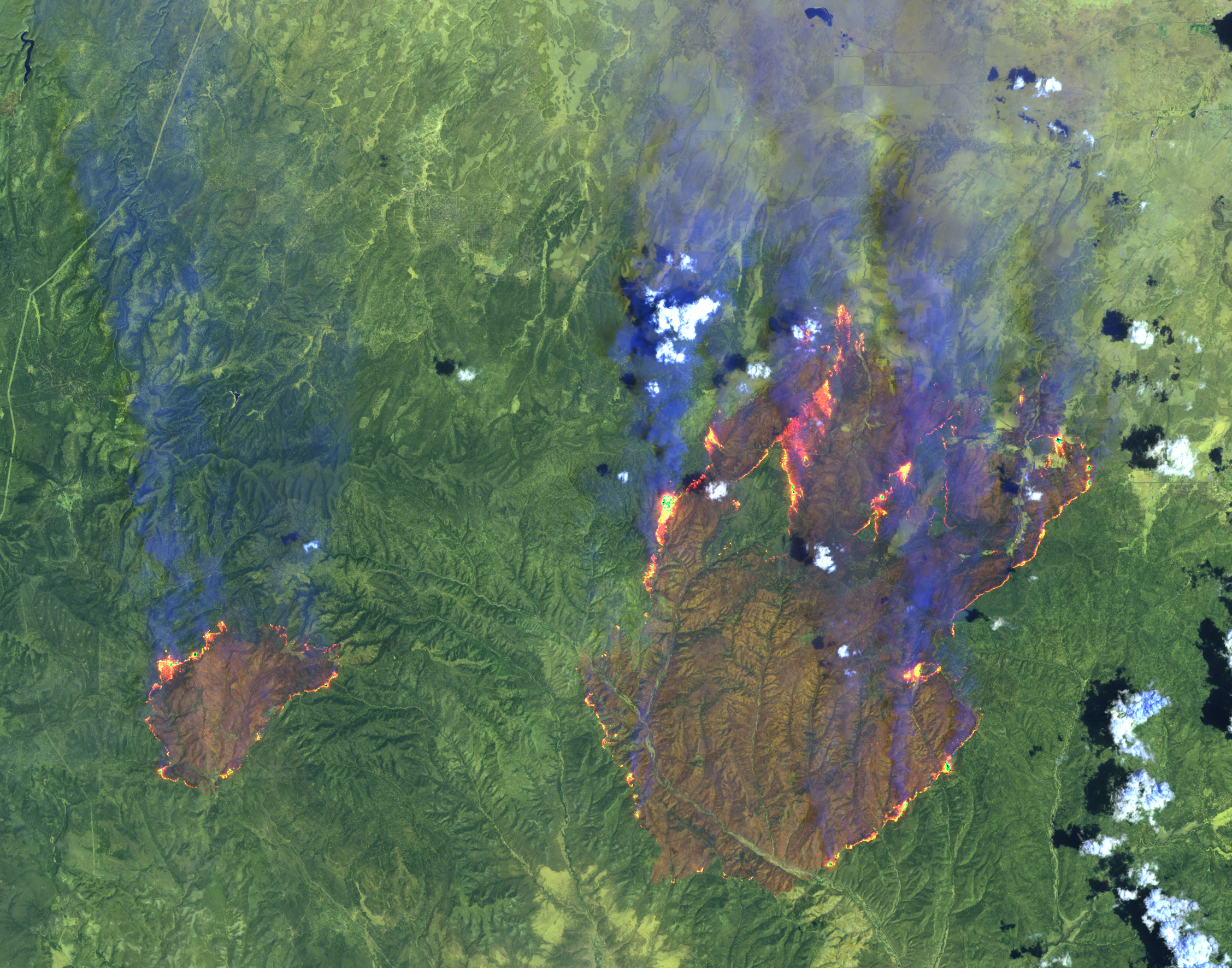
acquired June 21, 2002
Rodeo and Chediski Fires in Arizona
Downloads
- Az_fires.L720020621.jpg (540x408, JPEG)
- Az_fires.L720020621_lrg.jpg (2257x1707, JPEG)
- Az_fires752.L720020621_lrg.jpg (2255x1771, JPEG)
Metadata
- Sensor(s):
- Landsat 7 - ETM+
- Data Date: June 21, 2002
- Visualization Date: June 23, 2002
On June 21, 2002, the Rodeo and Chediski Fires in east-central Arizona were still two separate fires. This true-color scene from the Enhanced Thematic Mapper Plus aboard the Landsat 7 satellite shows the massive quantities of smoke streaming northward from the fires, which are burning about 100 miles east-northeast of Phoenix. The smaller Chediski Fire is on the left, and the Rodeo Fire is on the right. Over the weekend of June 22, the two fires merged into a single 300,000+ acre blaze.
Image courtesy Jesse Allen, Earth Observatory Rapid Response Team
This image record originally appeared on the Earth Observatory. Click here to view the full, original record.