Snow in Savannah
Downloads
- savannah_oli_2018004_detail.jpg (720x480, JPEG)
- savannah_oli_2018004_lrg.jpg (15282x15562, JPEG)
Metadata
- Sensor(s):
- Landsat 8 - OLI
- Data Date: January 4, 2018
- Visualization Date: January 4, 2018
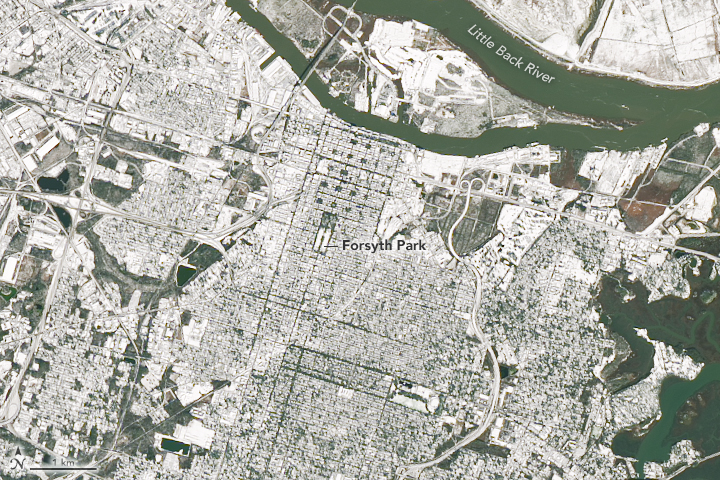
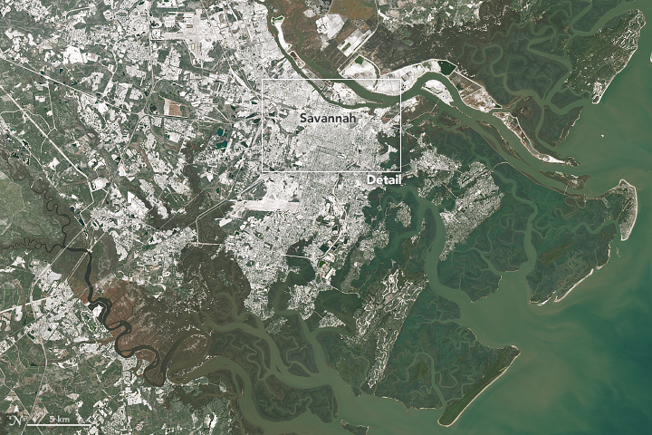
In a rare event, a powerful winter storm dropped snow in parts of the Southeastern U.S. in January 2018. The Operational Land Imager (OLI) on Landsat 8 captured an image of snow covering Savannah, Georgia, on January 4, 2018.
According to the National Weather Service, Savannah Hilton Head International Airport received 1.2 inches (3.0 centimeters) of snow, the 7th highest daily snowfall on record. That was the city’s heaviest snowfall since 1982, when 3.2 inches (8.1 cm) fell.
The storm was preceded by a cold snap that froze city fountains throughout the Southeast, including the fountain in Savannah’s Forsyth Park.
References
- ABC (2018, January 4) Fountains freeze over across the South as powerful storm moves through Florida, Georgia, South Carolina.
- National Weather Service Charleston, SC (2018, January 4) Preliminary snowfall amounts. Accessed January 5, 2018.
- Savanna Now (2018, January 4) Savannah area gets a giant taste of winter. Accessed January 5, 2018.
- The Weather Channel (2018, January 4) Winter Storm Grayson Southeast Recap: Snow and Ice From North Florida to the Eastern Carolinas. Accessed January 5, 2018.
NASA Earth Observatory images by Joshua Stevens, using Landsat data from the U.S. Geological Survey. Caption by Adam Voiland.
This image record originally appeared on the Earth Observatory. Click here to view the full, original record.