
Dust Coats Copper River Valley
Downloads
- copperriver_oli_2017319.jpg (720x480, JPEG)
- copperriver_oli_2017319_lrg.jpg (8073x5382, JPEG)
Metadata
- Sensor(s):
- Landsat 8 - OLI
- Data Date: November 15, 2017
- Visualization Date: November 17, 2017
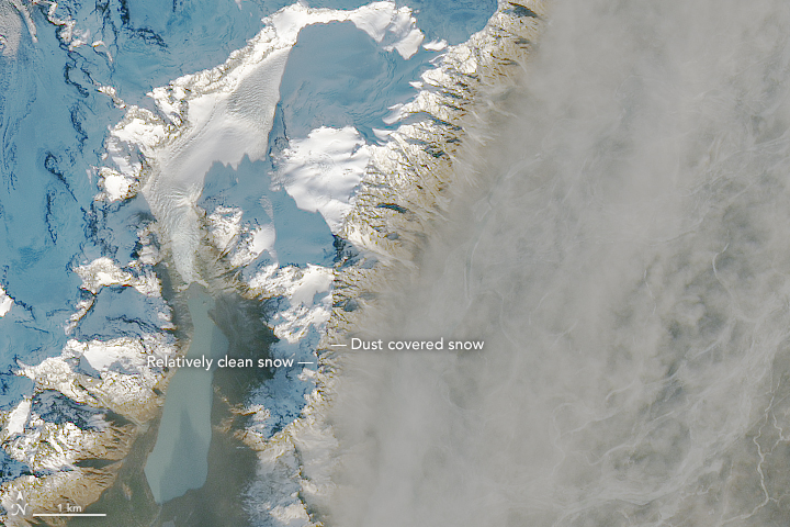
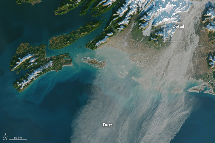
On November 15, 2017, the Operational Land Imager (OLI) on Landsat 8 acquired images of dust blowing out of the Copper River Valley on Alaska’s south coast. The dust was thickest within the valley. Just over the ridge line to the west, on Saddlebag Glacier and lake, the air and snow was comparatively clean.
The second image shows a wider view of the storm. The dust plume was likely comprised of fine-grained loess, which was formed as glacial ice moved over the area and ground the underlying rock into a powder (sometimes called “glacial flour”). Dust storms in southern Alaska generally occur in late fall, when river levels are relatively low, snow has not yet fallen, and the layers of dried, loess-rich mud are exposed to the wind.
The Copper River drains an area of more than 24,000 square miles (62,000 square kilometers) and it is, by volume of discharge, the tenth largest river in the United States. Its delta forms one of the largest and most productive wetlands on the Pacific Coast of North America. The river is named for ore deposits found upstream.
To help clarify the role of dust storms in promoting phytoplankton blooms, a small team of NASA-funded scientists has been studying the area since 2011 via satellites and ground-based air monitors on nearby Middleton Island.
Further Reading
- NASA Earth Observatory (2017, November 15) Connecting the Dots Between Dust, Phytoplankton, and Ice Cores.
- NASA Earth Observatory (2016, October 25) Iron in the Wind.
NASA Earth Observatory images by Joshua Stevens, using Landsat data from the U.S. Geological Survey. Caption by Adam Voiland and Mike Carlowicz.
This image record originally appeared on the Earth Observatory. Click here to view the full, original record.