
Lake Erie Abloom
Downloads
- erie_oli_2017269_detail.jpg (720x480, JPEG)
- erie_oli_2017269_lrg.jpg (7253x6154, JPEG)
Metadata
- Sensor(s):
- Landsat 8 - OLI
- Data Date: September 26, 2017
- Visualization Date: September 27, 2017
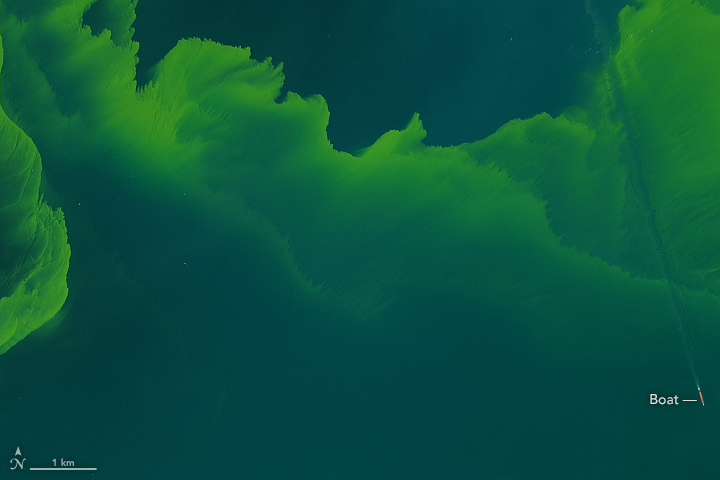
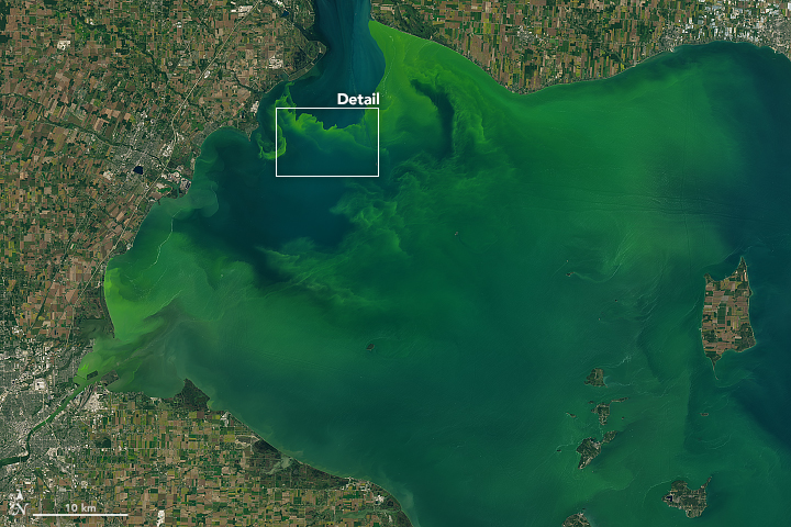
On September 26, 2017, the Operational Land Imager (OLI) on the Landsat 8 satellite captured these natural-color images of a large phytoplankton bloom in western Lake Erie.
According to the National Oceanic and Atmospheric Administration, the bloom contains microcystis, a type of freshwater cyanobacteria. These phytoplankton produce toxins that can contaminate drinking water and pose a risk to human and animal health (skin irritant, respiratory distress) when there is direct contact.
A few days earlier, the Moderate Resolution Imaging Spectroradiometer (MODIS) on NASA’s Terra satellite captured a wider view of the lake. Blooms tend to thrive in Lake Erie during summer, sustained by warm water temperatures and nutrients from farm runoff. This year, the bloom has been ongoing since mid-July.
References
- NASA Earth Observatory (2017, September 26) Bloom Persists in Lake Erie.
- NOAA Great Lakes Environmental Research Laboratory (2017, September 25) Great Lakes Harmful Algal Blooms (HABs) and Hypoxia. Accessed September 25, 2017.
NASA Earth Observatory image by Joshua Stevens, using Landsat data from the U.S. Geological Survey. Caption by Kathryn Hansen.
This image record originally appeared on the Earth Observatory. Click here to view the full, original record.