
Colima’s Plume Casts a Shadow
Downloads
- colima_etm_2017004_lrg.jpg (2903x1822, JPEG)
- colima_etm_2017004_geo.tif (2903x1822, GeoTIFF)
Metadata
- Sensor(s):
- Landsat 7 - ETM+
- Data Date: January 4, 2017
- Visualization Date: January 18, 2017
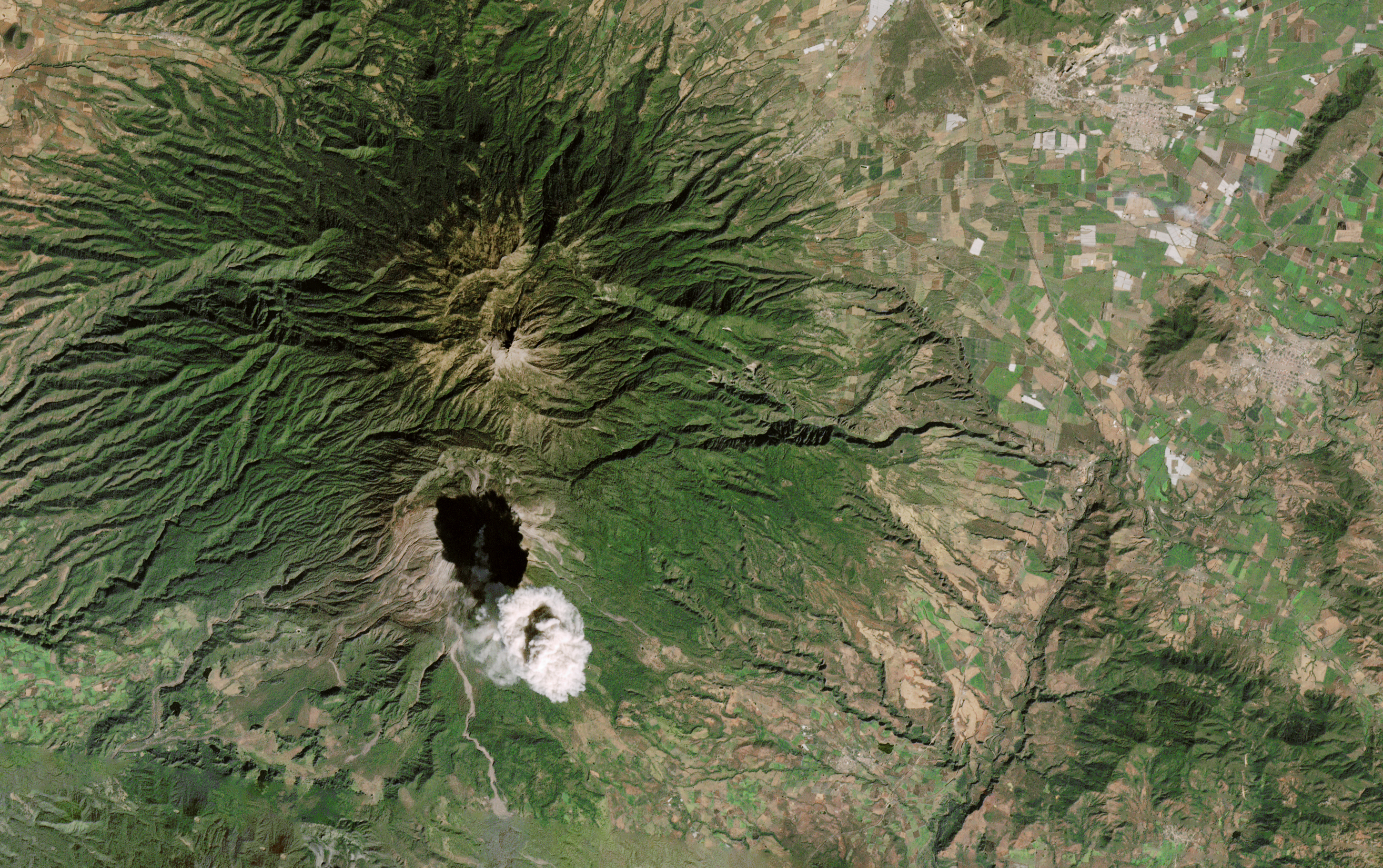
Colima Volcano in western Mexico displayed explosive activity throughout 2016; the sequence of lava-dome building and destruction earned the volcano second place in Wired magazine’s volcanic events of the year. Now, in the first month of 2017, Colima continues to erupt.
On January 4, 2017, the Enhanced Thematic Mapper Plus (ETM+) on the Landsat 7 satellite captured this image of ash rising from Colima. The plume’s dark shadow obscures much of the summit, but you can still trace the plume back to its source. Another image captured on the same day by the Terra satellite shows the wider view.
References and Related Reading
- Global Volcanism Program at the Smithsonian Institution National Museum of Natural History (2017, January 10) Colima. Accessed January 18, 2017.
- NASA Earth Observatory (2017, January 5) Active Mexican Volcano Erupts into New Year.
- WIRED (2017, January 10) And the Winner of the Volcanic Event of 2016 Is.... Accessed January 18, 2017.
NASA Earth Observatory image by Joshua Stevens, using Landsat data from the U.S. Geological Survey. Caption by Kathryn Hansen.
This image record originally appeared on the Earth Observatory. Click here to view the full, original record.