
Cedar Fire, Arizona
Downloads
- cedarfire_oli_2016171_swir3_lrg.jpg (2000x2000, JPEG)
- cedarfire_oli_2016171_swir3_geo.tif (2000x2000, GeoTIFF)
- cedarfire_oli_2016171_lrg.jpg (4000x4000, JPEG)
- cedarfire_oli_2016171_geo.tif (4000x4000, GeoTIFF)
Metadata
- Sensor(s):
- Landsat 8 - OLI
- Data Date: June 19, 2016
- Visualization Date: June 23, 2016
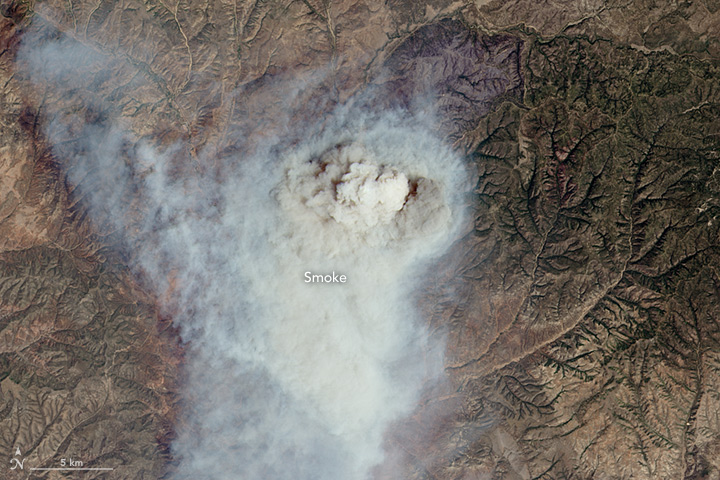
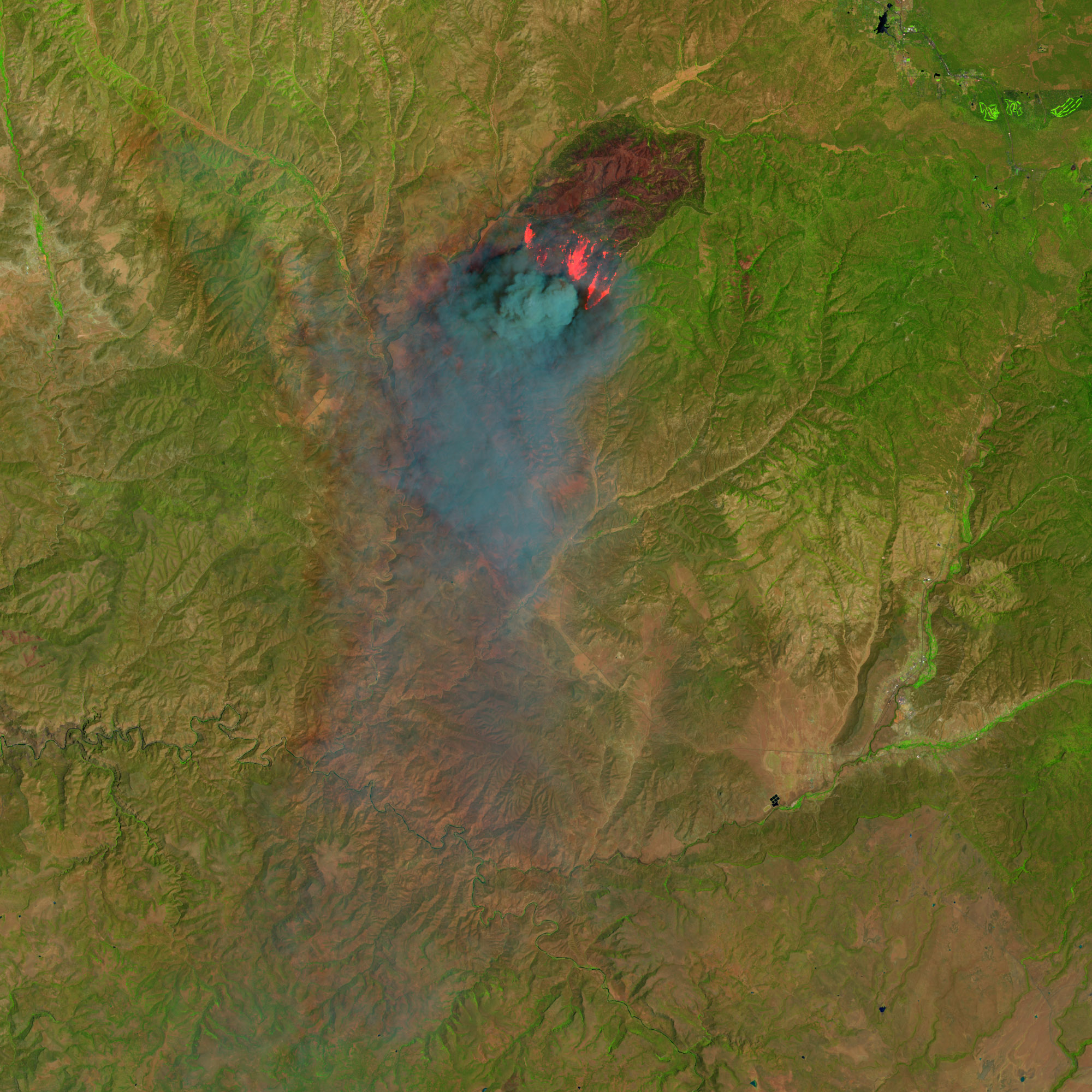
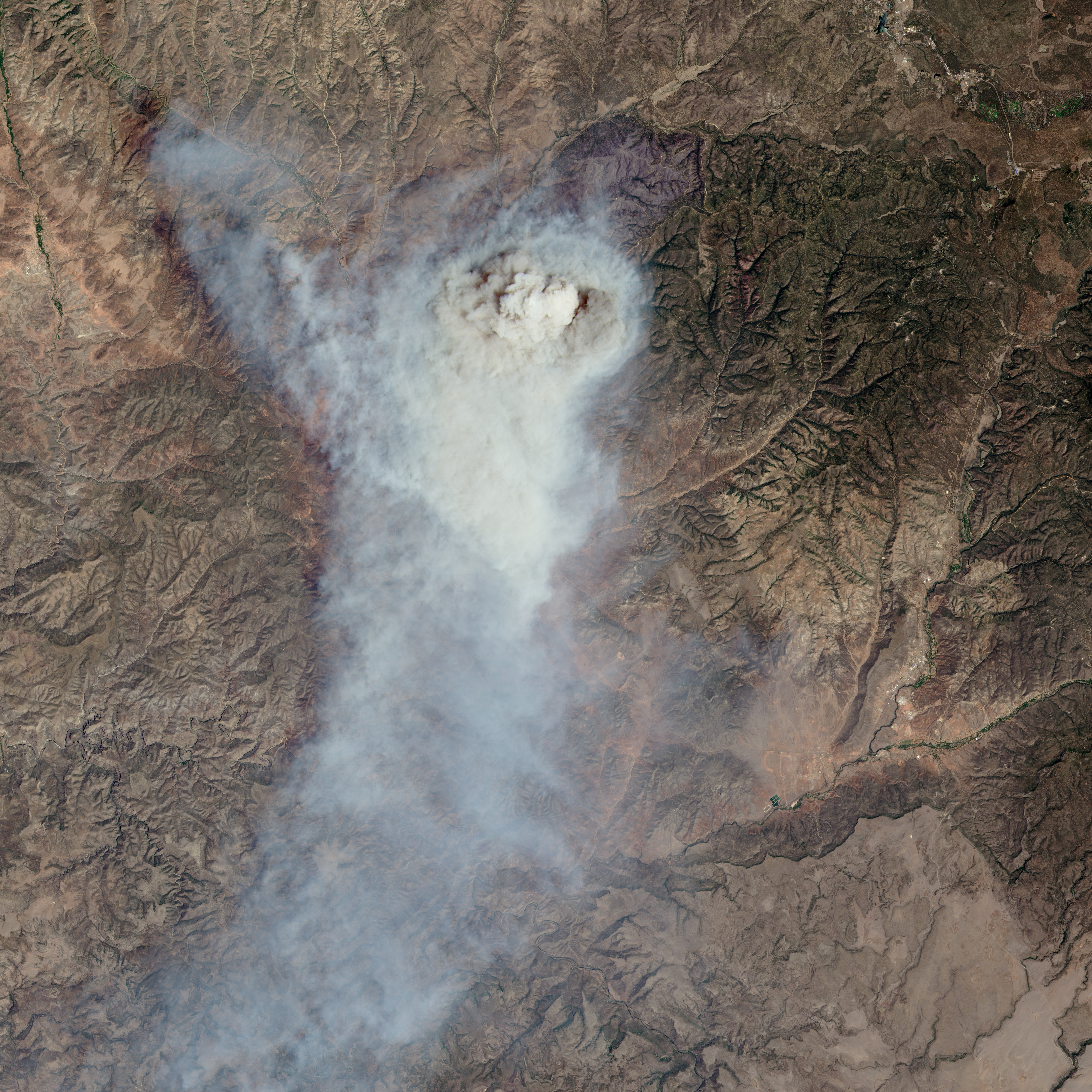
On June 19, 2016, the Operational Land Imager (OLI) on the Landsat 8 satellite acquired this false-color image of the Cedar fire, which burned in eastern Arizona. The image combines shortwave infrared, near infrared, and red light (OLI bands 6-5-4). Near- and short-wave infrared help penetrate some of the smoke to reveal the hot spots associated with active fires, which appear red. Smoke appears gray-blue and burned areas appear rusty brown.
The second image, also acquired by OLI at the same time, shows the scene in natural-color. This image, similar to what the human eye would see, shows smoke billowing up into the atmosphere as the fire advanced southward. Turn on the image comparison tool to see the hot spots below some of the smoke.
By June 19 the fire had burned 4,913 hectares (12,140 acres) and was 40 percent contained. As of June 24, the fire had burned almost 18,583 hectares (45,920 acres) and was 42 percent contained.
References
- Arizona Emergency Information Network (2016, June 19) Fire active on southern edge of Cedar Fire. Accessed June 24, 2016.
- InciWeb (2016, June 24) Cedar Fire. Accessed June 24, 2016.
NASA Earth Observatory images by Jesse Allen, using Landsat data from the U.S. Geological Survey. Caption by Kathryn Hansen.
This image record originally appeared on the Earth Observatory. Click here to view the full, original record.