acquired March 22, 2016
Activity at Dukono Volcano
Downloads
- dukono_2016082_lrg.jpg (3400x3400, JPEG)
Metadata
- Sensor(s):
- Landsat 8 - OLI
- Data Date: March 22, 2016
- Visualization Date: March 23, 2016
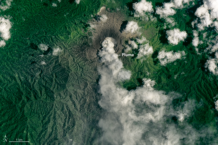
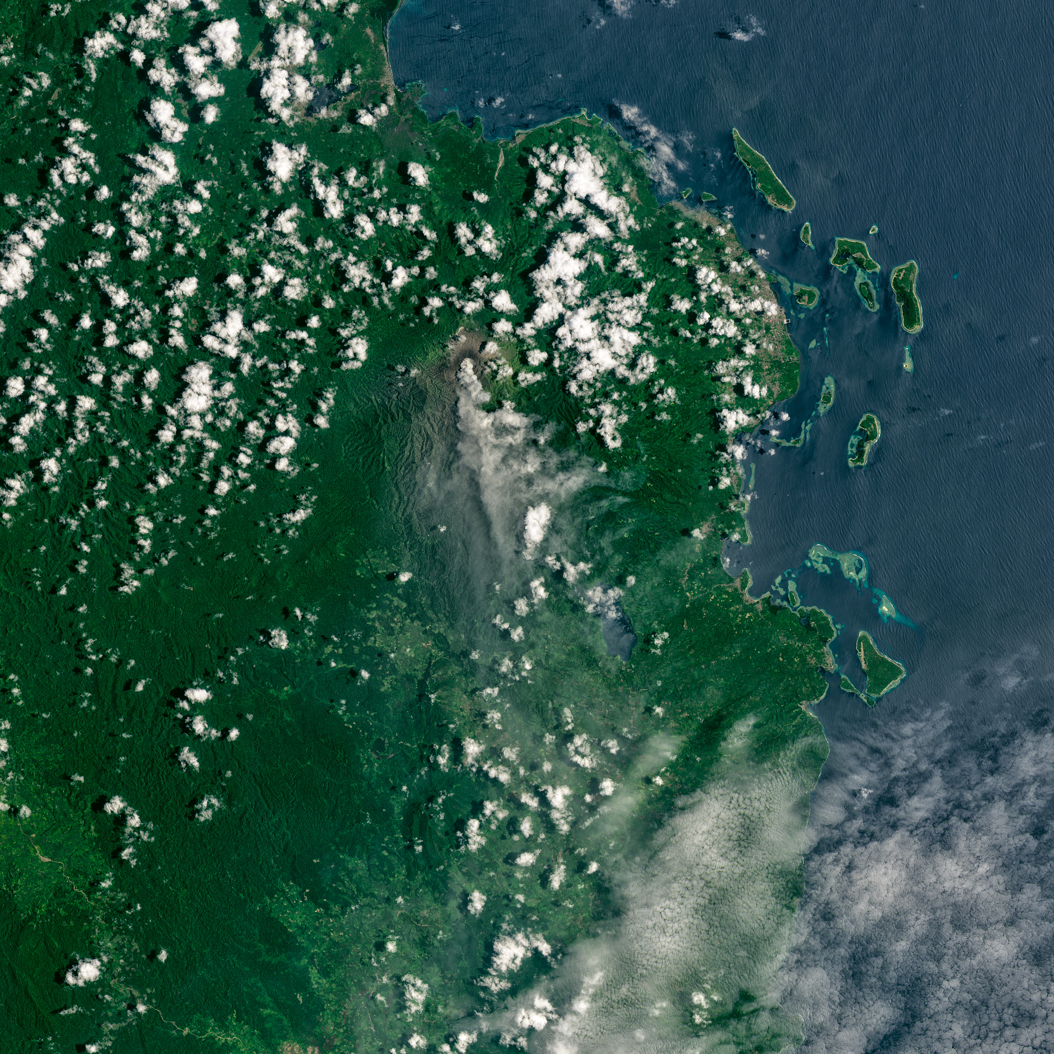
On March 22, 2016, the Operational Land Imager (OLI) on Landsat 8 acquired this image of an ash plume from Dukono, a volcano on a remote Indonesian island.
The volcano is frequently active, according to the Smithsonian Institution’s Global Volcanism Program. During the week leading up to this image, the plume reached as high as 2.4 kilometers (8,000 feet) above sea level.
References and Related Reading
- Smithsonian Institution’s Global Volcanism Program (2016, March 22) Dukono. Accessed March 25, 2016.
NASA Earth Observatory image by Joshua Stevens, using Landsat Data from the U.S. Geological Survey. Caption by Kathryn Hansen.
This image record originally appeared on the Earth Observatory. Click here to view the full, original record.