A Monumental Addition in California
Downloads
- monuments_oli_2016039_048_lrg.jpg (7654x7654, JPEG)
- monuments_oli_2016039_048_geo.tif (9174x9174, GeoTIFF)
- sandtosnow_photo_2012079_lrg.jpg (1894x1263, JPEG)
- mojavetrails_photo_2014045_lrg.jpg (1928x1285, JPEG)
Metadata
- Sensor(s):
- Landsat 8 - OLI
- Data Date: February 8, 2016 - February 17, 2016
- Visualization Date: March 9, 2016
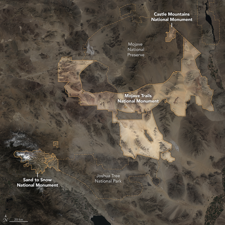
In February 2016, the United States government established the world’s second-largest desert preserve. In designating three new national monuments in the California desert, the U.S. Department of the Interior added 1.8 million acres to an existing 7.6 million acres of protected land. This image from the Operational Land Imager (OLI) on Landsat 8 shows how they all connect. (The image is a composite of satellite data from Landsat 8 passes on February 8 and February 17, 2016.)
The western edge of Sand to Snow National Monument is located about 120 kilometers (75 miles) east of downtown Los Angeles. This aptly named monument encompasses 150,000 acres from the desert floor to the mountaintops in San Bernardino National Forest. Ecological diversity at the various altitudes makes this monument unique.
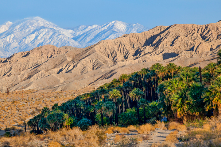
Hikers encounter some of this diversity along 50 kilometers (30 miles) of the Pacific Crest Trail that crosses through the monument, from Whitewater Canyon up 2100 meters (7,000) feet to Mission Springs. Desert oases, like the one in the top photograph below, are important refuges for animals and critical stopover spots for migrating birds.
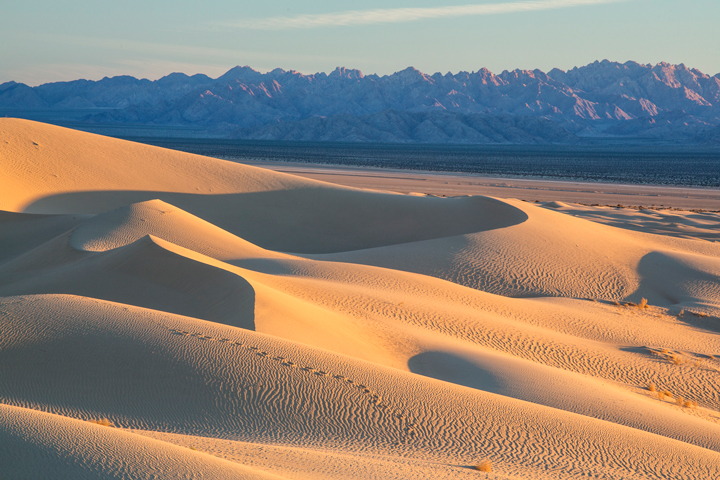
Sand to Snow shares a common boundary with Joshua Tree National Park, which in turn connects to Mojave Trails National Monument—the largest new addition at 1.6 million acres. Lava flows and mountains spread across this tract of the Mojave Desert. The focal point is the sand dunes; in particular, the remote and nearly pristine Cadiz Dunes that formed from the sand of dry lake beds. The second photograph above shows the ground-based view of dunes within the monument.
Despite the remoteness of this monument, the area is well traveled. The corridor connects the deserts of the southwest to the Pacific Coast and has been travelled by people for thousands of years. The Southern Pacific railroad and Route 66 are the most famous byways through this desert landscape.
Finally, tucked into the northeast corner of the pre-existing Mojave National Preserve is the smallest addition—the 20,920 acres of Castle Mountains National Monument. But this smallest addition is an important one. Inclusion of Castle Mountains connects ecosystems in the New York Mountains and the Piute Mountains. Protection of this area ensures that habitat stays intact for wildlife such as the desert bighorn sheep.
References and Related Reading
- Bureau of Land Management (2016, February 16) Sand to Snow National Monument. Accessed March 11, 2016.
- Bureau of Land Management (2016, February 16) Mojave Trails National Monument. Accessed March 11, 2016.
- Los Angeles Times (2016, February 11) Volcanic spires and Joshua trees: Obama protects 1.8 million acres in California's desert. Accessed March 11, 2016.
- National Park Service (2016, March 11) Castle Mountains National Monument. Accessed March 11, 2016.
- The White House, Briefing Room (2016, February 12) Presidential Proclamation—Establishment of the Sand to Snow National Monument. Accessed March 11, 2016.
- The White House, Briefing Room (2016, February 12) Presidential Proclamation—Establishment of the Mojave Trails National Monument. Accessed March 11, 2016.
- The White House, Briefing Room (2016, February 12) Presidential Proclamation—Establishment of the Castle Mountains National Monument. Accessed March 11, 2016.
NASA Earth Observatory image by Jesse Allen, using Landsat data from the U.S. Geological Survey. Photos by Bob Wick/Bureau of Land Management. Caption by Kathryn Hansen.
This image record originally appeared on the Earth Observatory. Click here to view the full, original record.

