Fire and Smoke in a Thai Wildlife Sanctuary
Downloads
- thailand_oli_2016062_urban_lrg.jpg (3002x4001, JPEG)
- thailand_oli_2016062_urban_geo.tif (3002x4001, GeoTIFF)
- thailand_oli_2016062_lrg.jpg (6000x8000, JPEG)
- thailand_oli_2016062_geo.tif (6000x8000, GeoTIFF)
- thailand_oli_2016062.kml (KML)
Metadata
- Sensor(s):
- Landsat 8 - OLI
- Data Date: March 2, 2016
- Visualization Date: March 4, 2016
Smoke from fires burning in Thailand was visible March 1, 2016, in an image from the Moderate Resolution Imaging Spectroradiometer (MODIS) on NASA’s Terra satellite. Some of those fires burned within the Huai Kha Khaeng Wildlife Sanctuary and in Khao Yai National Park.
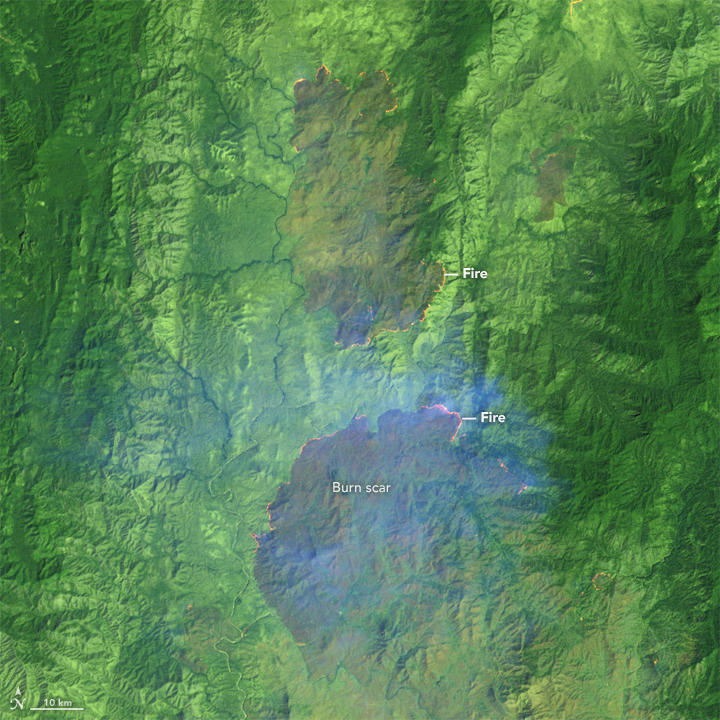
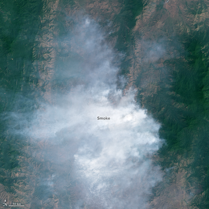
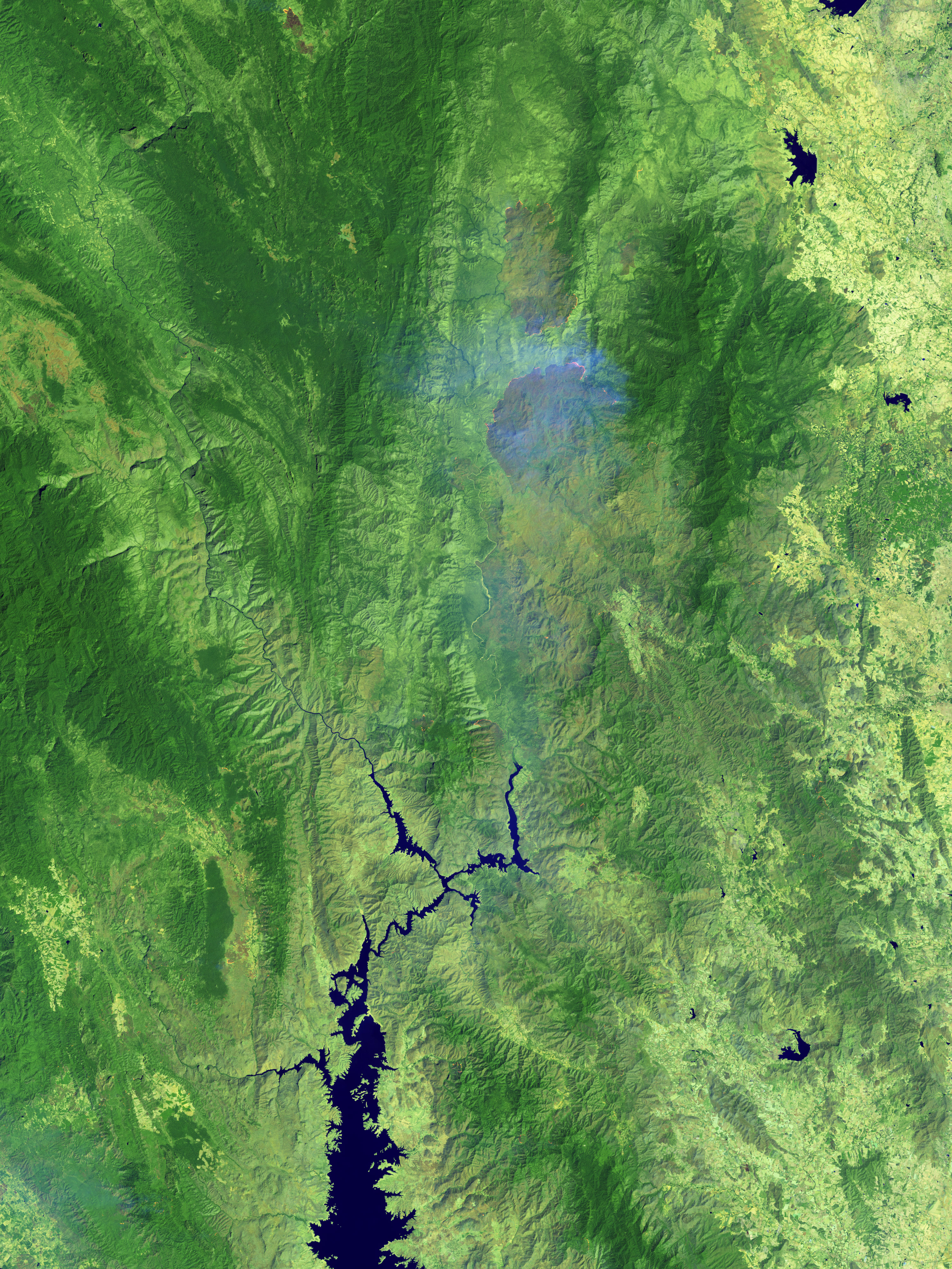
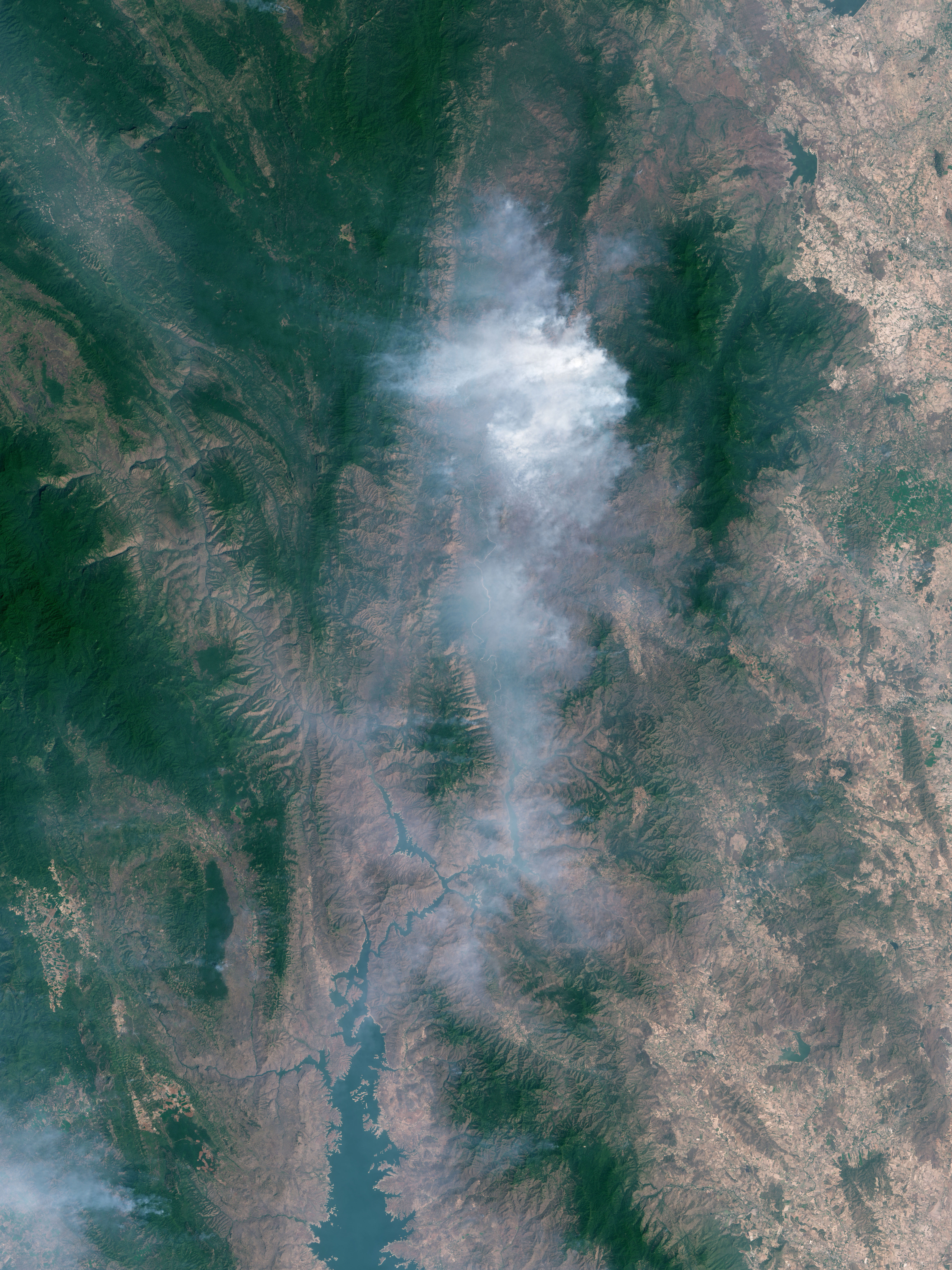
On March 2, 2016, Landsat 8 passed over the Huai Kha Khaeng Wildlife Sanctuary and captured these more detailed images the area. The top image is false color, made with a combination of visible (red) and infrared light (bands 7, 6, and 4). This combination allows the active fires and freshly burned land to stand out; fires glow orange, and newly burned land is rusty brown. The blue haze across much of the area is smoke. The bottom image shows the same scene in natural color, which is dominated by smoke.
References and Related Reading
- Bangkok Post (2016, February 26) Expert warns of worst haze since 1998. Accessed March 3, 2016.
- Thai National Parks (2016) Huai Kha Khaeng Wildlife Sanctuary. Accessed March 3, 2016.
- Thai National Parks (2016) Khao Yai National Park. Accessed March 3, 2016.
- UNESCO World Heritage Center (2016) Thailand. Accessed March 3, 2016.
NASA Earth Observatory images by Jesse Allen, using Landsat data from the U.S. Geological Survey. Caption by Kathryn Hansen.
This image record originally appeared on the Earth Observatory. Click here to view the full, original record.