acquired December 3, 2015
acquired December 3, 2015
Mount Etna Erupts
Downloads
- etna_oli_2015337_lrg.jpg (6000x6000, JPEG)
- etna_oli_2015337_geo.tif (6000x6000, GeoTIFF)
- etna_oli_2015337.kml (KML)
- etna_oli_2015337.jpg (720x480, JPEG)
Metadata
- Sensor(s):
- Landsat 8 - OLI
- Data Date: December 3, 2015
- Visualization Date: December 3, 2015
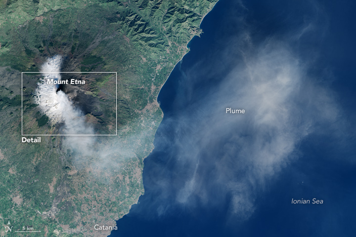
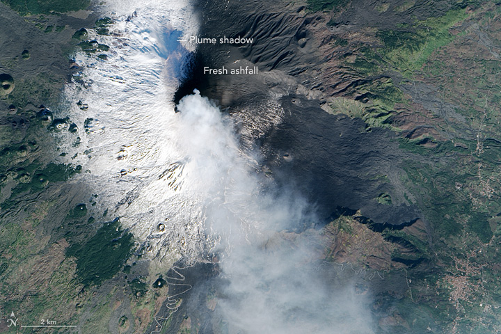
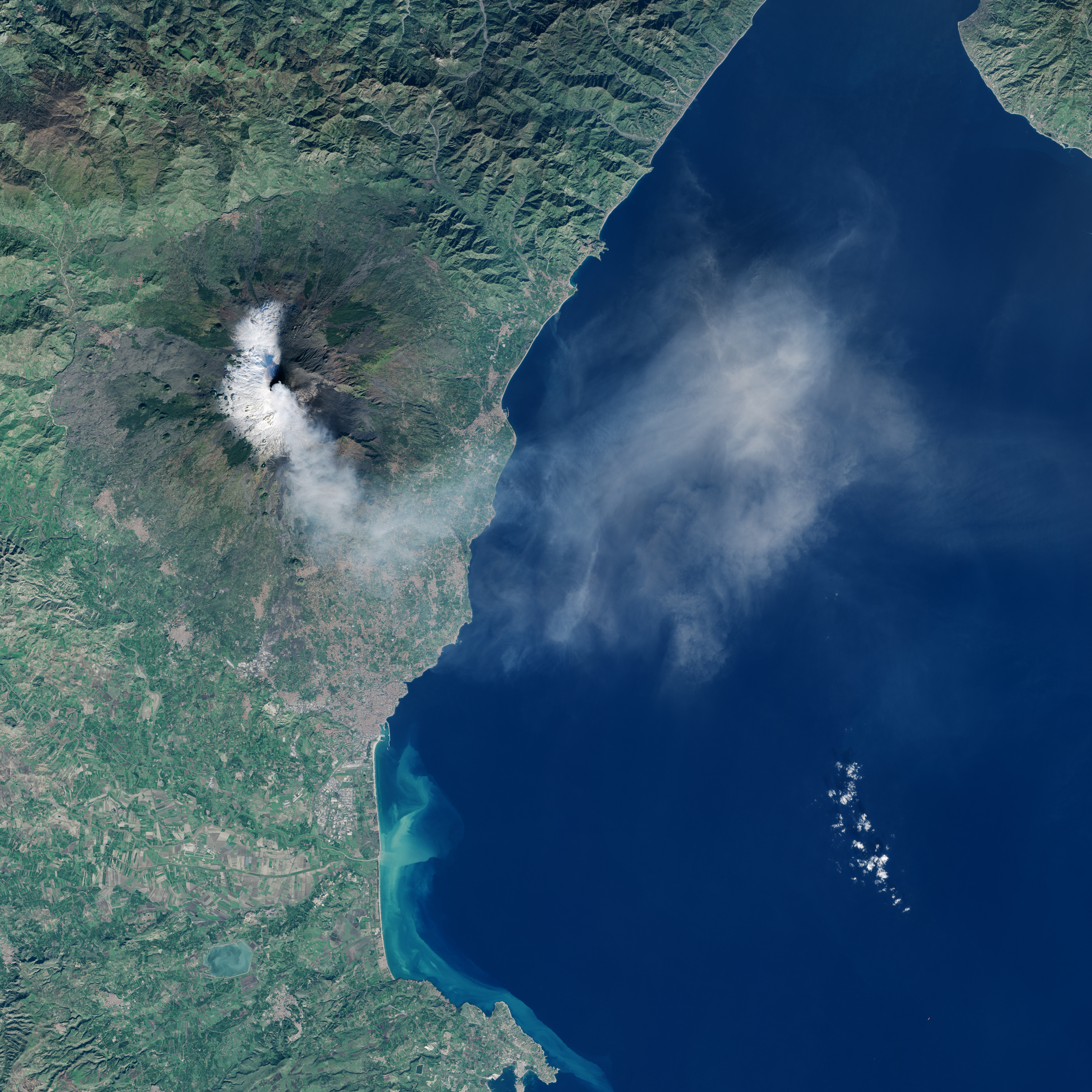
After a two-year respite, Sicily’s massive Etna volcano is showing signs of life. Beginning on December 2, 2015, the volcano began to erupt, sending fountains of lava into the air and jets of hot material as much as 3 kilometers above the summit. On December 3, 2015, the Operational Land Imager (OLI) on Landsat 8 collected this natural-color view of a plume of gas and ash streaming from the summit toward the southeast.
References
- NASA Earth Observatory (2015, December 3) Mount Etna.
- The Sun (2015, December 3) Breathtaking photos show the moment Mount Etna blows its top. Accessed December 3, 2015.
- Volcano Discovery (2015, December 3) Violent paroxysm at Voragine summit crater, lava fountains over 1 km height. Accessed December 3, 2015.
NASA Earth Observatory image by Jesse Allen, using Landsat data from the U.S. Geological Survey. Caption by Adam Voiland.
This image record originally appeared on the Earth Observatory. Click here to view the full, original record.