Flooding in Iraq
Downloads
- turkey_Iraq_tmo_2015285_lrg.jpg (1868x1245, JPEG)
- turkey_Iraq_tmo_2015315_lrg.jpg (1868x1245, JPEG)
- iraqflood_oli_2015286_lrg.jpg (4338x2892, JPEG)
- iraqflood_oli_2015318_lrg.jpg (4338x2892, JPEG)
Metadata
- Sensor(s):
- Terra - MODIS
- Landsat 8 - OLI
- Data Date: October 12, 2015 - November 14, 2015
- Visualization Date: November 17, 2015
In late October 2015, a weather system brought torrential rains to many parts of Iraq, Iran, and other parts of the Middle East.
In Iraq, the resulting floods prompted authorities to declare a state of emergency. Power outages, overflowing sewers, and flooded streets were widespread in Baghdad. Dozens of Iraqis were electrocuted when electrical systems coming into contact with flood water. According to news reports, close to 84,000 people have been displaced by the flooding.
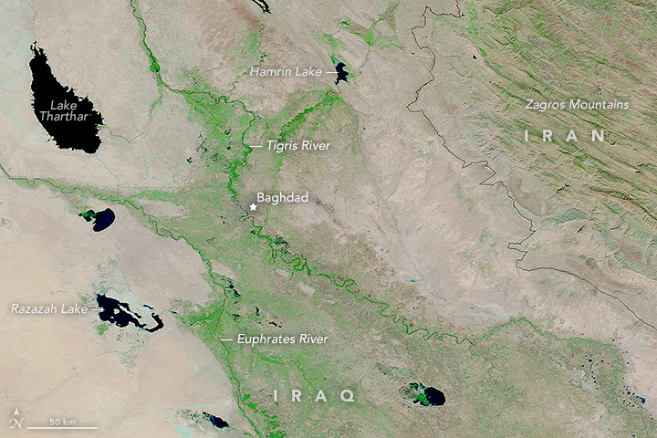
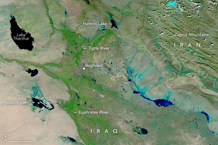
On November 11, 2015, the Moderate Resolution Imaging Spectroradiometer (MODIS) on NASA’s Terra satellite captured an image (second) of flooding in Iraq. The top image shows the same area on October 12, before the storm passed through.
The images are both composed with false color, using a combination of infrared and visible light (MODIS bands 7-2-1). Flood water appears dark blue; saturated soil is light blue; vegetation is bright green; and bare ground is brown. This band combination makes it easier to see flood water.
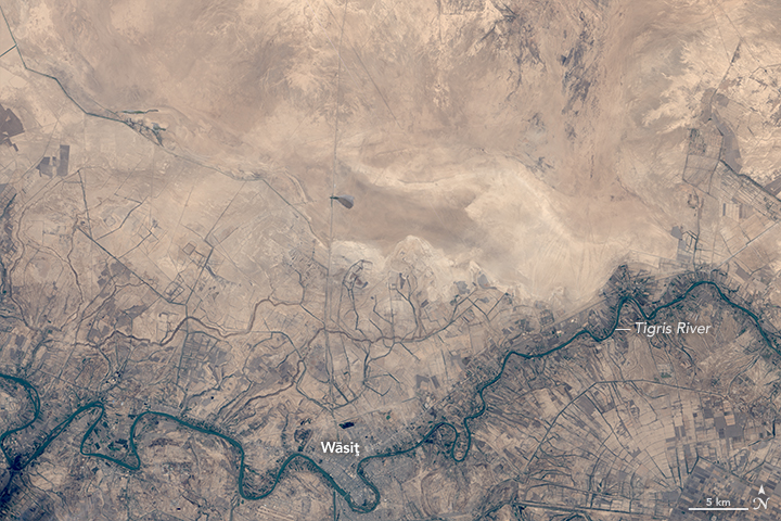
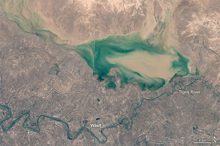
On November 14, 2015, the Operational Land Imager (OLI) on Landsat 8 captured an image (bottom of the page) that shows flood waters north of the Tigris River near the town of Wāsit (also called Kut); Landsat acquired an image of the same area on October 13, 2015, before the flooding. Though some farmland appears to be flooded, most homes in and around Wāsit appear to be protected by a flood barrier.
References
- The New York Times (2015, October 29) Rare Storms and Floods Bring Iraq to a Standstill. Accessed November 17, 2015.
- Reliefweb (2015, November 8) Iraq Floods. Accessed November 17, 2015.
- Reliefweb (2015, November 8) Humanitarian Bulletin 16 October — 5 November 2015. Accessed November 17, 2015.
- Seattle Times (2015, November 9) Outrage builds as dozens of Iraqis electrocuted in floods. Accessed November 17, 2015.
- United Nations News Centre (2015, November 9) Flooding wreaks havoc in Baghdad, overall emergency response hurt by lagging funds. Accessed November 17, 2015.
NASA Earth Observatory images by Joshua Stevens and Adam Voiland, using MODIS data from LANCE/EOSDIS Rapid Response and Landsat data from the U.S. Geological Survey. Caption by Adam Voiland.
This image record originally appeared on the Earth Observatory. Click here to view the full, original record.


