In the Aftermath of Cyclone Pam
Downloads
- vanuatu_oli_2015076_lrg.jpg (2000x2032, JPEG)
- vanuatu_oli_2015028_lrg.jpg (2000x2035, JPEG)
- tanna_oli_2015076.jpg (720x480, JPEG)
- tanna_oli_2015028.jpg (720x480, JPEG)
Metadata
- Sensor(s):
- Landsat 8 - OLI
- Data Date: January 28, 2015 - March 17, 2015
- Visualization Date: March 26, 2015
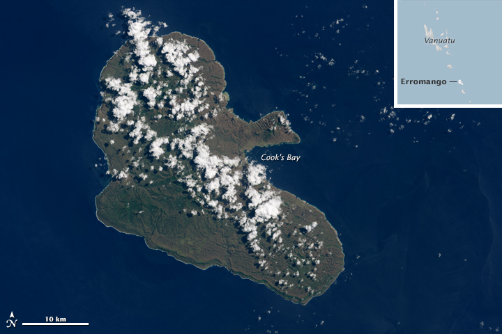
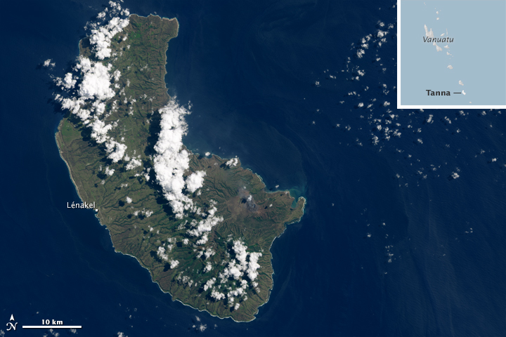
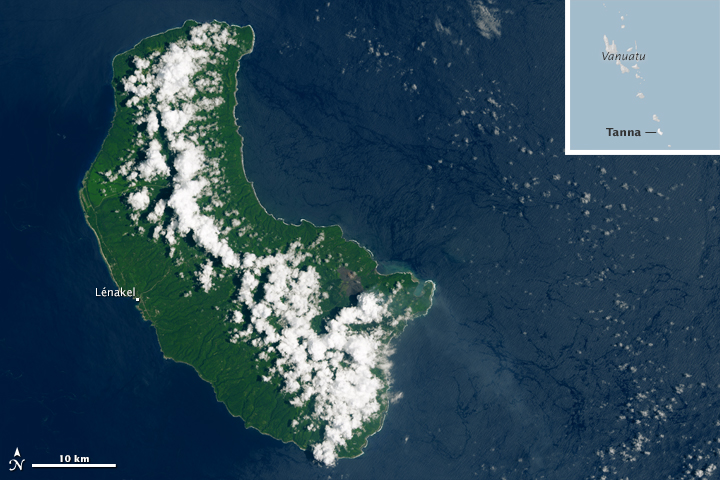
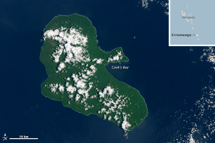
When category 5 cyclone Pam swept over the island nation of Vanuatu in March 2015, two of the hardest hit islands were Tanna and Erromango. While Erromango is home to just a few thousand people, about 30,000 people live on Tanna. On March 17, 2015,—three days after the storm hit the islands—the Operational Land Imager on Landsat 8 acquired imagery revealing the widespread effects of the storm.
Before Pam, Erromango appeared dark green due to the lush tropical vegetation that thrives on it. The cyclone’s fierce winds downed many trees, stripped vegetation, and coated leaves in damaging salt spray, leaving the islands with a browner hue in the aftermath. Before and after views of Tanna are available at the bottom of the page.
According to scientists from Tropical Storm Risk, Erromango likely faced the most severe winds. Their analysis of Pam’s wind field—based on data from the Joint Typhoon Warning Center and an analytical model of the atmosphere—suggested that Erromango saw gusts up to 320 kilometers (200 miles) per hour. With top gusts of 260 kilometers (160 miles) per hour, Tanna faired slightly better in the analysis. With Erromango’s vegetation appearing slightly browner and more disturbed than Tanna’s, this Landsat imagery supports that interpretation.
Pam took a heavy human toll. The storm killed six people and seriously injured many more, according to media reports. The homes of 80 percent of the residents of Tanna were either damaged or destroyed. Meanwhile, ongoing water and food shortages—and severe damage to the island’s only hospital—mean the humanitarian situation could worsen.


References
- The Guardian (2015, March 19) Cyclone Pam survivor’s harrowing story: ‘the noise, the destruction and the wind’. Accessed March 25, 2015.
- ReliefWeb (2015, March 19) Vanuatu: Tanna Island devastated by Tropical Cyclone Pam. Accessed March 25, 2015.
- Reuters (2015, March 17) Rescue teams reach cyclone-hit Vanuatu islands, official toll lowered. Accessed March 25, 2015.
- Sky News (2015, March 19) Aid, troops arrive on Vanuatu’s Tanna. Accessed March 25, 2015.
- Sydney Morning Herald (2015, March 19) Vanuatu Cyclon: Tanna’s homeless desperate for water. Accessed March 25, 2015.
- The Weather Channel (2015, March 24) Before and After Photos Show Parts of Vanuatu Stripped Bare by Cyclone Pam Accessed March 25, 2015.
- The Weather Channel (2015, March 15) Cylone Pam: Direct Hit. Accessed March 25, 2015.
- Washington Post (2015, March 16) Wind analysis, photos chronicle ‘monster’ cyclone Pam’s devastation in Vanuatu. Accessed March 25, 2015.
NASA Earth Observatory images by Joshua Stevens, using Landsat data from the U.S. Geological Survey. Caption by Adam Voiland.
This image record originally appeared on the Earth Observatory. Click here to view the full, original record.
