“V” is for Volcano
Downloads
- shiveluch_oli_2015082_lrg.jpg (5924x11847, JPEG)
- shiveluch_oli_2015082_geo.tif (5924x11847, GeoTIFF)
- shiveluch_oli_2015082.kml (KML)
Metadata
- Sensor(s):
- Landsat 8 - OLI
- Data Date: March 23, 2015
- Visualization Date: March 26, 2015
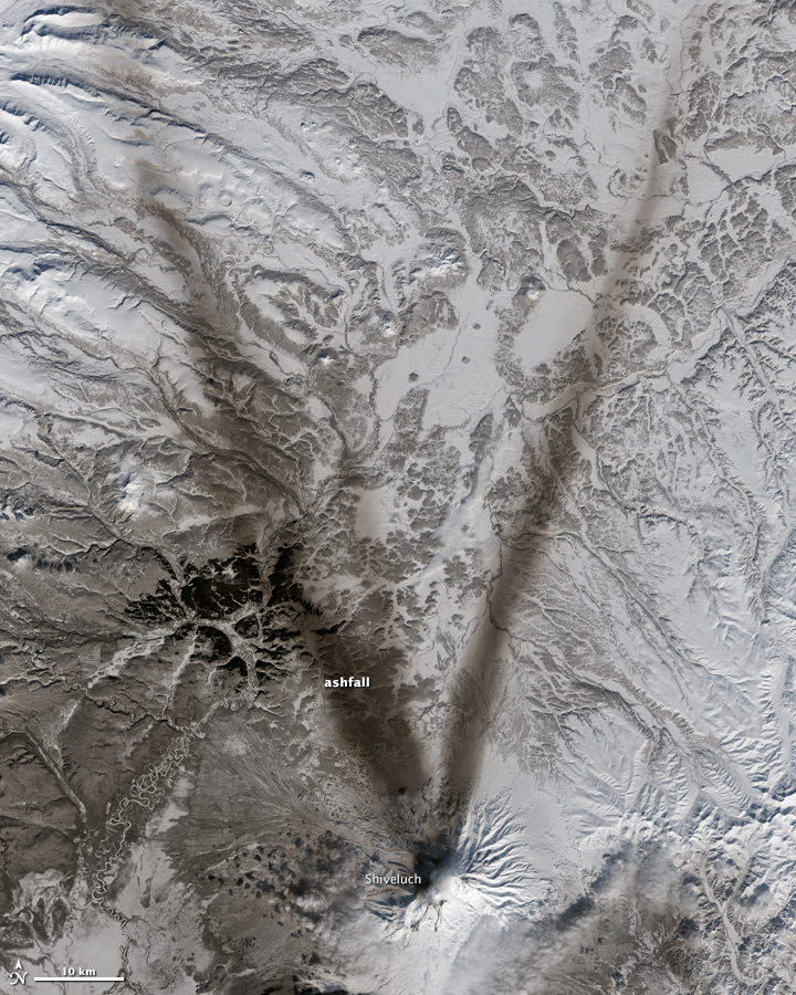
On March 23, 2015, the Operational Land Imager (OLI) on Landsat 8 acquired this image of ashfall on the snow around Shiveluch—one of the largest and most active volcanoes on Russia’s Kamchatka Peninsula. Ash from volcanic eruptions can be swept in a narrow direction by the wind. When the wind changes direction so, too, does the location of the ashfall.
A subsequent image, acquired on March 26, 2015, by NASA’s Aqua satellite, shows winds shifting again, this time carrying the ash toward the south and southeast.
References
- Jeff Schmaltz, LANCE MODIS Rapid Response Team (2015, March 26) Ash plume from Shiveluch, Kamchatka Peninsula. Accessed March 26, 2015.
- NASA Earth Observatory (2015, February 28) A Plume Advances Over Shiveluch. Accessed March 26, 2015.
- Smithsonian Institution Global Volcanism Program (2015, March) Sheveluch. Accessed March 26, 2015.
NASA Earth Observatory image by Jesse Allen, using Landsat data from the U.S. Geological Survey. Caption by Kathryn Hansen.
This image record originally appeared on the Earth Observatory. Click here to view the full, original record.